Nemrut Dag
Nemrut Dağ is a mountain shaped to hold the Hellenistic mausoleum of Antiochos.
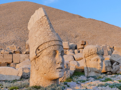
The funerary mound was built by the late Hellenistic King Antiochos I of Commagene (a kingdom north of Syria and the Euphrates) as a monument to himself. It consists of a number of statues of gods and of Antiochos built on terraces - the heads of the statues have tumbled down over the years and have been reerected on the place where they fell.
Community Perspective: This fantastic, bizarre site is located at the end of a treacherous mountain road. Bergecn and Clyde have written the most comprehensive reviews of a recent visit. And Philipp has proved that it can also be visited in the winter!


Map of Nemrut Dag
Community Reviews
Philipp Peterer

Visited March 2022. After Nan could not make it in January due to snow, I guessed end of March should be no problem. That was a massive misjudgement. I arrived on a sunny day from Diyarbakir. My hopes were high, as there was no snow until Karadut. From there the snow started, but was not significant and the road was cleared. Unfortunately the last 6km were not cleared. But after I came so close I was reluctant to give up and decided to walk the last part. There were four other tourists with the same stupid idea with a few minutes head start. I quickly past them, following the road. I was unprepared for the amount of snow I was about to cross. I brought only trekking shoes instead of my hiking boots and a light jacket.
The amount of snow alternated between 5cm and 1m. I followed the footsteps of one other crazy person, trying my best not to get my feet wet. At the end of the road I found what would be the parking lot and a visitor center sunk in the snow. From there, a shuttle bus normally runs closer to the mound. Not for me of course, so I kept walking. Reaching the final stop of the shuttle bus, the path to the mound started. Unfortunately I couldn’t see any of it besides the signs.
The climb up to the mound proofed to be the hardest part as there were tons of snow and climbing a steep snow covered hill is not that relaxing. Worse than the snow was the wind. Blowing little ice needles in my face and almost knocking me off my feet a few times. After what felt an eternity I reached the mound. The snow was so high, it covered most of the characteristic heads. Only one was clearly visible. I removed some more of the snow to make the face better visible.I didn’t spend too much time up there, as the wind started freezing my body and my feet were soaking wet. But filled with pride of my achievement the walk back was easier than expected. On the last 2 km I saw that they had started to clear the road. I found the workers further below, having lunch. They offered me some food, giving me a “local moment” at the end of my adventure.
It was a great hike and a crazy experience. Nevertheless I would not recommend to repeat that. I will surely revisit Nemrud Dag. But next time it will for sure be in August.
Clyde

I visited this WHS in Spring 2021. I arrived in the small town of Karadut via several minor scenic roads from Goreme NP. A very long drive indeed but it was an enjoyable one with fauna and bird sightings en route and worthwhile stopovers and panoramic viewpoints near the Roman bridge of Severan.
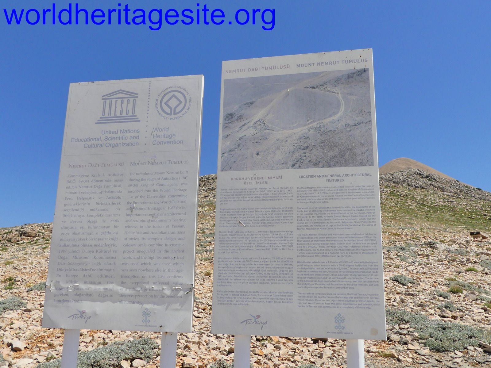
The narrow roads from Adimiyan or Kahta (the two main cities for tour departures) are a good hour to 90 minutes away from the Nemrut Dag visitor centre. The one hour ride both ways for a visit (especially if you opt to visit at sunrise) is quite dangerous and tiring so staying overnight in Karadut is an investment, also to beat the first tourist groups. Moreover, there are secondary archaeological sites which are worth visiting if you have extra time to spare such as Arsemia, Cendere and Karakus. The visitor centre had only a couple of information boards on the site excavation and facts on the site and on the German archaeologist Friedrich Karl Dörner when I visited, and the whole metal roof had incredibly been blown away by the frequent strong winds. The UNESCO signs nailed to the wall withstood the strong winds though. There are two separate entrances to the Nemrut Dag WHS: one from the top, beneath the artificial mound and several stairs, which you drive up to after paying the entrance ticket, and another from the National Park, well beneath the artificial mound, which involves a longer hike up.
The artificial mound, assumed to be a royal tomb from the 1st century BC, is the first peak (2,134 metres high) to be lit east of the Taurus Mountains by the early morning sun rays and remains lit the longest towards sunset. The pinkish-reddish sun rays are ideal for photography although on a sunny day, any time will be satisfying. In the morning the Eastern Terrace will be lit, while in the afternoon the Western Terrace will be lit. When we visited, the stairs leading up to Nemrut Dagi were infested with hundreds if not thousands of black, blue and green grasshoppers hopping around everywhere especially on the white stairs. Apart from the visitor centre, there are makeshift toilets available a few steps away from the Eastern Terrace. The mount and the lined statue remains are all roped off with security guards making sure the off limits signs are respected as much as possible.
The Eastern Terrace which measures 45 metres by 50 metres is the largest of the three terraces. Since 2002, the colossal statues are aligned in front of their respective bodies on the western side of the terrace. These are, from left/north to right/south, the protective animal statues of a lion and an eagle, and the heads of Antiochus, Commagene (the only female figure), Zeus, Apollo, Herakles, and once again the statues of an eagle and a lion. The bodies of the respective statues are 8-9 metres high, while the heads are 2.5-3.5 metres high including the tiaras (headwear). The statues are depicted in a seated position with the feet positioned on a stool. The eagle statues represent the domination of the Kingdom of Commagene over the skies. Additionally, it was believed that Zeus used an eagle to communicate his orders to mankind. On the other hand, the lions represent the domination of the Kingdom of Commagene over the earth. In front of the statues there is the fire altar/platform in the shape of a stepped pyramid which offers splendid views (in the morning) of the Eastern Terrace right above the stanchions holding the rope in place.
The Western Terrace is best viewed in the afternoon especially towards sunset. It is 10 metres below the Eastern Terrace due to the natural inclination of the mountain and mound. In order to enlarge this naturally smaller terrace, an L-shaped retaining wall was constructed. The Western Terrace has been affected more by past seismic activity and erosion than the other terraces due to climatic factors. It is largely similar to the Eastern Terrace with 5 God statues (Antiochus, Commagene, Zeus, Apollo and Herakles) and protectice lions and eagles on either end. This terrace also has stelae depicting ancestors and there also small altars but none are similar to the stepped pyramid altar in the Eastern Terrace. The Western Terrace is also known for its sanctification reliefs and a relief of a lion horoscope, possibly the oldest horoscope in the world, showing an arrangement of stars and the planets Jupiter, Mercury and Mars. The composition was taken to be a chart of the sky on 7 July 62 BC. This may be an indication of when construction began on this monument. This peculiar relief has been recently restored and for the time being can be admired at the Adimiyan Museum.
The Northern Terrace, situated to the northwest of the tumulus, is like a narrow rectangle and contains sandstone plinths. Next to these plinths lie collapsed stelae which bear no inscriptions or reliefs.
This open air museum is a really impressive WHS and certainly didn't disappoint, if only for the sheer size and magnitude of the whole site. It really was worth the long drive to get there, and sleeping overnight in Karadut made it easy to revisit in the morning without having to wake up too early.
Bergecn
On 1 November 2019 we left Adıyaman at mid-day to go to Mount Nemrut (Nemrut Dağ). It takes about 70 km to get there (best way is to go by car but there are also organised tours available from Malatya, Adıyaman or Kahta, or further afield from Gaziantep and Şanlıurfa). The region was part of the Kommagene kingdom (163 BC - 72 AD). On the way a good number of monuments can be visited from that era - they are situated in the Mount Nemrut National Park and are all well signposted. Several of them now being touristically upgraded with financial support from the EU. The first stop is at the Karakuş Tumulus ("Black Bird" in Turkish). It is a burial site of the women of the royal family of Kommagene. A column with an eagle sculpture on top and the tumulus itself can be seen from away and it is easy to get there - about 10 km from Kahta - it is just off the main road, not fenced off and there is no admission fee. Nemrut Dağ can be seen in the distance. A small kiosk nearby offers drinks.
Just around the corner the Septimus Severus Bridge stretches across the Cendere (Kabinas) River, built in in the second century AD. It is one of the most impressive Roman infrastructure monuments in Anatolia; it carried the traffic until the 1990s when a new bridge was built further downstream. On the eastern side of the bridge a small coffee shop offers refreshments and souvenirs.
Across the valley and up in the hills sits Yeni Kale (the New Castle), originally a Kommagene palace but in its latest form dating from the Mameluke period (13th century), now under restoration. At the time of our visit work was still going on and it was expected that the place would be opened to tourists in Spring 2020.
Further up in the hills you find the summer palace of the Kommagene family, the ruins of Arsameia on the Nymphaios River. Here is where they came when it was too hot in summer down in the Euphrates valley, in the capital Samosata, now disappeared in the Ataturk Lake. At the entrance (no admission fee) to the site a tea house offers refreshments - we were there during the pomegranate season and got wonderfully fresh and fragrant fruit to taste. There are three places to visit at the site: a bit further down from the entrance and parking lot we find the stele of Apollo/Mithras, further westwards a cave that as some say served as cold storage for the palace while others think it was a temple or burial site - a few meters into the cave it is closed off by a metal fence. The highlight of the site is a bit further up on a zig-zag path but not too far, a tunnel, 160 m long but steep and very dark - it was apparently a place to rid oneself of sins before ascending to Mount Nemrut. At its entrance you see the longest Greek inscription in Anatolia from that period and the larger than life-size relief of a handshake exchanged between King Mithridates and Heracles; here the King making sure he is seen as equal to the gods. There is nothing much left of the Summer Place but those three spots are worth the trip, not to mention the breathtaking view into the valley, full of lush oak trees.
From here onwards to Nemrut Dağ on a good road through valleys flanked by steep slopes. Cows and donkeys are using the road too - so drive carefully. The road ends at the Nemrut visitors centre (entrance fee, currently 20TL). From there a shuttle bus will take you another 1km to a now dilapidated ticket office from where you walk up to the summit (at 2150 m). It takes about 30 minutes depending on your speed but you walk on stairs made of stone slabs. You have choice between the paths to the East or West Terraces. My recommendation would be to go up to the East Terrace - the ascend is less steep. But it also depends on the time of the day: it is better to visit the Eastern Terrace first when you go in the evening - you then can admire the full spectacle of the sunset from the Western terrace. And the other way round if you choose to go up for sunrise. On the day of our visit in early November the weather was spectacularly beautiful: dark blue sky, clear view across the Euphrates valley with the Ataturk lake glistering in the distance, but it was cold - around 0°C, with the wind factor even less. So don’t get mistaken by the warm temperature down in the valley.
Nemrut Dağ is one of the most spectacular sites in Turkey, not only the monument itself, the hierothesion, which is witness to a religious syncretism that combined Greek, Persian and Armenian influences but also its setting in the Eastern Taurus mountains with breathtaking views across the Euphrates Valley and deep into Mesopotamia.
On the East Terrace you are greeted by the huge heads of lions, eagles, gods and King Antiochus. Their heads rest on the ground in front of their seated statues. An elevated platform used to be the altar of this burial site. Behind the statues rises the 50m high and 150m diameter tumulus made of stone chips. Rumours have it that the undiscovered burial chamber lays under the gravel. When you walk around the summit you can see earlier attempts to dig into the tumulus. On the Western side again heads of the king, gods, lions and eagles in front of seated statues. At the back a well preserved Greek inscription describing the purpose of the site in a very sombre tone. Flanking the row of statues are stone relief slabs with the king and gods. One interesting stone relief showing a lion horoscope with the astronomical constellation of planets as seen in the year 62 BC has been been removed to a locked shed - the Temporary Restoration Lab, apparently waiting to be removed to a museum and like some of the sculptures and other reliefs to be replaced by copies. From the Western Terrace the sun set was magnificent. The horizon turned from pink to dark red to purple. The colours of the sky turned the place into a romantic site - we witnessed a young guy proposing to his girlfriend under the cheers of the other visitors. And we got invited to the wedding next year ...
Joan Stribling de Launay
I drove to eastern Turkey in 1977 and was taken by jeep up Nemrod Dag. An incredible overnight journey [given chai by our hosts,half way up the mountain]
We reached the summit as dawn broke and witnessed the amazing mountain range; Nemrod Dag's large stone structures.On returning I was invited to a Kurdish village.An experience never to forget.
Read more from Joan Stribling de Launay here.
Janet Purdy
USA and Australia - 01-Nov-13 -
In 1962 I drove from Beirut to Nemrut Dag in a VW camper. We parked in the dusty remote primitive village, having used as a guide, the pointed mini mountain made of the chips left over from the caving of the extraordinary images.... Our Turkish was not fluent, so when the mule drivers came up to us, we followed as they took us into their house above the animals for breakfast...It was a huge platter of eggs and flies...we did not know that the left overs were for the drivers, so we regretted eating to be polite
We mounted donkeys and rode to the top to find the awesome heads and enormous still standing stone bodies. A German Archeologist was there. He had covered many of the heads with rocks, but removed some for us so we could view them. We were invited for lunch ,out of guilt perhaps, and had the most delicious yogurt I have ever encountered.
This place where East met West is very special. have a photo of me sitting at the feet of Apollo to give it scale. Not a tourist was in sight aside from us. I wonder what it is like now...
Thomas Buechler
We came from Diyarbakir via Siverek by public bus, the shortest and most scenic way to Nemrut Dagi is to take the short ferry boat ride across the Atatuerk dam, there is a minibus from Severik downtown opp Kiler supermarket.8TL leaves hourly.
A convenient place to stay is Karadut.If you call the owner of the pension house, they pick you up at the main road.
We have choosen a sunset visit to the Mt. Nemrut and the East terrace was already without much sunlight.But the athmosphere and the huge statues on top of this sacred mountain were so unique and well worth all efforts.
Paulo
Went there in 1987 as an 18 year old. Didn't really know what to expect and didn't really understand what it was when I got there. We didn't have the internet back then.
I remember that it was fantastic and fantastically remote. We travelled for hours along an unmade road in a dolmus/minibus full of goats and chickens. I kept falling asleep on an old lady's shoulder and may have dribbled on her, but she was too polite to complain. We spent the night on the mountain top under the stars. It was freezing, but worth it for the sunrise.
Hope it is still the same.
Emyr
I cycled up there in 1988 - 21 years ago!!!. It took all day. I remember being knackered by the time I reached the top, but it was well worth the effort. I camped up there overnight and was rewarded with a spectacular sunrise the following morning.
Douglas Scully
As you go down the highway to approach the town of Kahta you can see a mountain peak that looks very diffrent from the others. This is Nemrut Dag. As others have said there is long ride up through the awesome mountains to get there. There is a steep walk to go from the car park to the ruins. Due to the altitude it is much colder at the summit than where you started from, even on a warm sunny day - be prepared. The beheaded figures, their propped up heads, and the altar on the eastern side are the most dramatic. Nothing else anywhere can compare to this bizarre site. There are magnificent views of the mountains and the waters of the dammed Euphrates River. There are more remains of figures, including some of the best 'heads', on the western side. What isn't often mentioned are the sculptured slabs that are also part of the site. At the center of this place is the large tumulus of pebbles that is probably the tomb for which all this was built. While visiting think about all the labor needed to bring the marble for the figures and the stone pebbles up to this remote place.
Glenn Austerfield
Visited in 2000
Hard to get to, pretty much must hire a guide. Stayed in Kahta; had a chance to visit with a Kurdish family while we were there. Well worth the trip out there; Due to the altitude, it is cold, take a jacket.
Derrick Chapman
I and a small group of USAF friends took the time to visit Nemrut while we were staying in Diyarbakir. The drive was long, winding, and rough. There's a small hotel down the mountain--for those who want to really spend some time there. On the way up there is a carving of Antiochus shaking hands with Hercules (sort of a hero endorsement I guess). I made the mistake of wearing slick-soled cowboy boots. We met only a single other explorer, a German, who was on his way down. He looked at my boots with amusement. The climb was easy--more of an uphill walk--but I have a fear of heights and so I was uncomfortable. This was in March. The sky was overcast. As we reached the top, it started to rain cold drops which soon turned to ice/snow. Our time was cut short, but I remember thinking that the religious fanatics who toppled and damaged the statues were at least not lazy. I wish a reconstruction could be attempted before long. I'd like to see things as they were intended, even if some pieces have to be remanufactured. Don't get me started on the Venus de Milo's arms!
dorothy
tes it was very awe inspiring. We had driven up the back road to the top of the hill. the driver of our van was overcome by the height and the fear as he drove over the rough road and spent his time there lying on the ground feeling ill.
My companions and I walked around as we read from our guide books identifying all the statues. of course we took plenty of photos both of the remains and the view. It was easy to see why anyone would want to build a temple/burial site at this place. It was so isolated!!!! We were the only people there and enjoyed the peace and mystery of the ruins.
Lydia Persson
We traveled up the treacherous road to the top of the windy mountain as it neared evening. As we pulled to the top of the hill, the sun was just setting behind the mountains, making the sky a brilliant orange. The kurdish ranger allowed us to pitch our tent on the top of the mountian, and he entertained us long into the night with his talk of multiple wives. Just as we were settling down for the night, a group of Turks settled right next to us, and with their loud banter kept us awake all night. We got up at the wee hours of the morning in the frigid air to watch the sunrise. The Euphrates sparkled below as the statues of kings and eagles gave a mystical aura to the view.
All at once I felt a sort of awe for the relics that connected that age to ours. Mt. Nimrod was far from dissapointing, it was inspiring.
Els Slots

The most beautiful places always seem to be the most remote. Nemrut Dag is a good example for this theory. It is situated near the little town of Kahta, deep in the heart of Turkey.
From there you have to drive 1,5 hour by jeep through inhospitable surroundings. Finally a half hour-climb of the mountain itself awaits you, before you can see the magic sight with your own eyes.
Community Rating
- : Szucs Tamas Walter Maciej Gil Alexander Lehmann Can SARICA Afshin Iranpour BH Cluckily Mike Krijn George Evangelou Marty AYB Mia esguerra Rafał Kałczuga Tony H. Stanislaw Warwas
- : Philipp Leu Harry Mitsidis Tarquinio_Superbo Lucio Gorla Zoë Sheng
- : Bin Clyde Philipp Peterer Thomas van der Walt Wojciech Fedoruk Francky D'Hoop Usagi1974 Zoe Bergecn Yevhen Ivanovych Els Slots
- : Csaba Nováczky Solivagant
Site Info
- Full Name
- Nemrut Dag
- Unesco ID
- 448
- Country
- Turkiye
- Inscribed
- 1987
- Type
- Cultural
- Criteria
-
1 3 4
- Categories
- Archaeological site - Near Eastern
- Link
- By ID
Site History
1987 Inscribed
Site Links
Unesco Website
Official Website
Related
In the News
Connections
The site has 19 connections
Constructions
Damaged
Geography
History
Human Activity
Individual People
Literature and Film
Science and Technology
Timeline
Visiting conditions
WHS Hotspots
WHS Names
WHS on Other Lists
World Heritage Process
Visitors
107 Community Members have visited.
The Plaque
 (photo by Clyde)
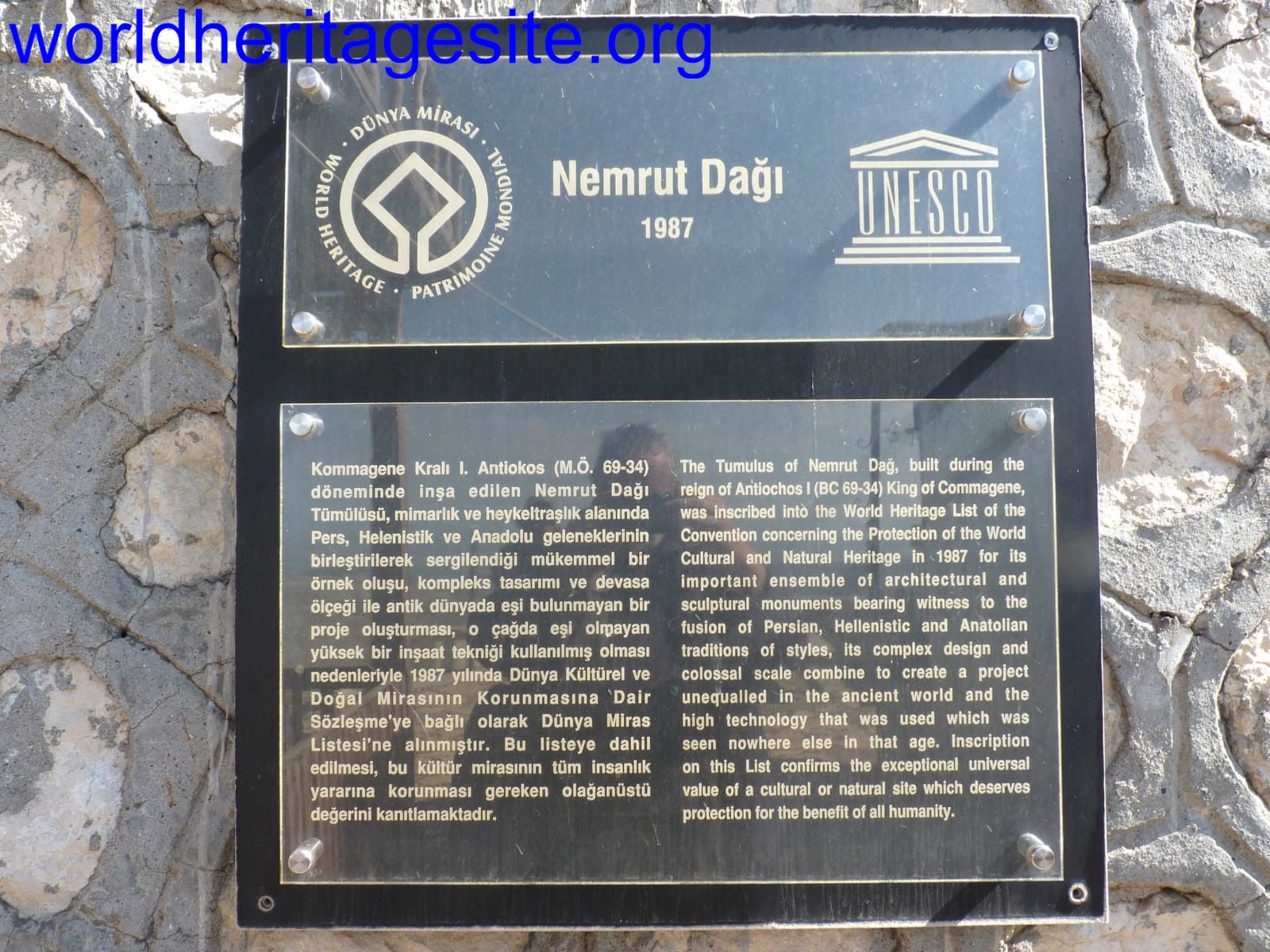 (photo by Solivagant)