WHS Plaque Collection
The Operational Guidelines of the World Heritage Convention state that "Once a property is inscribed on the World Heritage List, the State Party should place a plaque, whenever possible, to commemorate this inscription".
There are suggestions about how the Plaque should look like, but in reality they vary a lot. On this website we consider as WHS Plaques all markers and information panels found at or near UNESCO World Heritage Sites, that have at least several of the following elements: the UNESCO WH emblem, the official site name, the term "World Heritage Site", the year of inscription, and the reason for inscription (OUV). It doesn't include WHS Inscription Certificates (paper documents, often found framed in a museum or visitor center).
This collection has been brought together as a community effort. It's a work-in-progress: updates can be found and shared at this Forum topic .
The newest additions can be found below. You can view all plaques, ordered alphabetically by country, via following the links:
A-DE-H I-L M-P Q-U V-Z
Recently Added WHS Plaque locations
| Site | Plaque location | Image |
|---|---|---|
| Shiretoko | Wooden board along the elevated path around the Shiretoko Goko Lakes 44.1229792,145.0759915 | 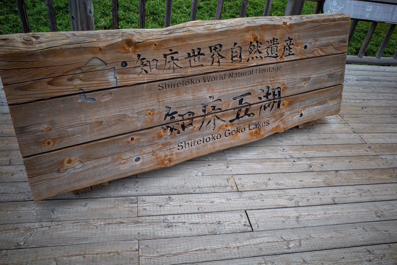 (photo by Casey) |
| Mount Kenya Mount Kenya National Park/Natural Forest | Name and emblem at Naro Moru Park Gate -0.17476174374025616, 37.14329477837782 | 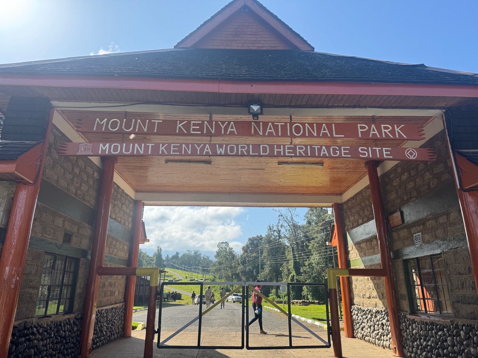 (photo by Randi & Svein) |
| Mudejar Architecture of Aragon Torre, techumbre y cimborrio de la catedral de Santa Maria | Tiny white sheet with basic info 40.3441150, -1.1076444 | 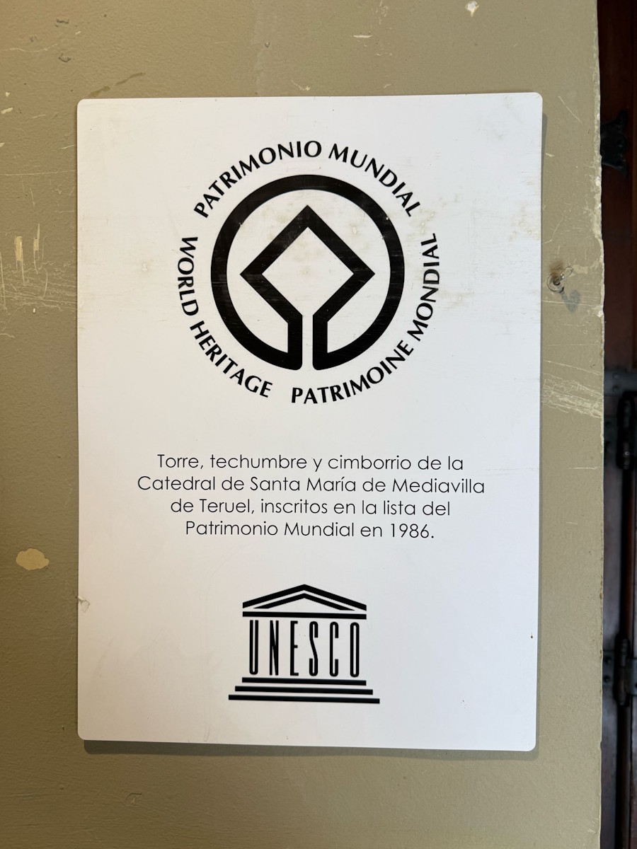 (photo by Christravelblog) |
| Congonhas | Narrow, tall marker with emblem and explanation -20.50704, -43.86097 | - |
| Congonhas | Tiny stone marker at a tree next to the steps -20.507476091570183, -43.86066696848579 | 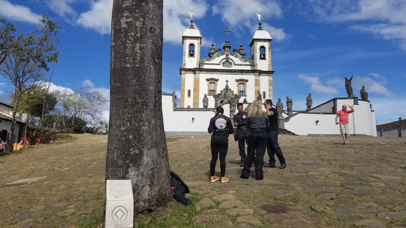 (photo by Zoë) |
| Prague Historic Centre of Prague | On exterior of tourist information centre in Old Town Square, to left of astronomical clock 50.086922, 14.42042 | 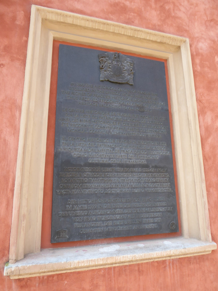 (photo by Flahr) |
| Khangchendzonga National Park | A marker somewhere in the bushes near Kabi Lungchok 27.39862245102754, 88.60959651150516 | 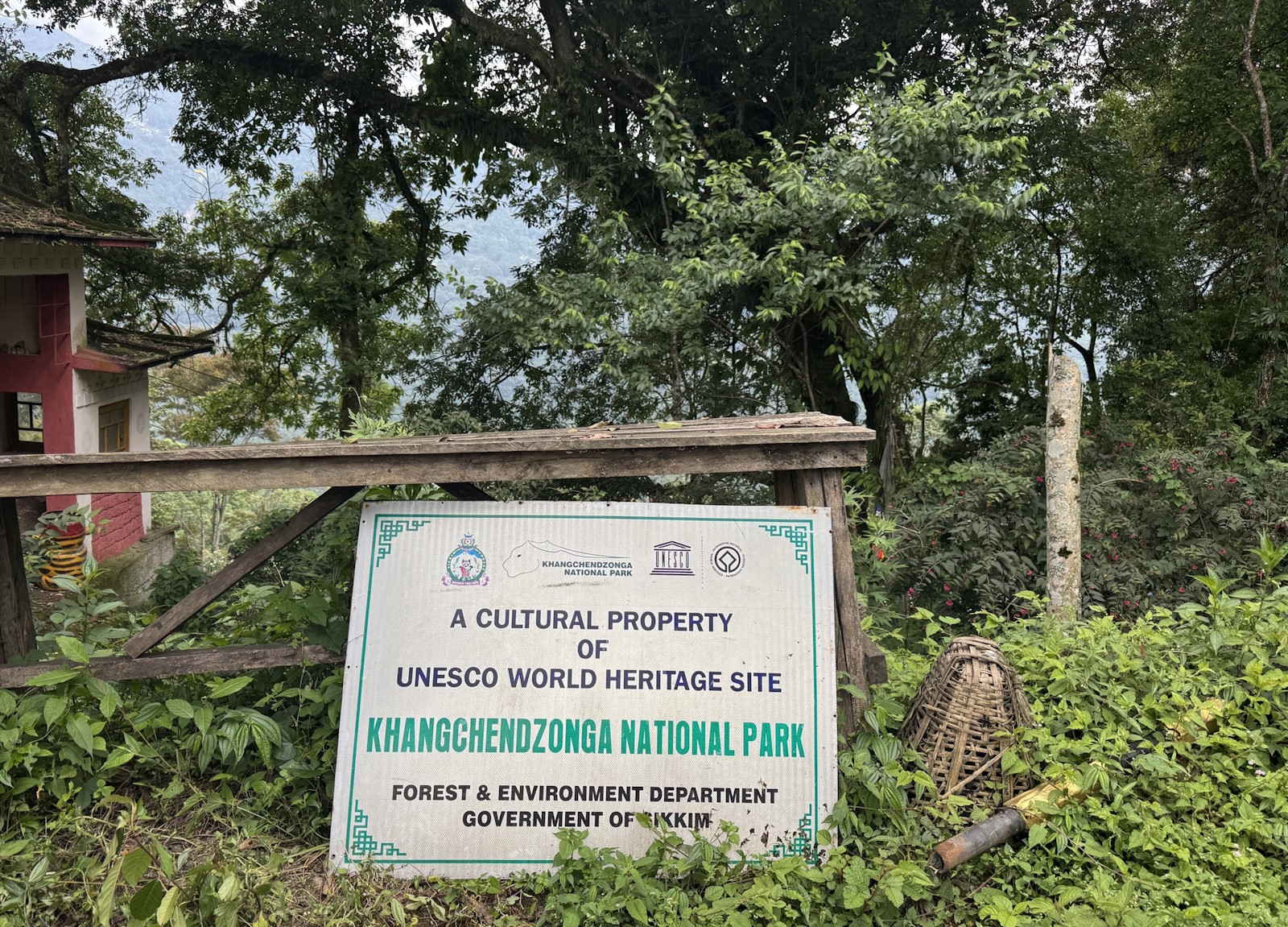 (photo by Bram de Bruin) |
| Meteora | Infopanel type marker by the side of the road just at the border of the core zone 39.7218482, 21.6222203 | 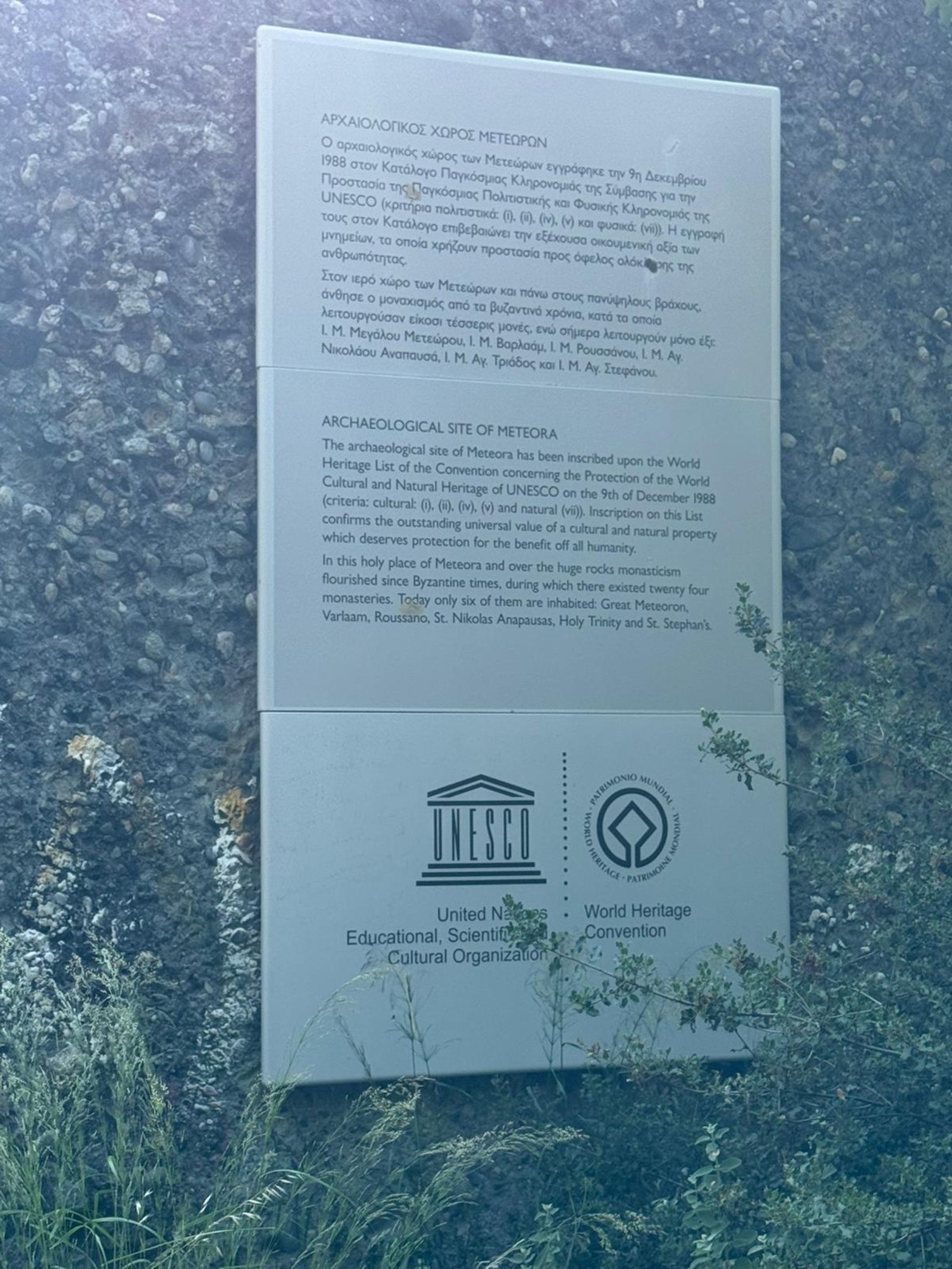 (photo by Christravelblog) |
| Zagori Cultural Landscape | Simple sign, mostly boasting the Geopark status but a bit of WHS too, at different spots in the area. 39.8053055, 20.7291211 | 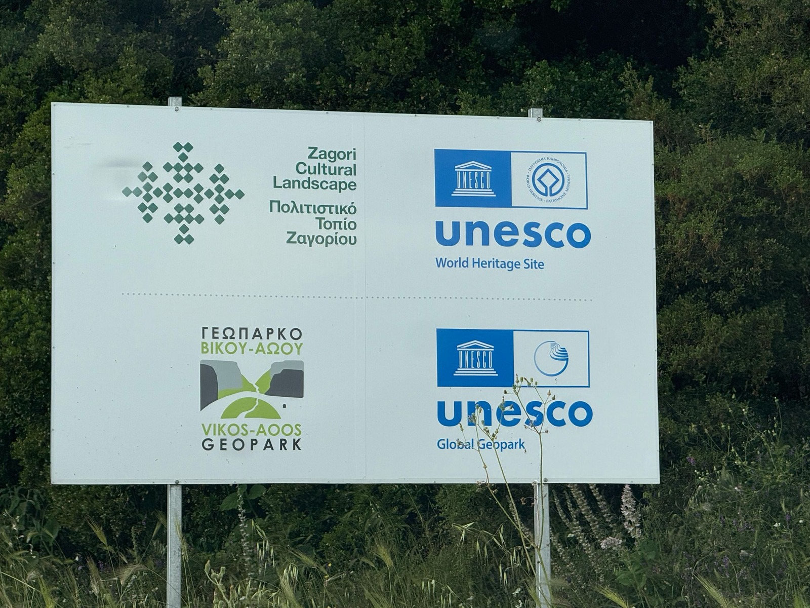 (photo by Christravelblog) |
| Thimlich Ohinga | Wood-carved plaque with all elements, at the entrance to the first gate -0.890878, 34.324739 | 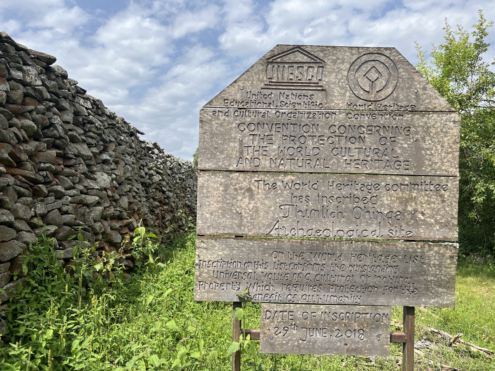 (photo by Els) |
| Kraków | Emblem with essentials on the ground between the Florian Gate and the Barbican 50.06504801174083, 19.941401910848885 |  (external source) |
| Lamu Old Town | Several Welcome signs around town, but the main plaque is at Lamu Fort -2.269356, 40.902325 | 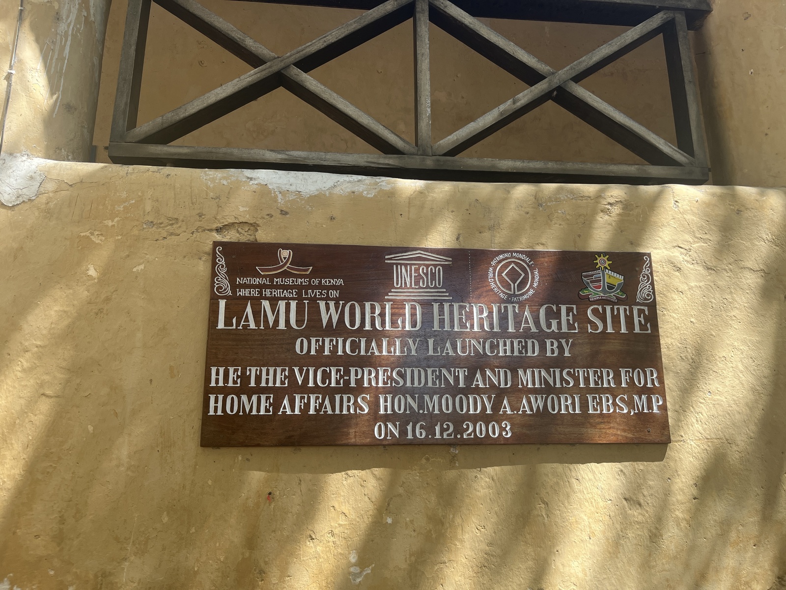 (photo by Els) |
| Quanzhou The Old City | Each component (except the Lao Tze statue) has its own official marker, but the main marker for the WHS is at the Confucius Temple and School 24.90544805051695, 118.58973177910248 | 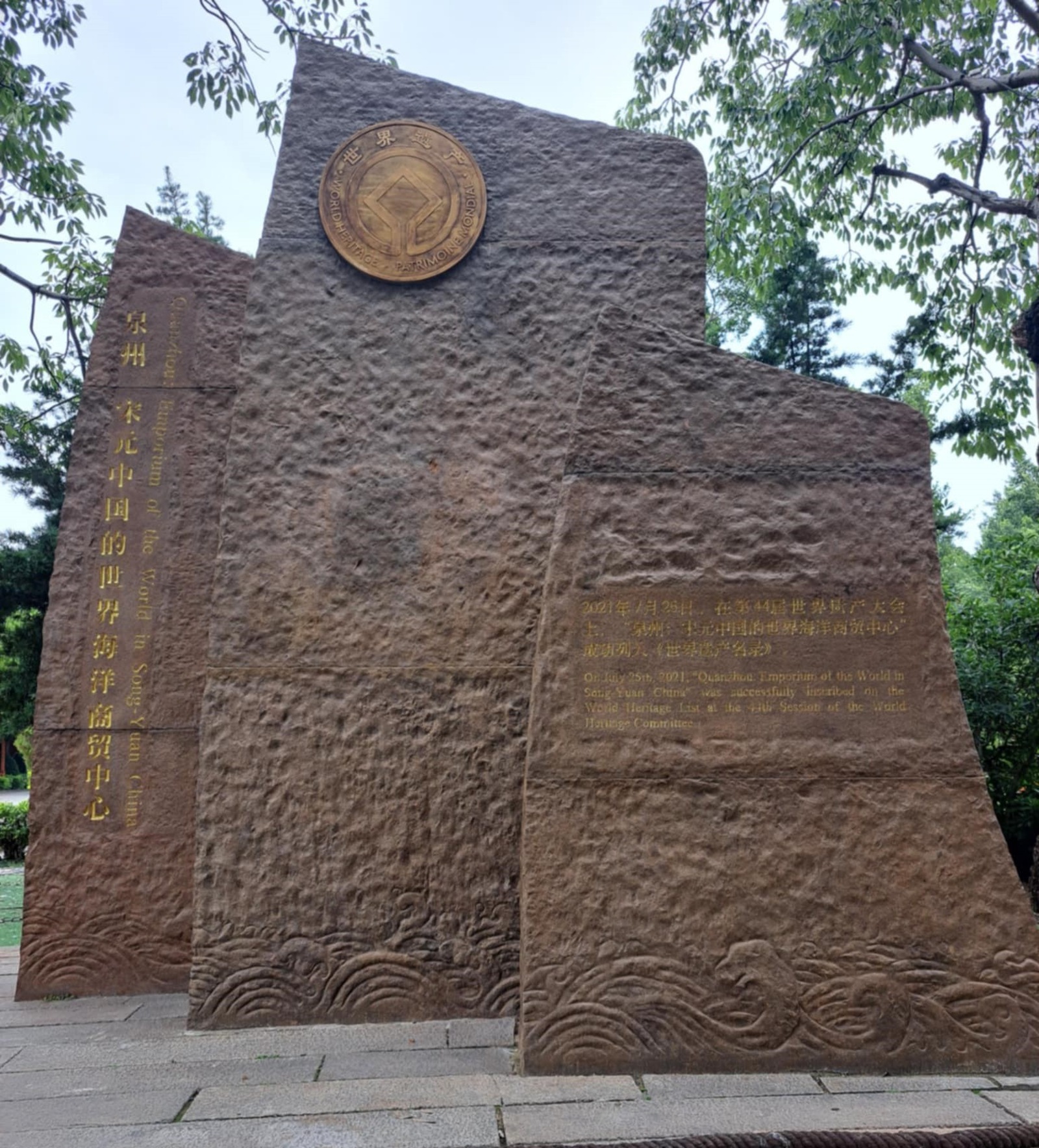 (photo by Bernard Joseph Esposo Guerrero) |
| Frontiers of the Roman Empire Housesteads fort, section of Wall & vallum between the field boundary west of milecastle 36 & the field boundary west of turret 37a in wall miles 36 & | pink metal plaque, including all elements, just to the right of the entrance to the museum 55.00977944570966, -2.324136294251086 | 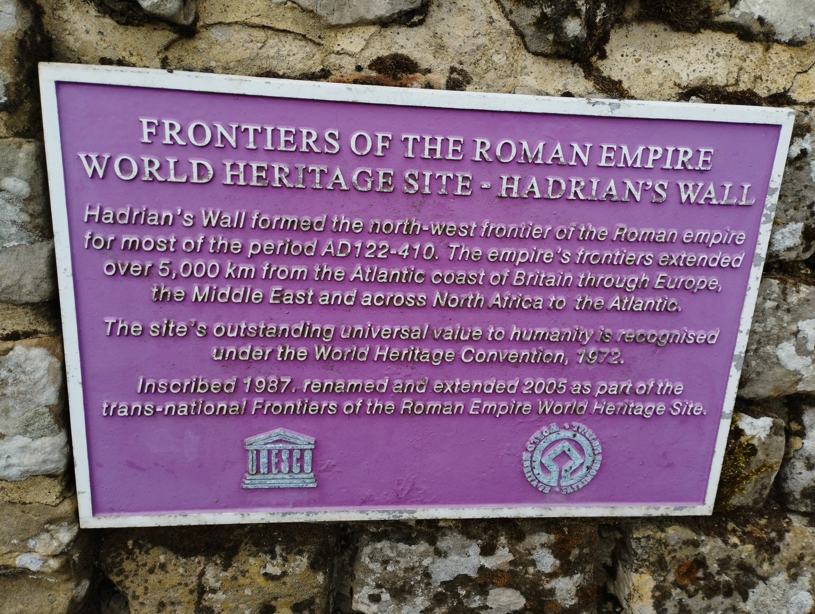 (photo by Squiffy) |
| Fort Jesus | Yellow on black stone marker right at the entrance (outside the walls), displaying all elements except OUV -4.062178, 39.679522 | 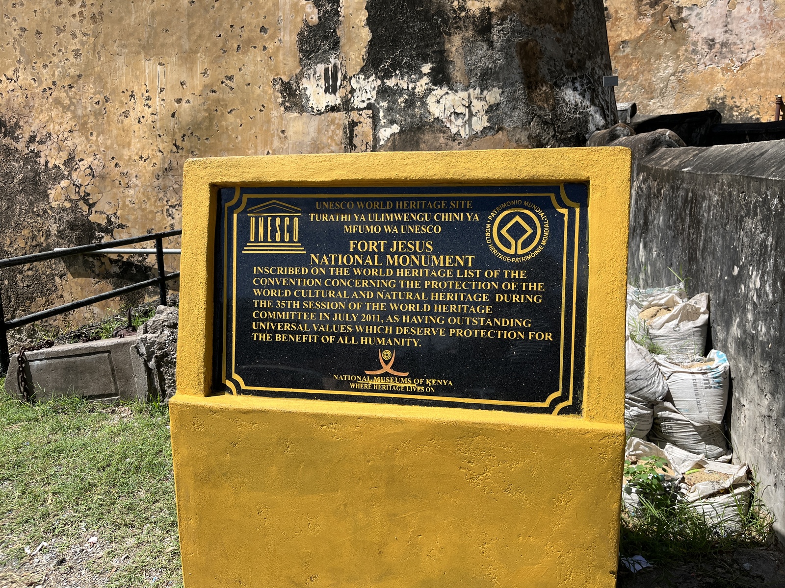 (photo by Els) |
| Kulangsu | Asian large stone plaque close to the garden-piano museum | 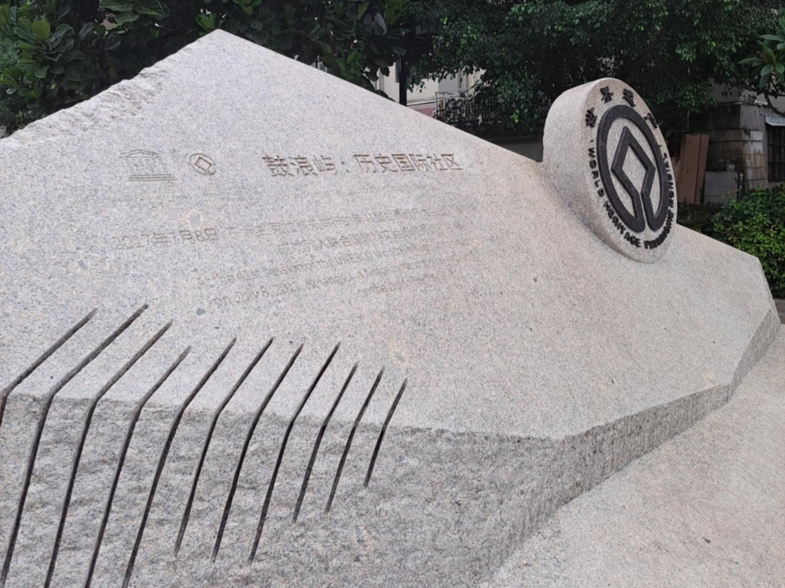 (photo by Bernard Joseph Esposo Guerrero) |
| Mycenae and Tiryns Archaeological Site of Tiryns | information board type plaque near entrance, including all elements 37.6007552, 22.7998207 | 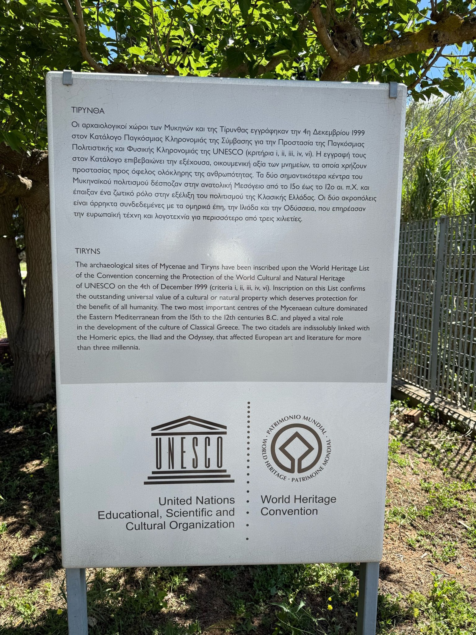 (photo by Christravelblog) |
| Rice Terraces of the Philippine Cordilleras Rice Terrace Clusters of Banaue: Battad Philippines | Black Welcome to Batad sign |  (photo by Randi & Svein) |
| Rice Terraces of the Philippine Cordilleras Rice Terrace Clusters of Mayoyao: Mayoyao Central Philippines | Green sign with painted text, includes all elements |  (photo by Randi & Svein) |
| Rice Terraces of the Philippine Cordilleras Rice Terrace Clusters of Banaue: Bangaan Philippines | Green sign with painted text, includes all elements |  (photo by Randi & Svein) |
| Nice | Information panels with all elements at different spots around the city. Featured is the one at Place Massena. 43.697292361044035, 7.2706304576889815 | 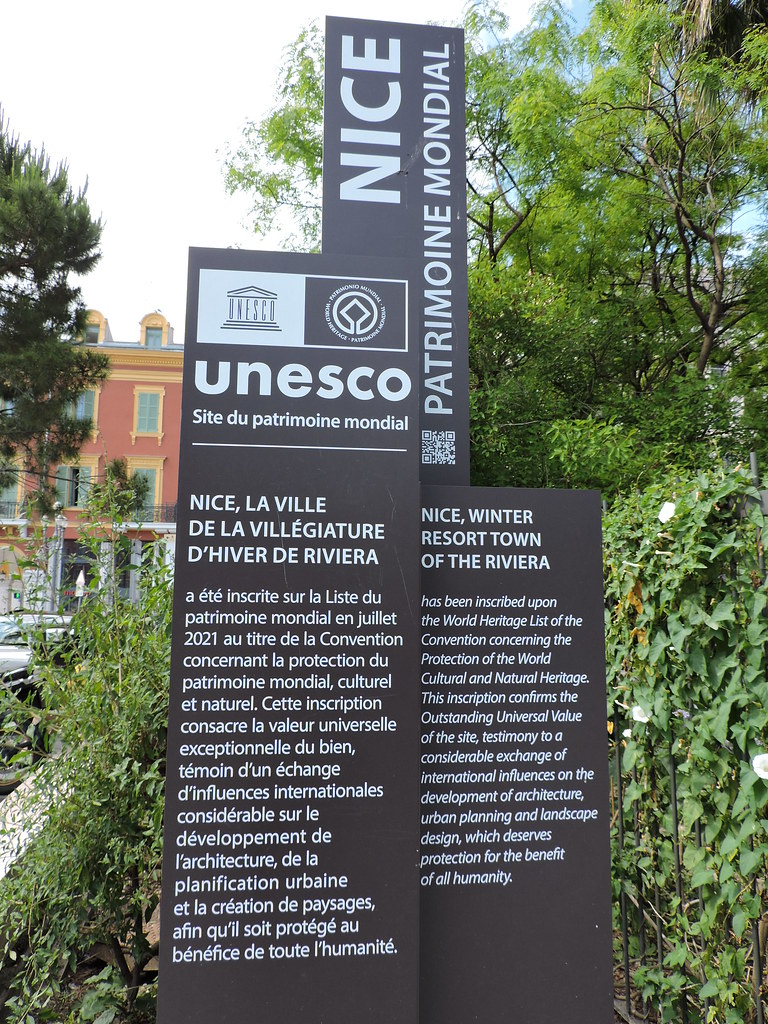 (photo by Digits) |
| Tubbataha Reefs | At the Tubbataha old ranger station, on the side, there is a big information board-like sticker missing only the criteria 8.849521691217644, 119.91684269375787 | 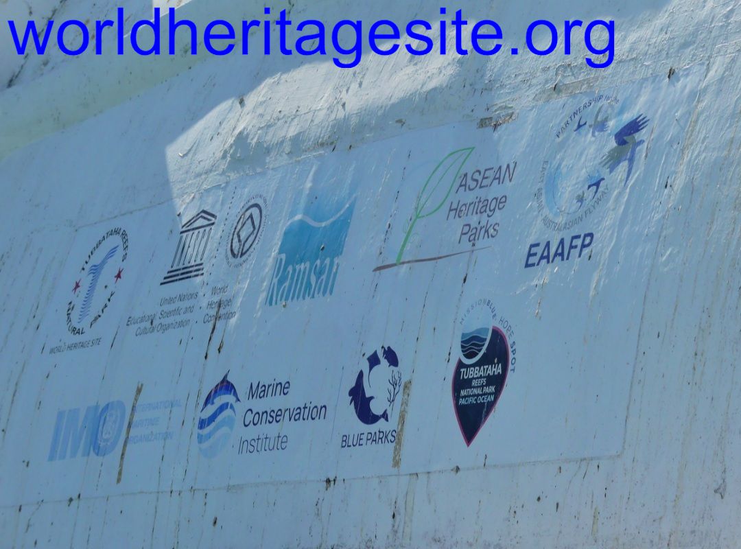 (photo by Clyde) |
| Tubbataha Reefs | At the Tubbataha old ranger station there is a marble plaque without the UNESCO symbol and without inscription criteria 8.849521691217644, 119.91684269375787 | 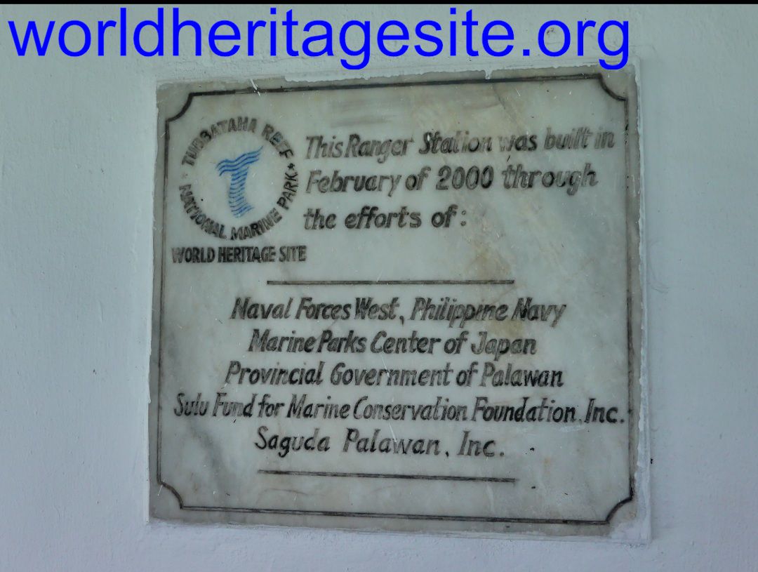 (photo by Clyde) |
| Baekje Historic Areas Royal Tombs in Songsan-ri | stone plaque 36.462222, 127.113225 | 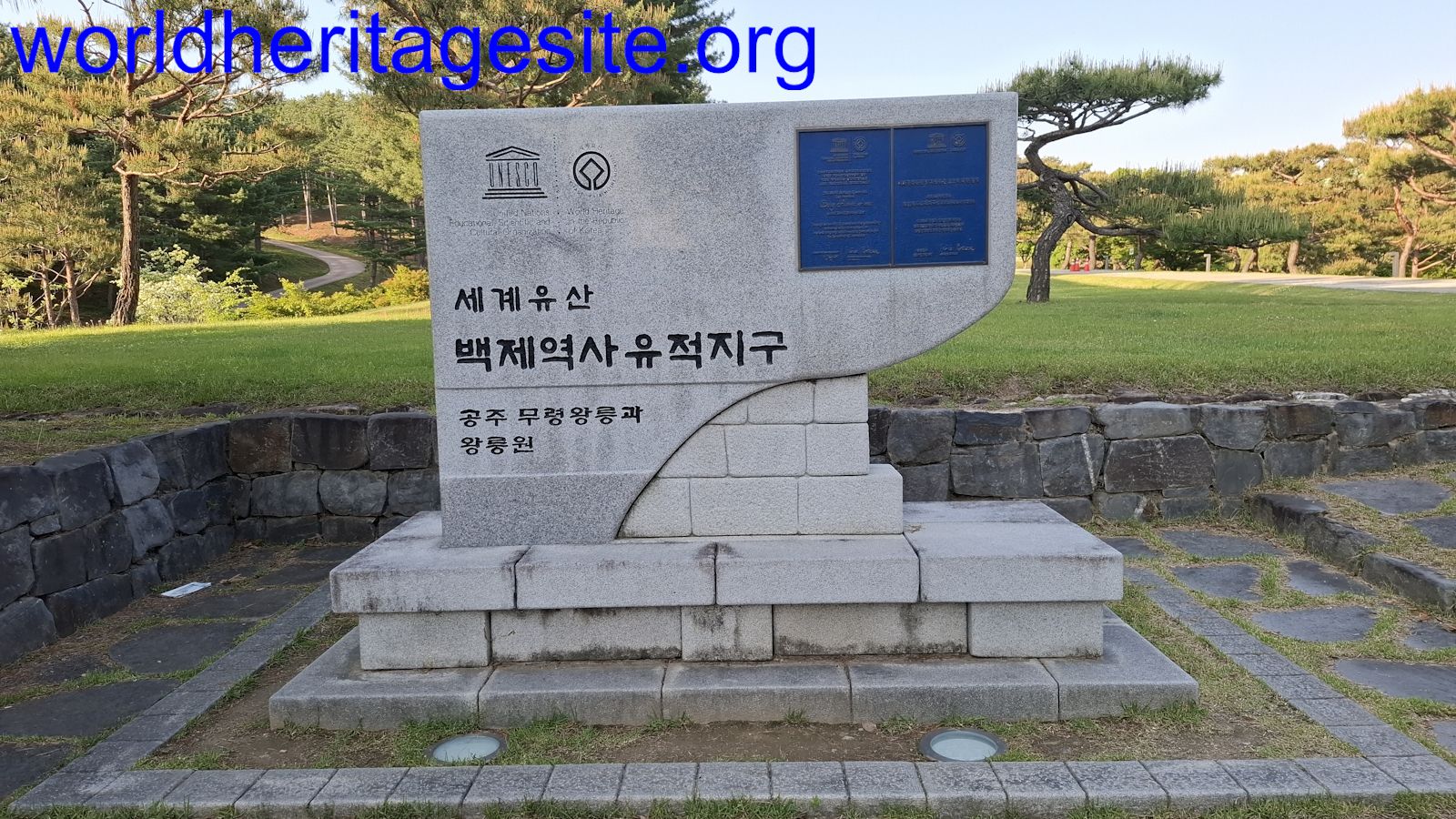 (photo by Paul Schofield) |
| Baekje Historic Areas Archeological Site in Wanggung-ri | stone plaque 36.276394, 126.945178 | 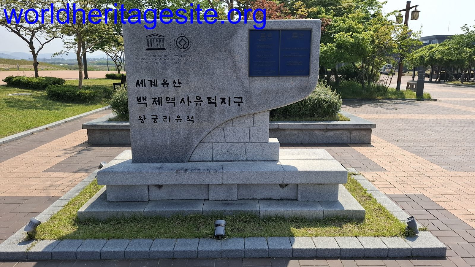 (photo by Paul Schofield) |
| Baekje Historic Areas Royal Tombs in Neungsan-ri | stone plaque 36.276394, 126.945178 | 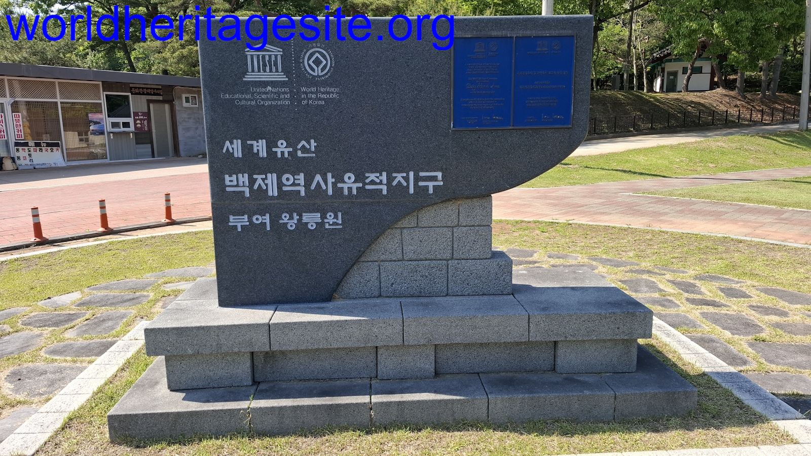 (photo by Paul Schofield) |
| Baekje Historic Areas Mireuksa Temple Site | stone plaque 36.009850, 127.030467 | 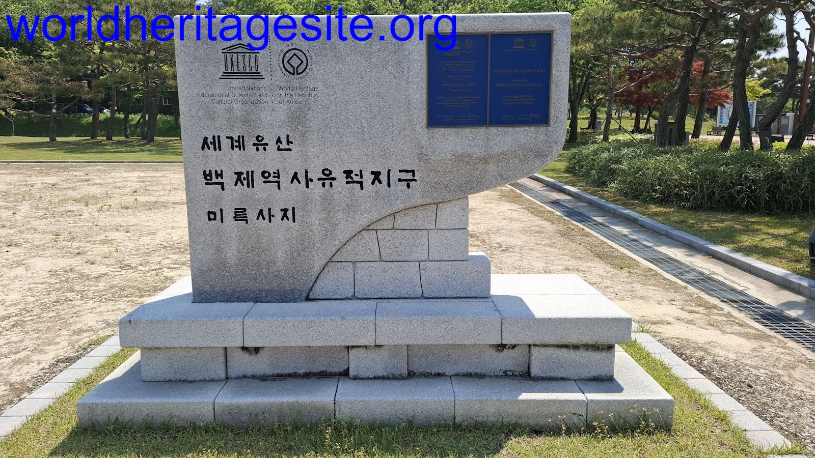 (photo by Paul Schofield) |
| Royal Joseon Tombs Jangneung Cluster Gangwon-do | stone plaque 37.195092, 128.454908 | 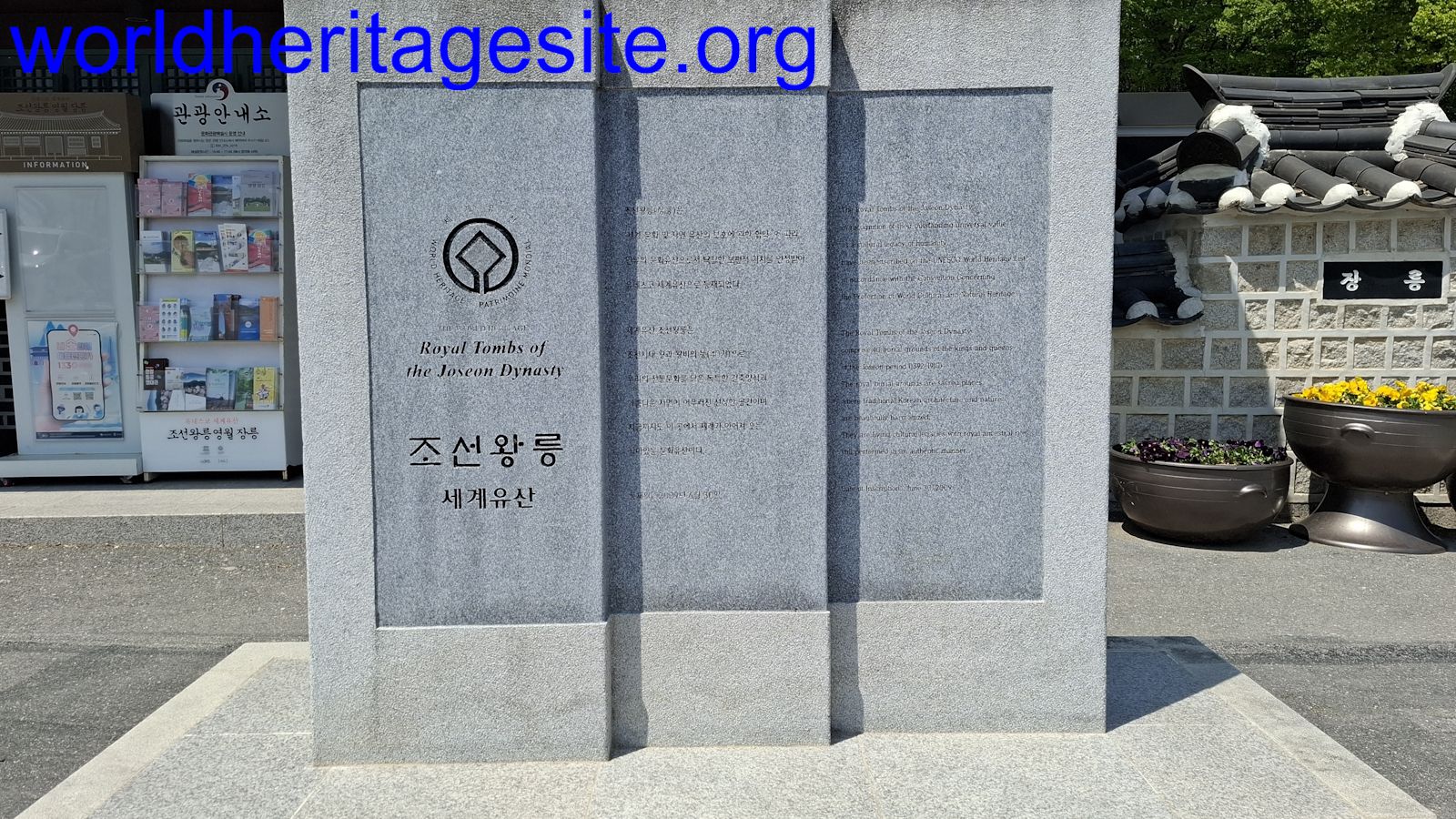 (photo by Paul Schofield) |
| Royal Joseon Tombs Donggureung Cluster | stone plaque 37.616692, 127.136442 | 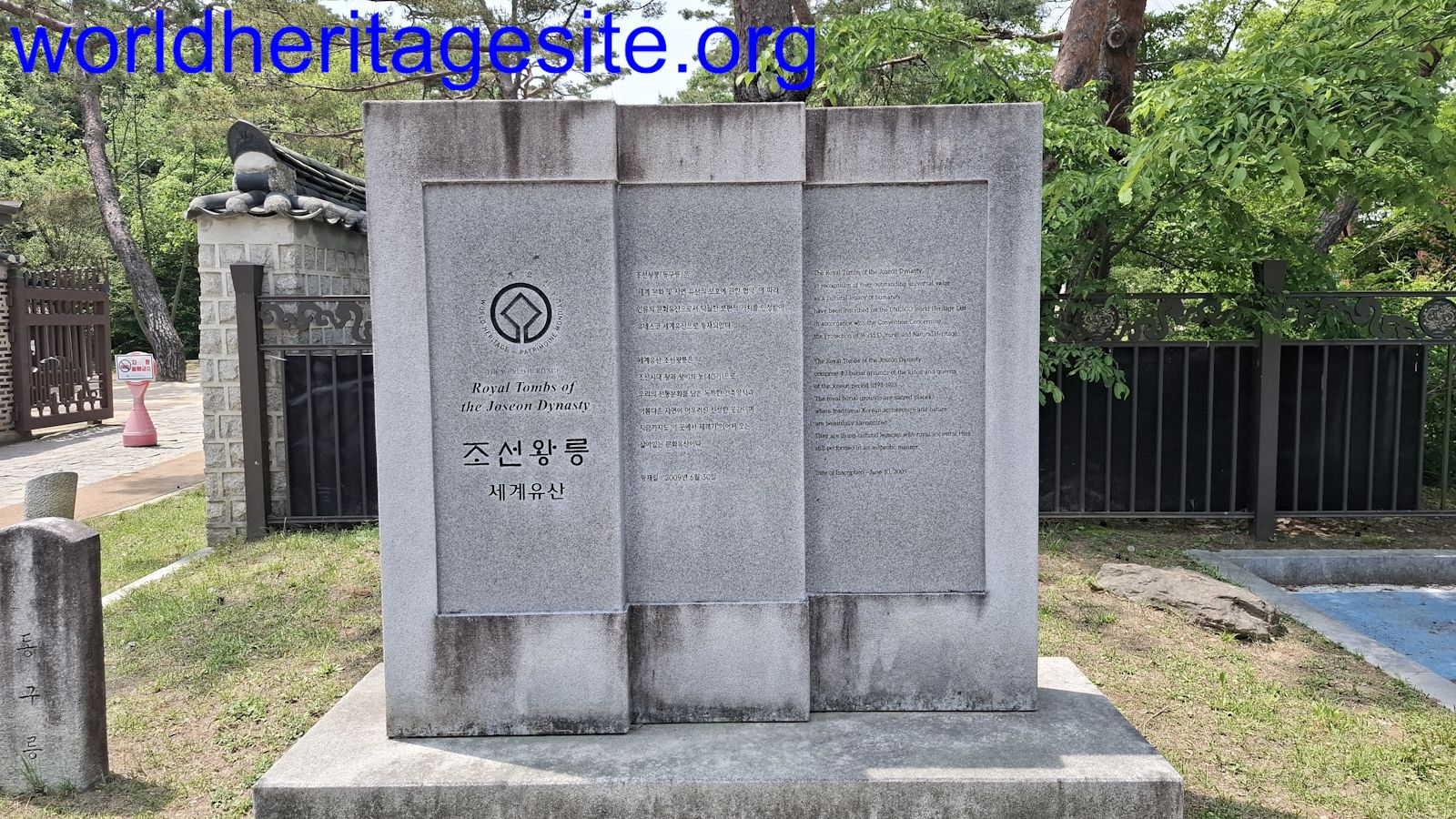 (photo by Paul Schofield) |
| Seowon, Neo-Confucian Academies Byeongsan Academy | stone stele 36.540011, 128.552944 |  (photo by Paul Schofield) |