Mount Kenya
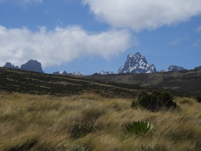
Mount Kenya National Park / Natural Forest protects the afro-alpine region surrounding Mount Kenya, the second-highest mountain in Africa at 5,199 m.
The mountain is an extinct volcano with 12 remnant glaciers on its slopes, which are retreating rapidly. Also, there are several small lakes and it is the main water catchment area for two large rivers in Kenya; the Tana and the Ewaso Ng'iso North. The site also comprises the Lewa Wildlife Conservancy and Ngare Ndare Forest Reserve in the foothills, which are within the African elephant migration route.
Community Perspective: Els has covered Ngare Ndare Forest, but this site requires additional reviews.

Map of Mount Kenya
Community Reviews
Els Slots

I have always wondered how a site that has been ticked by 63 members so far has only had one, tiny review dating back to 2006. I would guess that 90% of the “visits” here were drive-by ones. Even then, the mountain, with its characteristic rugged, glaciated peaks, isn’t always easy to see, as it is often covered in clouds. The best I could get was a silhouette at 7 in the morning from the pool area of my lodge.
Mount Kenya is known for its several vegetation bands with Afro-alpine flora from the base to the peak. I stayed for 3 nights at the Naro Moru River Lodge, a little oasis outside of the park borders, where you can experience the vegetation and wildlife of the lower regions of the mountain at 1,970m altitude. At night, you may hear the screaming of the tree hyraxes, and during the day, you’ll find many birds typical for the region (the lodge’s bird list includes a significant number of 399 species). The Cinnamon-chested bee-eaters put on a good show, but my favourite was the White-eyed Slaty-Flycatcher with its distinctive white ring around the eyes (pictured).
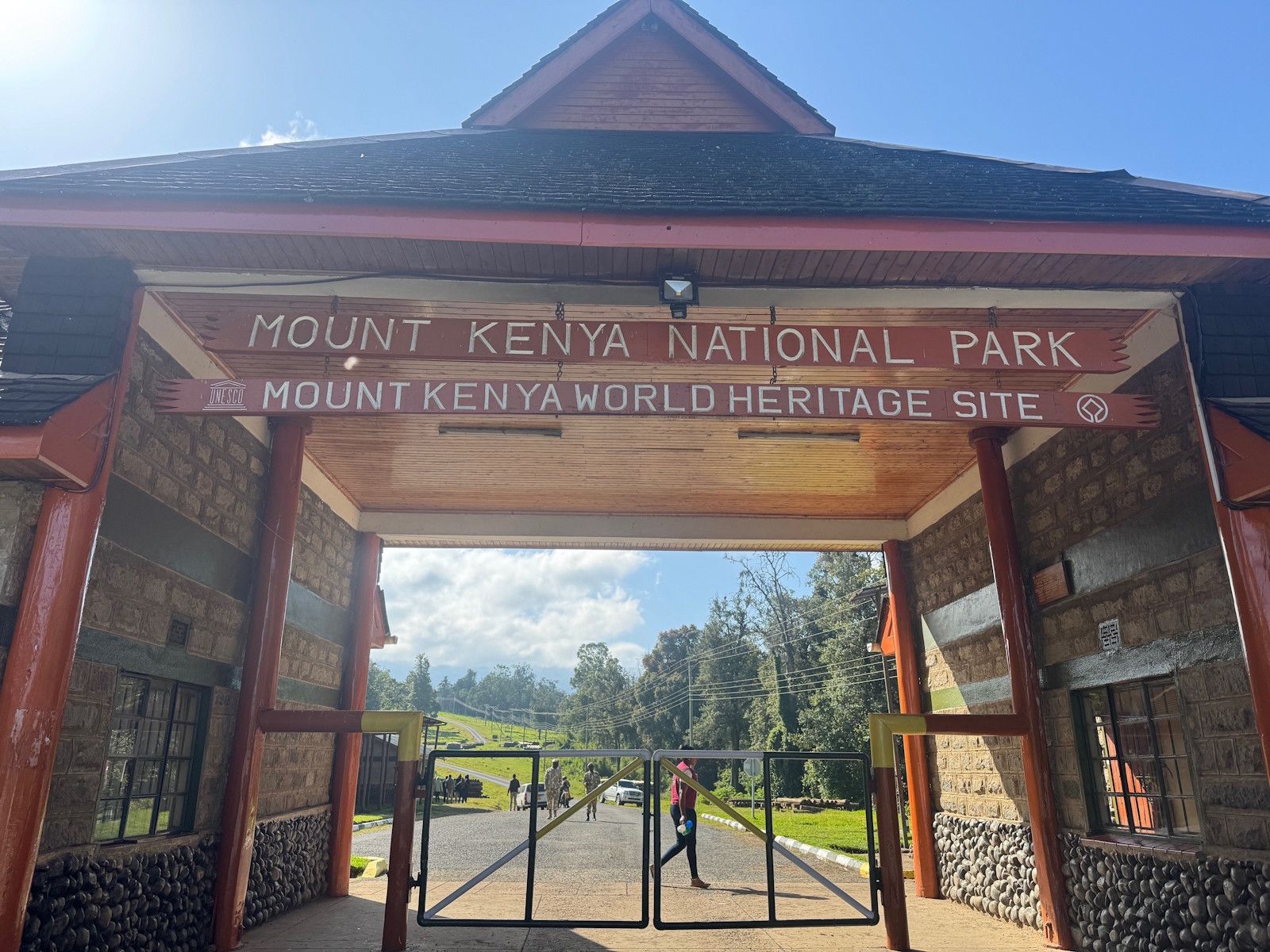
To enter the core zone of the WHS, there are three options: Mount Kenya National Park, Lewa Wildlife Conservancy, and Ngare Ndare Forest. The latter two were extensions and also include the Elephant corridor, where African elephants migrate with the season, away from the mountain when it gets too cold, and back when it gets too dry in the lowlands. They even have an elephant tunnel here, to avoid the main road! I decided against visiting the National Park as any hikes there seemed tough (uphill at high altitude). Lewa Conservancy is a formerly private reserve now owned by an NGO, with only exclusive accommodation on its grounds and very high entrance fees (198 USD per day). So that left me with Ngare Ndare forest, which is managed by a community organization that promotes ecotourism.
I went there with a driver/guide from my lodge. When you see the density of population in this area and the many farms (mostly producing flowers and linseed oil), you will immediately understand what a conservation success it has been that the remaining forest of Ngare Ndare is now protected. We picked up an armed ranger at the entrance, as all exploring here is done on foot and there are wild animals about (including the fairly dangerous elephants and black rhinos). The ranger started by telling that he had to fire a warning shot yesterday when he encountered a family of elephants while guiding a group of tourists. The program offered at Ngare Ndare is fixed: there's a 3km forest hike to a natural pool, and afterwards you will be sent to do the Canopy Walkway. You pay per tourist per day, plus a vehicle and a guide fee (all only collected via M-Pesa). I think you have to announce a few days beforehand that you will be visiting, at least their website suggests so and they need to have rangers available of course.
The hike was a bit of a mix of a walking safari and a forest trail. Except for one giraffe, we did not encounter any large animals, but we saw their tracks. They've managed to get the number of black rhinos at the combination of Lewa Conservancy & Ngare Ndare up to over 270 over the years (there were only 74 when the site was inscribed in 2013). Among the trees, the African olive trees and the Red cedars stood out.
I finished my visit at the Canopy walkway (they call it "the bridge"). It seems to have been made from iron wire, like a fence. And it is long, 450 meters. Due to the time of day, we did not see many birds from the bridge, although I came eye-to-eye with a pretty Hartlaub's turaco.
Read more from Els Slots here.
Zack Culvert
There is a drought now all over Kenya, as the mini rainy season of Nov 2005 did not come. So the Masai bring their cattle and sheep up to the tourist area. This drove away the animals. The cows meanwhile are dying from the altitude and new germs which they have no resistence to. Seeing a lot of dead and dying cows being butchered was not fun.
Community Rating
Site Info
Site History
2013 Extended
To include Lewa Wildlife Conservancy and Ngare Ndare Forest Reserve
1997 Inscribed
Site Links
Unesco Website
Official Website
Related
In the News
Connections
The site has 46 connections
Constructions
Damaged
Ecology
Geography
Human Activity
Individual People
Religion and Belief
Timeline
Trivia
Visiting conditions
WHS Names
WHS on Other Lists
World Heritage Process
Visitors
66 Community Members have visited.
The Plaque
 (photo by Randi & Svein)