Coffee Cultural Landscape
The Coffee Culture Landscape of Colombia is a system of collectively cultivated coffee plantations in a mountainous landscape.
The area comprises 6 regions with a total of 18 villages and 24,000 small coffee farms. Together they account for around 35% of Colombian coffee production. The plantations and associated villages were founded in the 19th century and are still in use.
Community Perspective: the first reviewers tried to make sense of which areas exactly are part of the core zone, until Solivagant shed light on the matter. Els describes the particular way of coffee production that got the site inscribed, and Solivagant (in his 2nd review) highlights the coffee towns.
Map of Coffee Cultural Landscape
Community Reviews
J_neveryes

This review is not intended to be a review of the Coffee Cultural Landscape of Colombia generally because I was only physically in the buffer zone of this World Heritage Site. Specifically, this review is based on my visit of a coffee farm near a small town named Salento. While small portions of the World Heritage Site is within the political boundaries of Salento municipality, the town of Salento, as most know of it, is neither a part of the core zone nor the buffer zone
However, if you are in this pretty and somewhat touristy town of Salento, you should have no trouble arranging a coffee farm tour, some of which will be within the core or the buffer zone. I visited Las Acacia Coffee farm, which is nestled in the green mountain valleys near Rio Navarco and Rio Quindio. The photo accompanying this review is a view from the road in front of the farm, but facing away from the farm.
The Coffee Cultural Landscape near Salento is very pleasant to view and explore, but to be frank, you should be visiting Salento less for its small participation in the World Heritage Site, but more for its proximity to Valle de Cocora. Valle de Cocora, which is not within the World Heritage Site boundaries, is a striking valley filled with incredibly tall wax palm trees. The loop hiking trail (2-3 hours, moderate difficulty) is fantastic and strongly recommended.
Els Slots

It is really telling that the 5 reviews of the Coffee Cultural Landscape so far focused fully or at least partly on the boundaries of this WHS. It reminded me of a WH travelers group T-shirt suggestion (made by Samuel) that promoted the slogan “Are we in the core zone yet?”. Well, I will focus on the coffee production instead as the ‘tick’ should consist of having seen/experienced the OUV in addition to setting foot in a certain area.
What makes Colombian coffee farming (especially in and around the selected areas) different from others? Most farms are small-scale family operations using manual labour, shade-grown coffee is the traditional system and there is a strong community focus on coffee production in all aspects of life. I decided to look for these characteristics south of Salento, in an area called Palestina. Here there are a number of coffee farms that are open to visitors. The biggest (which even needs pre-booking) is El Ocaso, one of the most popular among English-speaking tourists is Don Elias, but I went for the more low-key El Recuerdo. I hiked there in just over an hour from Salento on a pleasant path, where the coffee plants that had been absent so far on my travels in this region became more and more prominent in the surrounding landscape.
El Recuerdo is a small, organic farm that applies polyculture. Besides coffee, they grow fruits and herbs for their own use. They adhere to the principles of the Rainforest Alliance for sustainable farming. I was assigned a young biologist as a guide and we could start the tour right away. They usually see only a handful of tourists a day.
The tour started with an explanation of how coffee growing came to the region. This was relatively late into the whole expansion of coffee production around the world: Jesuits brought it with them from Venezuela in 1732. First, to the region around Medellin and in the 19th century, it spread further around Colombia due to internal migrations. We then moved on to have a look at the herbal garden – it even holds one original Colombian coca plant (“It’s not the plant’s fault what happened…”).
In contrast to many other farms in the region, this one still produces shade-grown coffee. This essentially means that the coffee plants are planted within a thin forest of trees. The trees provide shade, but also fertilize the ground through their leaves and attract insects and birds. At other places the trees have all been cleared to increase productivity (more coffee plants per square meter), a practice that attracted a sour remark from IUCN (“They can’t be included, can they?”). Among the plants in the forest of El Recuerdo are various kinds of citrus fruits. And the guide showed me a beautifully woven hummingbird nest with 2 eggs.
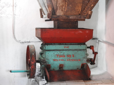
In general in Colombia, the coffee farmers only produce dried coffee beans which are then sold to the cooperation which in its turn sells it often to roasters abroad. This farm cut out the middlemen, uses a private roaster near the town of Armenia and sells its coffee in its own shop at the farm and in shops in nearby towns.
I had been to a small coffee farm once before, that was near Matagalpa in Nicaragua. The process used there is exactly the same as far as I can see as a non-expert. The farm used polyculture as well. There I also enjoyed the bustle of a coffee market town, with sacks of coffee beans being transported in various manners. They do also have larger factories (processing plants) there. I missed this transport & trade aspect here in the Armenia/Salento region, but it must be said that I arrived outside of the coffee harvesting season which takes place yearly in May/June and October.
Read more from Els Slots here.
Solivagant

My previous review for this WHS explained how, in Nov 2019, we determined that we had visited 4 towns in the core area (Zone D) of the “Coffee Cultural Landscape” (CCL). We also visited a number of neighbouring “Veredas” (or “rural areas”) including some in “core” areas and some in “buffer zones”. So, what did we make of this WHS - what was its “Heritage value” and was there a coherent story to tell?
We didn’t take a “Finca Tour” in the CCL as we had already done so in other parts of the World where coffee is grown. However, in other coffee producing areas of Colombia we had pleasant and close interactions with “Campesinos”, visiting and talking to them in their homes and seeing them preparing and drying the coffee there from “plant” to “sack”. We had also visited the town of Inza (nr Tierradentro) on its coffee market day and concluded that it was difficult to envisage an area more reliant on the coffee business than it was – certainly the CCL isn’t any more so. See this article about Inza's small coffee growers. Which raises the question as to what is so “special” about the inscribed CCL which raises it above (or at least makes it different from) the multitude of non-inscribed coffee producing areas in Colombia?
It isn’t the quality of the coffee either. We asked Colombians we met whether the coffee from that area was the “best” in Colombia. It appears that it produces a wide range of types and qualities and that there is as good (and as “bad”) in other areas too. Maybe, to the true coffee connoisseur, the differences between coffees are as significant and as noticeable to the palette as different wines, and a good “Aranzazu” is as identifiable as fine “Bordeaux”! Of course the different inscribed wine regions around Europe (and possibly yet around the World?) are not inscribed solely because of the nature and fame of the wine produced at each but because of their differing histories, architectures and landscapes. And there perhaps lies the aspect which ties together the differing locations included within the CCL.
The “Foundation” dates of the 4 towns we visited provide a clue – Salamina 1825, Pacora 1832, Chinchina and Neira 1857. The reason for this is that the area’s “Coffee Landscape” was initially the result of a movement of peoples into an area of Colombia previously largely untouched by non-indigenous people. This took place mainly through the 19th C and is known as the “Antioquian Colonisation”. This comment in the Nomination sets out the “story” of the inscribed landscape as presented in the nominated areas - “There are four distinct periods in the PCC’s historical process. First is the pre-Hispanic or pre-Columbian epoch; second, the Antioquian colonization; third, the expansion of coffee production; and lastly, the fourth period corresponding to the technification of coffee production”. This initial migration is a part of the “national mythology” of Colombia, much as with the Voortrekkers in S Africa and the opening of the West in USA. In modern Manizales there is a powerful monument to that initial migration titled “El Monumento a los Colonizadores” (well worth seeing if you need to pass through Manizales and have time to spare). A noteworthy aspect of this colonisation was that it was carried out by families who used their own labour to develop the land they had occupied rather than being large landowners with paid servants. This created both a very different type of society than existed elsewhere in Colombia and, at least initially, a different type of land holding with predominantly small production units. The nature of coffee as a crop also required a mixed agricultural economy with a wide variety of other crops and activities. The “story” which the WHS claims to tell is of a landscape which reflects this history.
The first of the 4 “core inscribed” towns we visited was Chinchina. This turned out to be a busy, modern town (it has suffered several earthquakes) with no noteworthy “built” historical heritage whatsoever. What were we meant to be looking for/at? We visited the helpful tourist office in the main square and asked about the Coffee Landscape attributes of the place. First we were referred to a giant coffee cup in the square which had won Chinchina a place in the Guiness Book of Records for the “Largest cup of coffee in the World”!! Next we were told where the modern “Buencafe” freeze drying coffee factory was. Also about “Cenicafe”, the nearby Coffee Research Institute. I have checked, and both of these organisations get their share of pages in the Nomination file!! These are examples of what the Nomination calls the “technification” stage of development of the landscape. We later attempted to visit the Buencafe factory but it was of no architectural value and inaccessible – I even got shouted at by security guards for photographing it through the fence!! Finally we were told that we should visit nearby “Alto de la Paz” which was the “Paisaje cafeteria mas hermosa de Colombia”. How could we miss such a place? So we left the “town” and passed under one of the brown PCC signs into a "rural area!! Both the UNESCO “Zone” and the Municipality maps show Chinchina to be surrounded by one of the most extensive rural core areas in the entire WHS – the “Vereda” of La Paz is clearly a part of that core area and is only a few kms out. But what we saw was unlike any of the coffee areas we had seen before in Colombia - we had entered a new world of industrialised coffee growing - a monoculture of coffee bushes as far as the eye could see, stretching over every hill. The Nomination file (page 265) calls it “High tech full sun monoculture” and ICOMOS wasn’t very pleased with this, wondering, in that case, what was left from the past! The mixed planting of small fincas, common elsewhere in Columbia, was totally missing. The coffee was still growing on what were sometimes precipitous slopes and we were told that all picking was still carried out by hand. Presumably much of it finishes up in the factory being freeze dried. The view from the top down into Chinchina and across vast areas of coffee fields was striking. We were certainly seeing a “Coffee Landscape”! The location is at 4.971174, -75.620916.
Our next “core” town was Salamina. We spent 2 nights there and it turned out to be a very pleasant, relatively small and still un-touristy town with many streets of attractive buildings dating from its foundation in 1825 through the 19thC. There was almost no jarringly 20th C development whatsoever. We preferred it over Salento which we found to be totally turned over to tourism – Salamina on the other hand clearly has an extensive “real life” as a town. Both have similar brightly coloured houses with overhanging roofs and intricate carved wood and fretwork balconies, doors etc (photo). The Nomination file states for Salamina that it is “one of the most ornate towns—is famous for its woodwork by Eliseo Tangarife, shown off as a great masterpiece that adorns many of the town’s houses”. After modern Chinchina, it also takes one much closer to the origins of Coffee in this part of Columbia. The town’s “Casa de Cultura” contains mementos etc of the earliest immigrants and other references to those early “pioneers” abound. We got the feeling however that coffee had perhaps “moved away” from the town somewhat compared with previous years – there were no dealers with sacks of coffee outside etc as we had seen in Inza but the town still contains a major building in the form of the “Coffee Growers Committee”. The Municipal map shows the inscribed core rural areas to be situated to the west of the town and not passed through in any major way on the road up from the South or going further North.
We had a spare afternoon and decided to drive the c35kms from Salamina to another “core inscribed” town at Pacora. The rough road provided fine scenery (and amazing views of Salamina on its mountain top), dropping into a deep canyon with plenty of small fincas growing coffee in traditional mode with mixed planting (but not in a core area). Later it climbed high into forest and passed under a brown sign with a UNESCO logo indicating that we had entered “Pacora PCC”. But all around were pine forests, sugar cane, avocados and pasture for cattle and horses. Not a coffee bush in sight!! The Municipal map confirms that this area is not “core inscribed”. Pacora is smaller than Salamina but founded around the same time. Its “period” architecture seemed less fine and one wondered how much of it was new but built to look authentic. The Nomination file describes its church as an example of “Eclectic Historicism”, i.e a mixture of almost everything! We found our UNESCO logo in the Plaza Mayor and went for a coffee (!!). Several farmers were in and I asked about where the coffee was grown – “further down” they said “the climate’s not right here”. So there you have it – Pacora town is inscribed as part of the core CL and the whole of the “Municipality” claims its UNESCO logo. But the rural core area is only further down. The Nomination file (PDF page 256) states that Pacora, like the other core inscribed towns, provides “valuable examples of the conservation of outstanding characteristics that distinguish the architecture of the colonization”. Maybe – but if you have already seen Salamina then Pacora has little to offer. Our final core town visit was to Neira. It had even less of note than Pacora!
So - Salamina is undoubtedly the “star” town. It is, in our view, one of the most attractive historic towns in Colombia for its architecture, its setting and its general ambiance - and a nice destination within the CCL. On the other hand, despite being a “core inscribed” urban area, the town of Chinchina is not worth visiting. If you are passing through anyway, however, it is worth visiting the nearby rural areas to see what “technified” coffee production looks like.
Overall our view is that this WHS is an ill-formed "monster" which tries to cover every base across a huge area. It would have been far better if the site had been limited to the best historic aspects of the Antioquian Migration – but that of course would not have met the Coffee marketing aspirations of the entire region!
Solivagant

As of May 2023 a number of the links referred to in my 2 reviews of CCL are broken. Many (but not all) are still available if you enter the link into Wayback Machine
As previous reviewers have identified, the first problem when making a visit to the Coffee CL WHS is to determine where exactly the boundaries are and how you “know” if you are/have been inside them. The execrable maps provided on the UNESCO Web site (Michael Ayers - I agree with every word you say!) show 6 inscribed “landscape areas” (or “Zones”) which cover a large area of central/western mountainous Colombia. I have studied those maps (and other sources), both before and after our travels, trying to make sense of them and, before reviewing any of the areas we visited, I will cover below the conclusions I reached and suggestions as to how others might use the available sources to determine their own visits to this WHS ensuring that they visit a core area if they so wish! If the detailed boundaries of the CCL are of no interest to you then please read no further!
The best entrée to making sense of the boundaries is via the Nomination file. The Executive Summary on PDF Pages 10/11 states that “The Coffee Cultural Landscape (PCC) covers areas of 47 municipalities spread over four Colombian departments” (these in turn are spread across the 6 “Zones” so a few departments, e.g Risaralda, have areas in more than one zone) and lists those “municipalities” within each relevant “Department”. Taking “Caldas Department” as an example - the inscribed area “includes rural areas housed in the municipalities of Aguadas,,…Chinchiná .... Manizales, Neira, Pácora……Salamina…… and the urban areas of the …..Chichiná, Neira, Pácora, ..... Salamina and San José municipalities”. So - a “Department” comprises “Municipalities” and a “Municipality” contains “rural” and “urban” areas. But which rural and which urban areas are inscribed? “In Colombia, the rural areas of each municipality are divided into “veredas” or rural districts, which are considered the smallest territorial divisions possible in the country. The PCC includes certain veredas of the above mentioned municipalities”. The Urban areas are in turn called “Casco Urbanos”. So – a “Department” has “Municipalities” and Municipalities have “Veredas” and “Cascos Urbanos”! The inscription content is defined at this lowest level of “Vereda and “Casco Urbano”. BUT – there are 2 additional complexities. First - whilst it seems normal to inscribe complete “Veredas” and “Cascos Urbanos” I haven't studied every map and can’t guarantee it! Second, and more importantly, when the nomination file states that urban and rural areas in a municipality are “inscribed” it uses the word “inscribed” to include BOTH Core and Buffer zones!! So – some listed Veredas and Cascos Urbanos are only in buffer zones and indeed some listed municipalities only include Buffer zones!! This latter aspect only becomes clear on PDF Page 19 – “The PCC’s Buffer Zone also includes areas in the municipalities of Viterbo (in Caldas), Dosquebradas and Mistrató (in Risaralda) and Argelia (in Valle).” That is why some documents refer to 51 municipalities being “inscribed” – the 47 which contain SOME core area (though which may be mainly Buffer) plus 4 which definitely only contain “buffer zones”. So I hope that is all clear now!
How can you make sense of this “on the ground? As identified by Michael Ayers, you will, as you travel through the area, frequently pass under enormous brown signs sporting a UNESCO Logo and stating e.g “Palestina PCC. Paisaje Cultural Cafetero”. Unfortunately they cannot be relied upon to determine whether you are in a “Core” area! E.g - As you cross the modern bridge in Pereira into the next admininstrative area you will pass another large brown sign (Photo) with a UNESCO Logo stating that you are now in “Dosquebradas Paisaje Cultural Cafetero”. Dosquebradas is a municipality in the Risaralda Department, Even the awful UNESCO map shows clearly that the inscribed boundary reaches nowhere near the crossing point from Pereira to Dosquebradas!! Furthermore the Nomination file even states “The PCC’s Buffer Zone also includes areas in the municipalities of ….. Dosquebradas….” So the whole of Dosquebradas municipality is “claiming” a UNESCO logo on the basis that a PART of it is in the Buffer Zone!! It contains NO core areas whatsoever! I am afraid that overhead road signs just cannot be relied upon as proof that a core area has been entered. They seem to have been placed to indicate that you have now crossed the boundary into a Municipality which contains an inscribed area – somewhere (and maybe not even a “core area”)!! This conclusion is confirmed by the fact that there are often adjacent signs stating "Aqui comienza el Municipio de xxxxx"
And what about the core boundary of a “Casco Urbano”? We visited 4 of the towns within Caldas Department included in the list of included “Urban Areas” above – Chinchina, Salamina, Pacora and Neira. Now, if you spend any time in Colombia, you will grow to know and love the ubiquitous, standard design Information Boards which grace nearly every Plaza Major and stand outside any building of “interest”. They have a front, back and side with the name of the site written vertically on the side face and in those 4 towns I can confirm that the board included a UNESCO Logo on both font and side! However the information boards in Salento have also managed to find an "excuse" to show a UNESCO logo (small - on the front). This is in direct contradiction with what is written in the Nomination File - “Filandia and Sevilla housed in the Buffer Zone are also exceptional, as is Salento, located in its surroundings”. i.e Not only is the urban area of Salento NOT in the Core zone – it isn’t even in the Buffer zone – merely in its “surroundings”!!! This seems to show that Information Boards in towns can also NOT be relied upon to confirm WHS "Core" status.
It is a mess. From its comments and questions I don’t believe that ICOMOS understood this nomination (Its deferral recommendation to sort out boundaries etc was overturned of course). The Nomination file seems designed to confuse and bring in every aspect of the area whether in the core or buffer zones – or indeed in neither!! Thus, large parts of it are concerned with describing towns, musea etc etc which are clearly NOT a part of the inscribed site.
So, I am afraid I have concluded that, particularly as regards rural areas, the ONLY reasonably sure way to ascertain whether you have entered/are planning to enter a core zone is by zooming in on and studying such maps as are available – however poor they may be. In addition to the Nomination maps I have also found a set at the “Municipality” level. They are within the Web site of the organisation which “runs” the entire “PCC” scheme and initiated the Nomination itself. This seems to be a umbrella organisation carrying out PR and Lobbying for all matters related to coffee within the 4 departments it represents. As such, it “fights” for all its areas and this perhaps explains both why it pushed through such enormous areas for inscription and why it is complicit in the “muddling” of what is “core”, what is “buffer” and what is neither! For convenience you can access the same maps as are in the Nomination file here The Municipality maps are to be found here (Choose 1 of the 4 Departments and then whichever of its municipalities you wish to investigate in detail! This will download a 3 page document. Page down to the Municipality map on the 2nd page. Note the "green" to indicate which areas within the Municipality and its Veredas are growing coffee.The 3rd page lists all the separate “rural” and “urban” areas in that Municipality both “core and “buffer”). Unfortunately these maps too are very poor and make it difficult to relate inscribed administrative boundaries to roads or natural features – but they do provide more clues!.
These detailed maps demonstrate why road signs placed at municipality boundaries cannot be relied upon. But they may also provide some “good news”! If, for instance, you have visited Salento and are disappointed that it isn’t even in the buffer zone you can use the map of Zone D and the appropriate Municipality maps to confirm that, if you had reached it from the south up Rte 29 from Armenia you WILL have passed briefly through the core zone!!
And so to our visit in Dec 2019. We mainly visited Zone C and only briefly passed through Zone D. That is situated south of Periera around the towns of Armenia and Salento. BUT I can confirm that none of those 3 towns is actually within the core or even a buffer inscribed area. Zone C is situated to the North of Pereira, particularly around Chinchina, and also stretches in a thin strip north of the largest town of the area at Manizales. This "capital city" of Caldas has a population of over 400k and is said to be “at the heart of coffee production in the region” – but it too is excluded from both core and buffer. In fact, among all the inscribed areas, inclusion of “Cascos Urbanos” within the core is uncommon and, if you are in a town, then probably you are NOT inside an inscribed area! You will need to check at “Municipality level”!
Here are the Municipality maps for the 4 towns we visited whose “Cascos Urbanos” ARE inscribed as core areas –
a. Chinchina
b. Salamina
c. Pacora
d. Neira
Conversely here are some Municipality definitions to show towns which are NOT included in a core area
a. Salento
b. Filandia (in buffer zone only)
c. Calarca ("officially"in buffer zone only but the map suggests that part of the Casco Urbano area might be in the core zone)
I will cover our visits to the 4 above towns and their related “Veredas” in my next review and limit this one to the issue of “boundary establishment”!
Ammon Watkins

We finally made it to a WHS my wife was more excited about than I was. I knew we would pass through this WHS somewhere along the road between Armenia and Salento at the very least but like others before us, were unsure of the exact boundaries. So we adopted our own interpretation of what we were supposed to be seeing/doing there. For the cultural part we visited Salento and nearby Filandia, both nearly identical in appearance with pretty, colourful buildings spreading outwards for a few block radius from their central squares. This is tourist central, especially on the weekend with all the local tourists day-tripping in.
We also observed the landscape within the core zone, both as we passed through but also from several viewpoints around Salento and especially Filandia where there is a tall wooden observation tower from which you can see all the surrounding villages as well as Armenia. There wasn't as much coffee growing here as we expected considering the importance of the crop to the local economy. We visited a family run coffee finca too and took the tour. It might've been within the buffer zone but we aren't sure. This seemed a fair example with their traditional methods still preserved unlike some of the larger, commercial operations. We learned quite a bit in the process and found it worthwhile. My wife insisted on drinking copious amounts of local coffee so we nailed that part too ;)
Michael Ayers

Visited in February 2019.
Like many members, I am often bewildered when trying to determine exactly what I am supposed to see when visiting a Cultural Landscape site. Colombia's recently-inscribed Coffee Cultural Landscape is a perfect example of that.
As I prepared my recent visit, there was a map available on the UNESCO page for this site that, in theory, gives the location of the core- and buffer-zones of this site. However, the map is close to impossible to read easily, seemingly being created from whatever public-domain map its creators could find. Text labels for cities and towns are sometimes in the wrong place, and the roadways, and other landmarks, are also not very clear. Nevertheless, after staring at this map for a long time, I was able to determine that I would pass through two sections of the core zone on my recent cycling trip, namely the town of Anserma (presumably all of the city center is not included, but the area just beyond that is), where I spent one night, and the roadway connecting the towns of Viterbo and Apia.
There is certainly coffee being grown in these areas, though maybe not as much as you might expect. There is also a lot of sugarcane and bananas, though the latter are often used as a shade crop for coffee. I did not notice any sort of buildings or other infrastructures involved in the processing of coffee in these two areas.
The only informational items relating to the WHS that I saw were a new road sign over the highway leading into Apia from the west that said "Apia: Coffee Cultural Landscape" (in Spanish) with the WHC logo (I'm not sure about the eastern approach since I used the very hilly, rocky "short-cut" road in that case,) and a mural in a narrow hallway inside the old hotel where I stayed in Anserma that is the photo for this review. It says: "We are Coffee Cultural Landscape", "Anserma is Grandmother of the Caldas (region)" "Greets you."
Overall this site does feel more like a marketing ploy than a WHS, but a lot of people like to drink Coffee, so perhaps that is understandable. I probably should have drank a cup while I was there, for the experience, but I don't really like coffee, so I didn't.
Read more from Michael Ayers here.
Jarek Pokrzywnicki
First of all - it is not easy to distinguish what exactly was inscribed as Coffee Cultural Landscape - particular coffee farms, land area, towns and villages. All available maps do not show inscribed zone, there are no signs of World Heritage in the places (yet, November 2011) that is for sure inscribed as UNESCO heritage. But for sure the landscapes are spectacular although I haven't seen any difference between inscribed part and non-inscribed.
I was visiting Salamina, passing through Chinchina, travelling around Salento, Manizales, Armenia and Pereira. Those areas are either directly inscribed as WHS (Salamina, Chinchina) or located in close vicinity of Coffee Cultural Landscape. Salamina is truly remarkable (nice colonial town, sourrounded by high mountains, with lovely old houses, one the most interesting places in Colombia). Chinchina looks to be quite ordinary, like many other towns.
Community Rating
- : Misio_pysio Camelopardus Shombob Little Lauren Travels
- : Tamara Ratz Rvieira
- : Larry F Tevity Priyaranjan Mohapatra
- : Cmtcosta Alberto Rodriguez Gutierrez Hanming Roman Koeln Carlos Garrido Sutul Carlos Sotelo Maciej Gil Philipp Leu Javier
- : Roger Ourset Els Slots J_neveryes Alikander99 Alejandro Lau Szucs Tamas
- : Ammon Watkins Alexander Barabanov Joyce van Soest Dorejd Solivagant Adrian Turtschi
- : Zoë Sheng Lucio Gorla
- : Michael anak Kenyalang
- : Frédéric M
Site Info
- Full Name
- Coffee Cultural Landscape
- Unesco ID
- 1121
- Country
- Colombia
- Inscribed
- 2011
- Type
- Cultural
- Criteria
-
5 6
- Categories
- Cultural Landscape - Continuing Human activity - Agriculture
- Link
- By ID
Site History
2011 Advisory Body overruled
ICOMOS recommended Deferral - OUV (v, vi) not proven, comparative analysis needed improvement, boundaries/buffer zones needed improvement, serial approach as selelcted not justified. WHC inscribes with push from Bar, Mex, Brz
2011 Inscribed
Site Links
Connections
The site has 19 connections
Art and Architecture
Constructions
Damaged
Geography
History
Human Activity
Religion and Belief
Science and Technology
Timeline
Trivia
Visitors
116 Community Members have visited.