Zagori Cultural Landscape

Zagori Cultural Landscape covers an agro-pastoral landscape with numerous traditional villages.
It lies in Epirus, a mountain region in north-western Greece near the Albanian border. Most of the villages were founded in the 15th century and are examples of vernacular stone architecture adapted to the conditions of a mountain region. Besides buildings like schools and churches in the villages, they include stone bridges, stone paths, and stone staircases.
Community Perspective: best to be explored over 2 to 3 days by rental car and on foot, with the target to see Gorges, Bridges and Villages.
Map of Zagori Cultural Landscape
Community Reviews
Hubert

Zagori is a World Heritage Site just the way I like it: a beautiful landscape, vernacular architecture, great hiking opportunities and not crowded with tourists.
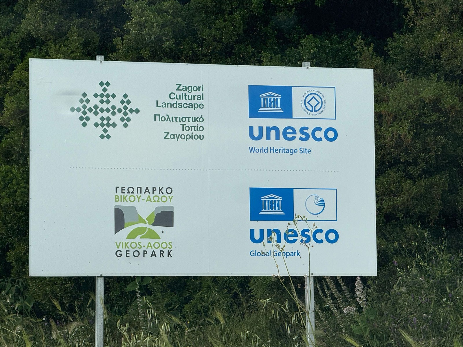
The inscription in 2023 was controversial. It was initially proposed as a mixed site, ICOMOS recognised the cultural OUV, but IUCN had concerns about the biodiversity criterion. They proposed extending the core zone to include the entire Northern Pindos National Park. The final compromise was to inscribe Zagori only for its cultural values (criterion v only). Most visitors come to Zagori for the nature, but that may now change after inscription. I came for both, nature and culture, and was not disappointed by either.
Cultural values in Zagori mean in particular the villages, the stone stairways and the stone arch bridges. For centuries, these bridges and steps were the only connection between the villages. The modern road network was only opened in the 1950s. If you find a small car park at the side of the road, you can assume that a stone bridge is not far away. Two of the most beautiful are the three-arched Plakidas (or Kalogeriko) bridge (photo) near the village of Kipoi and, nearby, the Noutsou (or Kokkoros) bridge (photo in Els' review), with its picturesque location between two high rock faces. The area near the villages of Kipoi and Koukouli is a hotspot for these stone bridges. On a loop of about 10 kilometres you can hike to six bridges. All types are represented: one, two and three arches.
The Vradeto Steps are another masterpiece of engineering. Until the 1970s, this was the only way to reach the village of Vradeto. Well, "steps" is an understatement here. The staircase meanders its way uphill on more than 1000 steps and climbs 250 metres in altitude. But refreshment awaits after the steep climb: there are two taverns in the tiny village. And you can walk on to the Beloi viewpoint, from where you have a beautiful view of the Vikos Gorge.
There are around 20 villages in the core zone. The villages are quite similar: traditional stone houses with slate roofs, narrow cobbled streets and a central square with a church, a public fountain, an old plane tree and a taverna. I visited quite a few of them, the most picturesque being Megalo Papingo and Mikro Papingo. I also liked the village centres of Tsepelovo, Ano Pedina and Monodendri. The churches are large compared to the size of the villages. Usually, they were closed. The best chance of finding them open is probably on Sunday mornings after the mass.
Monodendri is by far the most lively village in Zagori and the starting point for hikes through the Vikos Gorge. I started my hiking tour in the morning in Monodendri and arrived in Vikos in the early afternoon. The trail starts with a steep descent down to the bottom of the gorge, then about 10 kilometres along the Voidomatis River until it climbs steeply uphill again to the village of Vikos. The return trip by taxi (40 euros, 25 km, 40 minutes). Alternatively, you can also start in Vikos, hike as far as you like and return the same way (then I would skip the steep climb up to Monodendri). In any case, the landscape is marvellous. You have magnificent views of the gorge, best from Vikos, so it is a good idea to arrive at Vikos when the sun is at its highest and you can take the best photos. I would also recommend the detour to the Panagia Virgin Mary chapel, a lovely spot right on the riverbank (the trail branches off a little before the uphill climb to Vikos).
A second hiking recommendation is the Drakolimni (Dragon Lake), but only if you have a good physical fitness. The trail starts in Mikró Pápingo and climbs to more than 2000 metres above sea level and an altitude difference of about 1100 metres. The first part to the Astraka hut (about 3 hours) is quite demanding, but worth the effort: the last section to the Dragon Lake (1 hour) is a marvellous landscape with panoramic views in all directions. And the lake itself is a real gem. I had the scenery all to myself for about an hour, I only had to share it with some birds of prey high above me and the population of newts, which are easy to observe in the clear water of lake.
Not to be missed are the Papingo Rock Pools, a small gorge with limestone rocks and small waterfalls, surrounded by forest. It is only a few steps from the car park at the road from Mikro to Megalo Papingo.
The best means of transport is the car. It is fun to drive in the Zagori Mountains, the roads are in good condition, there is almost no traffic. There is also public transport, at least I saw a few bus stops, although I saw almost no bus. And I don't think that all villages are accessible by bus.
I stayed in Monodendri, it is the most touristic village in Zagori and probably the only place where you can have problems finding a parking spot. You can find numerous options for accommodation and also several restaurants. However, this does not mean that you have a wide choice. The restaurants in Greece all seem to have the same menu. Others have complained elsewhere on this website about food in Greece (Els and Nan, as far as I remember). I totally agree with them. But Monodendri has an alternative: the Hotel Arktouros. The owners are from Italy, from what I understood, and they have pasta, pizza and risotto on the menu (and a delicious orange cake). That was very welcome after a week with Greek cuisine.
I spent three and a half days in the Zagori Cultural Landscape. If you focus on the cultural values, I would recommend to visit the stone bridges near Kipoi, the Vradeto steps and stop in some of the villages. If you also want to catch a glimpse of the nature and geology without going on a long hike, I would recommend the viewpoints into the Vikos Gorge: from the village of Vikos, the Monastery of Saint Paraskevi (700 metres from the central square of Monodendri) and/or the Oxya viewpoint (accessible by car).
A proper visit to just tick off this WHS is even possible on a day trip from Ioannina. But I would recommend spending at least one night there. If only for the atmosphere of walking through the sparsely lit cobbled streets between the old stone houses in the dark. Very special, like travelling back in time.
Els Slots

Zagori and the Pindos mountains will be Greece’s nomination for 2023. It will be a shoo-in, I can already see ICOMOS drooling over features such as “traditional villages with vernacular architecture” and “bridges sponsored by wealthy merchants”. It’s a wonderful site to visit as well: this is a region in Northern Greece that for long has been a well-kept secret within the hiking community. It will be a mixed proposal, combining the cultural features of Zagori with the Pindos Mountains. Northern Pindos National Park is a UNESCO Global Geopark already, so it’s well-protected and has an abundance of information panels both on the area’s geology, plants, and fauna as well as on its villages.
I stayed in the area for 2 nights, exploring it by rental car from a guesthouse in a traditional home in Asprangeloi. On the first day, I focused on the northwest of the region, and on the second day on the southeast. Although the distances are short, the driving takes a lot of time because of the winding, minor roads. The roads were never too narrow though and there is little traffic, so it was fun to drive.
I started my visit by going to the village of Vikos in the early morning. It has a good viewpoint of the Vikos Gorge. The town itself, like many others I would encounter, felt deserted. One shouldn’t be too early in the morning for a good look at the gorge, as it is covered in clouds often. It had rained heavily overnight as well, a common feature in the Pindos mountains.
I then drove much further north, to the twin villages of Mikro and Megalo Papingo. These are very picturesque because of their stone houses. I left my car at the large parking lot just at the town entrance of Megalo Papingo, and then hiked the final 3km to Mikro Papingo. I followed the main road for a while (there is hardly any traffic anyway) until I saw a sign for a shortcut trail across the valley towards Mikro Papingo. This path took me across my first stone bridge, one of the characteristic features of this region.
I had lunch in the somewhat larger town of Vitsa (many of the smaller ones have no amenities at all) and drove through the popular town of Monodéndri. I couldn’t find parking there, so I drove on towards two of the major stone bridges. The Noutsou bridge has a spectacular setting between two huge cliff faces. The Bridge of Plakidas has 3 arches (you’ll only see all 3 when you walk there). It was getting later in the afternoon already and dark clouds had gathered, but I pushed on to the village of Vradeto, where ancient stone stairs apparently can be seen. However, it poured when I arrived so I just turned around my car.
The next day I moved to the other end of this region. Even taking the main road around it took me 1.5 hours to arrive in the village of Trísteno. This is a less densely populated area than the northwest, but the forested scenery of the Pindos Mountains is pretty. In Trísteno I stumbled upon the early morning coffee session of the elderly population and its priest at the village square. The squares here in Zagori are really one of the outstanding features. They are hard to describe – they are oversized and there always seems to be a large old tree and a low church. It may sound like a colonial town in Mexico, but it’s a totally different setting. A better comparator for this region would be Svaneti.
The furthest north I got was to the Bridge of Vovousa, which spans a river in the town center. There are many more villages and stone bridges to be found than I have mentioned above, as well as longer hikes to do and some monasteries to visit. It would take days to see it all. Tourism in the area still is pleasantly low-key, as is the Epirus region overall.
Read more from Els Slots here.
Assif

We visited Zagori, another name for Zagorochoria, in Summer 2020 during the Corona pandemic and spent three days exploring the area. We felt it was enough time to grasp the site, but I could easily imagine spending an entire week there. Travelling with children, we could not hike a lot, but we still managed to explore different aspects of this nomination.
Steps - There are several stone steps connecting the villages. Until the 20th century they were often the only connection to the outside world. The most famous one is in Vradeto, the highest village, connecting it to Kapesovo (in the picture). We descended the steps, which was worthwhile.
Villages - From the 46 villages we only saw 7, but after a while they all tend to look the same. All of them are built of dark stone with no ornaments. The most picturesque ones were Kato Vitsa, Tsepalovo and Macro Papingo.
Hiking trails - Easy and recommendable hiking trails are the walk along the Voidomatis river starting after Aristi and the popular Papingo rock pools. A very different trail starts at the monastery of Paraskevi in Monodendri. It leads to a cave shelter historically used by the monks. The trail is narrowly located at the edge of the mountain next to a steep abyss. It is not well posted and when we were there I was the only one walking it, which was a special experience.
Museums - We tried to visit the museums in Kipi, Kapesovo and Monodendri, but they were all closed during high season.
Bridges - We visited three bridges next to Kipi. They are all very easy to reach and there are several more in the area.
Matejicek

I visited this magical corner of Greece in early summer of 2006. After arrival to Thessaloniki by plane from Prague, we went to Ioannina by bus with one change in Kozani. The bus trip was quite lengthy but it was immediately clear and at the same time enchanting that we enter very different part of Greece as compared to touristy coast and islands. Ioannina is the best basement for trips to Pindus Mountains close to the border with Albania, and we stayed in the camp by the Ioanina Lake for a couple of days. On the opposite side of the lake, we could see the mountains, where Zagorochoria starts. The name is of Slavonic origin and thus understandable even for us, Czechs: Zagori = the place behind the mountains, and being by the lake we actually were just on the opposite side.
To reach the area and enter the place behind the mountain, we took an early morning bus to the mountain-village of Monodendri, which is the usual starting point for tourists who want to explore the Vicos-Aoos gorge the main attraction of the area. The gorge and mountains are wonderful there but I would say that the potential OUV of this site is rather the interaction of the Slavonic immigrants from the North with remote mountains that isolated and protected them from the majority population.
From Monodendri, we first went to Paraskieva monastery located on the edge of the canyon. The place was deserted early in the morning, thus, we quickly descend to the gorge. Unfortunately, the friend of mine injured his leg that meant spending in Zagori only two/three days that is much shorter than we had planned. It was not enough to fully understand the potential OUV of Zagori.
The upper parts of the canyon were very rocky and totally dry, and we lost our way a little bit. After overnight in a tent, we found our way and continued to Papingo village, so we missed the Vicos village with its bridge. However, we spot the huge spring that turned the completely dry canyon to the wild river with almost painfully cold water contrasting with hot summer weather. Mikro and Megalo Papingo villages are located on the slopes of huge rocky mountain that was very picturesque. The houses there are made from stone and they are built in quite uniform style. The second night we overnight just in the outskirts of the village, where we saw wild horses, friendly homeless dogs, turtles running over the roads, scorpions beneath the stones, huge fireflies in the evening, and other slightly fantastic things and creatures. I felt like in Carpathians and Balkan, indeed, rather than in the stereotyped Greece.
Next day in the morning, we went by bus back to Ioannina, and we could see one of the famous bridges at least through the bus window.
After recovery in Ionnina, we traveled further to the South in direction to Meteora and Olympus Mountains. However, we did a short stop to overnight in hotel in Metsovo that is mountainous town located still in Pindus Mountains but already outside Zagorachoria, although it name also sounded Slavonic to Czech ears, because it was inhabited by Aromanian (Vlach) minority. Metsovon was surprisingly touristy place but visited only by local tourists. It is built in quite distinct architectonic style with half-timber houses.
Well, I spent too short time in Zagori reagion, and I promised myself to return one day and explore this interesting area a bit longer and more intensively.
Solivagant

This Website currently suggests that Zagorochoria - North Pindos National Park (NP) will be nominated at the 2020 WHC. I can find no evidence for this, and the announcement in Dec 2014 of the intention to go for nomination made no mention of a possible date. However, that uncertainty should not reduce anyone’s interest in visiting it, nor be taken as an indication that it would be any less “worthy” a WHS than many other Cultural Landscapes (CLs) which have gained inscription! We visited in April 2018 and were impressed with what we saw - wishing indeed that we could have given it more time than the half day we had allocated. We travelled by car and targeted 3 aspects - Gorges, Bridges and Villages - but with more time and different interests there is so much more, with fine walking country, flora and fauna, monasteries/churches….
The scenic “star” of the area is the Vikos Gorge. According to the Guinness Book of Records, it is the deepest canyon in the world in proportion to its width - though this is disputed! There is a trek route though it but, travelling by car, 2 good locations we discovered for viewing it were in the village of Vikos in the North (Photo. 39.951248, 20.708274 ) and the Oxya Viewpoint in the south ( 39.906705, 20.751794 ). The latter possesses a rather fine lookout along a 1 to 2 metre wide path in the cliffside past a sign stating “You pass at your own risk” (not really that dangerous provided you don’t get carried away looking though the camera viewfinder!)
Stone “Bridges” are significant man-made features of the area. They date mainly from the 18th C and were built to connect the villages with mule train paths (many of which are now used for hiking). There are said to be 92 of them, with the biggest concentration in the south around the village of Kipi. One of the “most photographed” is the 3 arched Bridge of Plakidas (39.861714, 20.786348 ). See link
Finally, the 46 “traditional” villages. Based on the title of the intended nomination, they constitute its cultural heart – “Zagorochoria” = Zagori Villages. Whilst, as the UNESCO T List introduction states, “Zagori (“the place behind the mountains”, from the Slavic za “behind” and gora “mountain”) constitutes a distinctive geographic and cultural unit of great architectural and environmental interest”, we felt that they possibly looked a bit “better” from a distance, dotting the hillsides. Close up it was clear that many of them had undergone a fair bit of reconstruction and expansion recently to provide more and more accommodation, restaurants etc, But the planning authority has done a good job in ensuring that the new structures fit in well with the older ones and adopt the traditional rectangular design in stone with loose stone tile roofs. Such signs of economic growth and the, often new, roads hide the fact that the area was left almost entirely empty after the Greek Civil War and suffered from remoteness for many years thereafter. The Zagori area possesses a proud and distinctive culture with an economy in which transhumance was important. There are also significant “intangible” aspects to discover - I suspect we could have gained more value from a longer stay during which we could have investigated such matters!
Much of the area likely to be covered by any nomination has already gained inscription as a “UNESCO Global Geopark” (GG) in 2015 under the name of “Vikos – Aoos GG” (Having joined the pre-existing “GG Network” in 2010. Transfer from that onto the UNESCO-badged scheme seems to have been automatic in 2015 and all new sites now become members of both). Currently there are 140 UNESCO GGs and our Connection shows that 21 WHS are, or contain, GG areas. In addition there will be a number of T List sites such as this one. The full situation regarding the overlap between and coexistence of, the GG and WHS schemes is not clear to me. One would think that prior inscription as a UNESCO Geopark should be a good start towards gaining WHS status at least in terms of having adequate Management plans etc. But what about OUV? The criteria for becoming a Geopark are set out in Section 3 of this document and only partly duplicate those for WHS. The issue of whether existing WHS should also become GGs is addressed - but not the other way round! A quick perusal of the dual inscription sites would seem to indicate that perhaps more were WHS before they became GGs than vv. Whilst the prime objective of a GG is to recognise and preserve “Geological Heritage” (“a unified area with a geological heritage of international significance”) it also majors on matters such as sustainable development. At the Aspraggeli NP information center we asked the helpful and knowledgeable ranger if she knew of any intention to gain WHS status in the near future. I am not sure she fully understood the difference between UNESCO “GG” and “WHS” but certainly there was no indication of any involvement of/knowledge by staff at her level in any WH nomination at this point. But we have found such communication “disconnects” between work-face and executive staff are common around the World so that may not be conclusive!
Community Rating
- : Nicole Lampos
- : John Smaranda Puessergio Kent Elia Vettorato
- : Farinelli Alexander Lehmann Philipp Peterer JoStof
- : Els Slots Roger Ourset Randi Thomsen Matejicek Svein Elias Argo Hubert Can SARICA Christoph
- : Szucs Tamas Christravelblog Assif David Berlanda Giannis75
- : Wojciech Fedoruk Solivagant Philipp Leu
Site Info
- Full Name
- Zagori Cultural Landscape
- Unesco ID
- 1695
- Country
- Greece
- Inscribed
- 2023
- Type
- Cultural
- Criteria
-
5
- Categories
- Cultural Landscape - Continuing
- Link
- By ID
Site History
2023 Advisory Body overruled
Proposed as a mixed site: IUCN advised Deferral, ICOMOS Referral. Inscribed as cultural site only.
2023 Revision
Was on T List as "Zagorochoria - North Pindos National Park" (2014-2023), was nominated as "Zagori Cultural Landscape". Inscribed on cultural criteria although it was nominated as a mixed site. Potential for natural criterion X remains.
2023 Inscribed
Site Links
Unesco Website
Connections
The site has 15 connections
Art and Architecture
Constructions
Geography
History
Human Activity
Religion and Belief
Timeline
Trivia
WHS on Other Lists
World Heritage Process
Visitors
62 Community Members have visited.
The Plaque
 (photo by Christravelblog)