Sub-Antarctic Islands
The New Zealand Sub-Antarctic Islands comprise some of the world’s least-modified islands and the surrounding marine area.
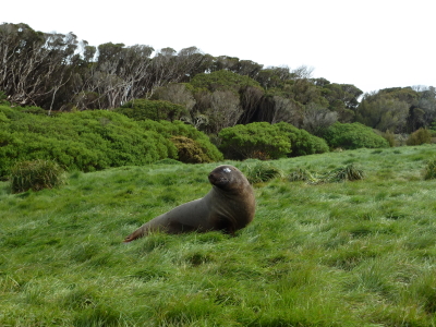
As a group, they hold an outstanding diversity of endemic and threatened species among its marine fauna, land birds, and invertebrates. It’s an important area for research into island dynamics and ecology, such as the study of the loss of flight in birds. It also has the most diverse community of seabirds in the world with eight species endemic to the region
Community Perspective: This site has been unreviewed so far. The included islands are: Antipodes Islands, Auckland Islands, Bounty Islands, Campbell Island group, and The Snares.


Map of Sub-Antarctic Islands
Community Rating
Site Info
- Full Name
- New Zealand Sub-Antarctic Islands
- Unesco ID
- 877
- Country
- New Zealand
- Inscribed
- 1998
- Type
- Natural
- Criteria
-
9 10
- Categories
- Natural landscape - Insular
- Link
- By ID
Site History
1998 Inscribed
Site Links
Unesco Website
Official Website
Related
In the News
Connections
The site has 36 connections
Damaged
Ecology
Geography
Human Activity
Individual People
Literature and Film
Timeline
Trivia
Visiting conditions
WHS on Other Lists
World Heritage Process
Visitors
13 Community Members have visited.
The Plaque
No plaque has been identified yet for this site.