Rwenzori Mountains
Rwenzori Mountains National Park supports the richest montane flora in Africa.
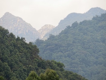
This mountain range with steep slopes ranges from 1,670m to 5,109m in altitude. Its highest peaks have permanent snow fields and glaciers. It constitutes also a vital water catchment area, sheltering the highest and most permanent sources of the River Nile. Due to high and regular rainfall, the area is home to luxuriant and unusual flora such as giant lobelias.
Community Perspective: the park has two entries for visitors, two main entries: one at Nyakalengija and one near Kilembe. Michael has described what a day visit to the former entails, while Els covered the latter. To see the unusual flora would require a seven-day trek to the higher elevations of the Rwenzori Mountains.
Map of Rwenzori Mountains
Community Reviews
Zoë Sheng
Chinese-Canadian - 16-Jan-24 -

I can't add much new to this site. I did even less hiking than Els doing only 4.75km to the first camp and then back to the main gate. It is easy to add this to any itinerary but not usually offered by your agencies by default as they don't expect tourists wanting to visit. The road from Kasese is long and rough though. You won't experience anything special on your hike as the exclusive flora is deep in the range which means a 7 day trek is required. It's mainly done by hardcore trekkers. The camps will be cold, no shower, tough hiking if it's raining. The best part of my journey was the scenery around me. Surrounded by lush forest butterflies, birds, a monkey here and there is good, but the peaks in the near distance make you believe this is Jurassic Park. No road, people in sight. It's a shock when you meet a fellow trekker or porter. Most people coming to Uganda will prefer gorilla or chimpanzee trekking, safari game drives as a bonus, but adding a tough hike like Rwenzori isn't really their thing. The branded spring water sold in Uganda isn't even from the mountains.
Originally my plan was to do a night at the camp and return but seeing that it's only 2h hiking each way I said well do it quicker and I have extra day for seeing something else. I know this sounds silly but with all the other activities on the agenda and needing a week to really appreciate the mountain I did not want to pack more in at the time. I can't see myself doing it in the future either because rain can make it just not enjoyable, and it WILL rain almost every day. If you are looking for the best time to go then do the trek in July for slightly less rain and that also means clearer views.
Michael Ayers

Visit in December, 2020
The post made by Els for this Site is informative and comprehensive, but I will add a short review because, though my visit was also rather minimal, I utilized the alternative entry point to the park. Specifically, the gate reached by turning off the main highway at Mubuku. From there a dirt/gravel road gains 700 meters of elevation over 17 kilometers, with a variable quality, but which can be traversed by any type of common vehicle. The route follows the Mubuku River valley, which is surprisingly densely populated with rural villages. That was an issue during the previous month of May, when a severe flash-flood tore down from the mountains of the Park, taking three lives and causing significant property damage, providing another example of the misfortunes of that particular year.
I stayed at the Ruboini Community Camp, which has the benefit of being owned and operated by local residents, which keeps the monies collected close to the community and the Park. The camp has a small restaurant and cottages, which, at the time, cost $US 25 per night. These had wood-heated hot water, but the Camp had no phone or internet service. From there it is short walk to the Park gate, though when I arrived at 9:30 AM on December 23rd I was dismayed to find the gate post unoccupied. Thinking that this might have been due to the upcoming holiday, and still feeling frustrated by recent failed attempts to get to other Sites, I snuck around the gate, intending to walk around for a few hundred meters in the Forest Zone, just so I could count the Site as visited. However, after only a couple of minutes, a Ranger came up from behind, apologizing that no one had been around when I arrived because they had all been in a “meeting.” Shortly after, I was registered for an official visit. The entry fee for international visitors was $US 35, with another $30 for the required escort to go on the trails. This, to me seemed a little costly for what would be only a short visit.
The important feature of this Park is its altitude-graduated ecology. However, to experience those aspects from that location requires a seven-day trek to the higher elevations of the Rwenzori Mountains. Just to leave the Forest Zone, and enter the Bamboo Zone involves 900 meters of elevation gain, with an additional 2,300 needed to reach the iconic Afro-Alpine Zone. Consequently, I intended to be satisfied with a walk along one of the two shorter trails near the gate, which pass through a fairly typical parcel of humid forest. The Ruboni Camp also has similar activities available, and on the following day I went on their fairly long “Forest Walk,” which actually spends most of the time along the partially-degraded habitat along the riverbank, but terminates at another section of forest that is just within the Park boundary. At $US 15, this could be a possible option for those who want to claim a visit to this Site with a minimal expense.
I appreciated seeing three species of chameleons on the latter walk, and also highly enjoyed relaxing on the Camp balcony, watching clouds periodically engulf the peaks of the mountains throughout the afternoon. The high elevation areas of this Site are usually cold, and rain or snow are to be expected, so those taking the long trek need to be well prepared.
Read more from Michael Ayers here.
Els Slots

Rwenzori Mountains National Park covers an 80km long mountain ridge in the far west of Uganda. It forms a natural border with the DR of Congo. The park attracts some 2,700 visitors a year, of which at least half are local schoolchildren. The others are mainly trekkers and mountaineers, arriving to hike a 10-day circuit or give the 3rd highest peak in Africa (Margherita’s Peak) a try. WH travellers do not often make it there: so far only 16 claim to have visited it, while no one has written a review yet.
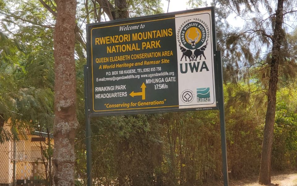
In preparation for my visit, I had been looking for the best access point to get into the park without having to do a multi-day hike. I found out that there are two main entries: one at Nyakalengija (with the Equator Snow Lodge and Ruboni Community Camp) and one near Kilembe. I choose the latter, as the Rwenzori Trekking Services (RTS) advertised one-day treks into the park departing from the associated Trekkers Hostel Kyanjiki. The office of the RTS, whose members accompany the hikes and maintain the trails, is also found on the hostel’s premises. The Nyakalengija trailhead is managed by another company (Rwenzori Mountaineering Services), which gets mixed reviews especially due to its mountaineering safety standards.
So I ended up in Kyanjiki near Kilembe, itself already an extraordinary sight: it is an abandoned mining village, with lots of collapsed buildings and a broken-down cable car system. The endless rows of houses for the miners are now rented out to ordinary people, it looks very shabby and poor. Since last year mining (for copper and cobalt) has resumed however in this area when the Chinese-owned Tibet-Hima Mining Company Limited won the concession.
After a good night’s sleep in the basic Trekkers Hostel, I started my one-day trek at 7.30 a.m. Our goal would be the Musege rock shelter, a post at 2,240m elevation. This is a 9km walk one-way, and you have to return the same route. I was in the pleasant company of three young Chinese (two men and a woman) who work for a Chinese oil company in Kampala. They were visiting the Rwenzori on a weekend trip from the capital. We had two dedicated RTS guides with us.
The hike started out quite strenuous, it’s a 2.2 km long route out of the village and over a ridge before you even enter the national park. Fortunately, it gets much better after that. On the other side of the hill, we walked on paths through farmlands. They mostly grow cassava here. And there are cows and goats. After an hour’s walk, we came upon a stone building: the park office. Here we had to pay the 35 US dollar entrance fee and write down our names in the visitors' log.
I had been deliberating quitting the trek here (the Chinese girl had had the same thoughts, she confided), as I was afraid the hiking would be too tough for me. But I decided to continue as the going had been so easy. And it stayed that way for another hour or 2. Within the park borders, the trail runs parallel to the Nyamwamba River and is almost flat. Monkeys are often seen here, but we didn’t encounter any. One of the guides showed us a chameleon: it was so well camouflaged that it looked like a dead leaf.
After about 3.5 hours we left the forest track to start another steep climb. That brought us to the finish of this hike: the Musenge rock shelter. The shelter is nothing more than that, a roof attached to an overhanging rock. It is sometimes used by park staff. That shelter suddenly also served us well because it started raining.
The rainforest really lived up to its name. We waited for an hour for the rain to stop, but when it didn’t we started the 9km march back to the hostel. We only had a quick stop again at the park entrance where we muddled the warden’s office with our wet gear.
Neither from the trail nor from Kilembe did I see the Rwenzori’s famed snow-capped mountain peaks. Later I asked a guide in Fort Portal about it, and he said that there is a viewpoint along the main road between Kasese and Fort Portal from where on a clear day you can see them. Otherwise, there's no other option than embark on a multi-day hike through the Rwenzoris.
Read more from Els Slots here.
Site Info
Site History
2004 Removed from Danger list
1999 In Danger
Security situation
1994 Inscribed
Site Links
Unesco Website
Official Website
Related
In the News
From the Forum
Locations
The site has 1 locations
The nearest city is Kasese in Western Uganda. Kasese has good transport links with main cities such as Fort Portal, Mbarara and Kampala. From Kasese you can access one of the trailheads such as Kilembe or Nyakalengija within 30 - 60 minutes. The park boundaries are only reachable on foot.
Connections
The site has 27 connections
Ecology
Geography
Individual People
Literature and Film
Timeline
Trivia
Visiting conditions
WHS Names
WHS on Other Lists
World Heritage Process
Visitors
36 Community Members have visited.
The Plaque
 (external source)
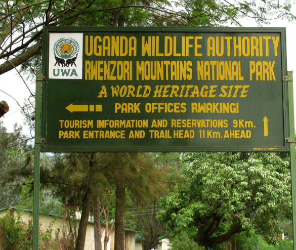 (external source)
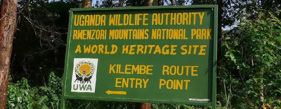 (external source)