Andrefana Dry Forests
The Andrefana Dry Forests represent centres of endemism within its western dry forests and southwestern dry thorny forests.
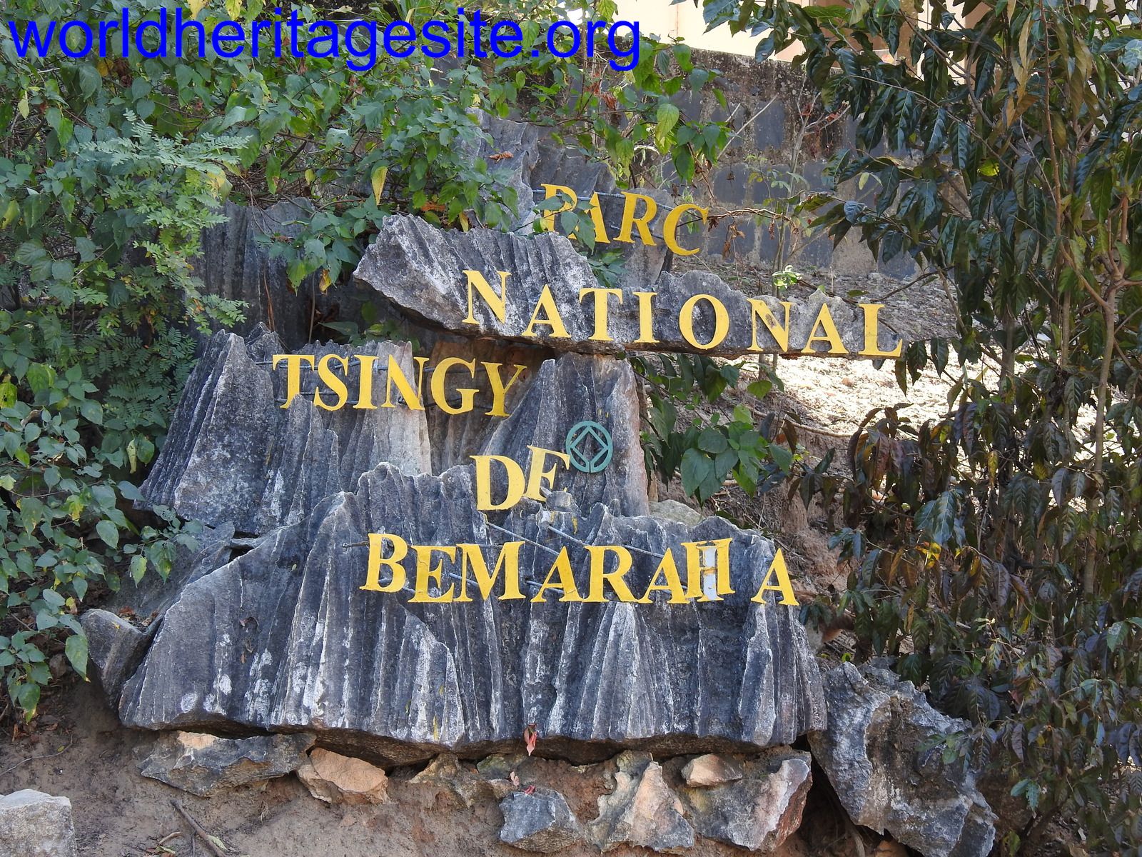
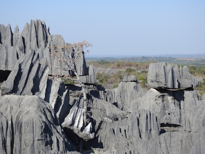
The habitat in the four national parks and two special reserves evolved in isolation. The dry forests are known for their baobabs and many endemic species of fauna. In addition, Tsingy de Bemaraha Strict Nature Reserve covers a spectacular landscape of limestone karst pinnacles.
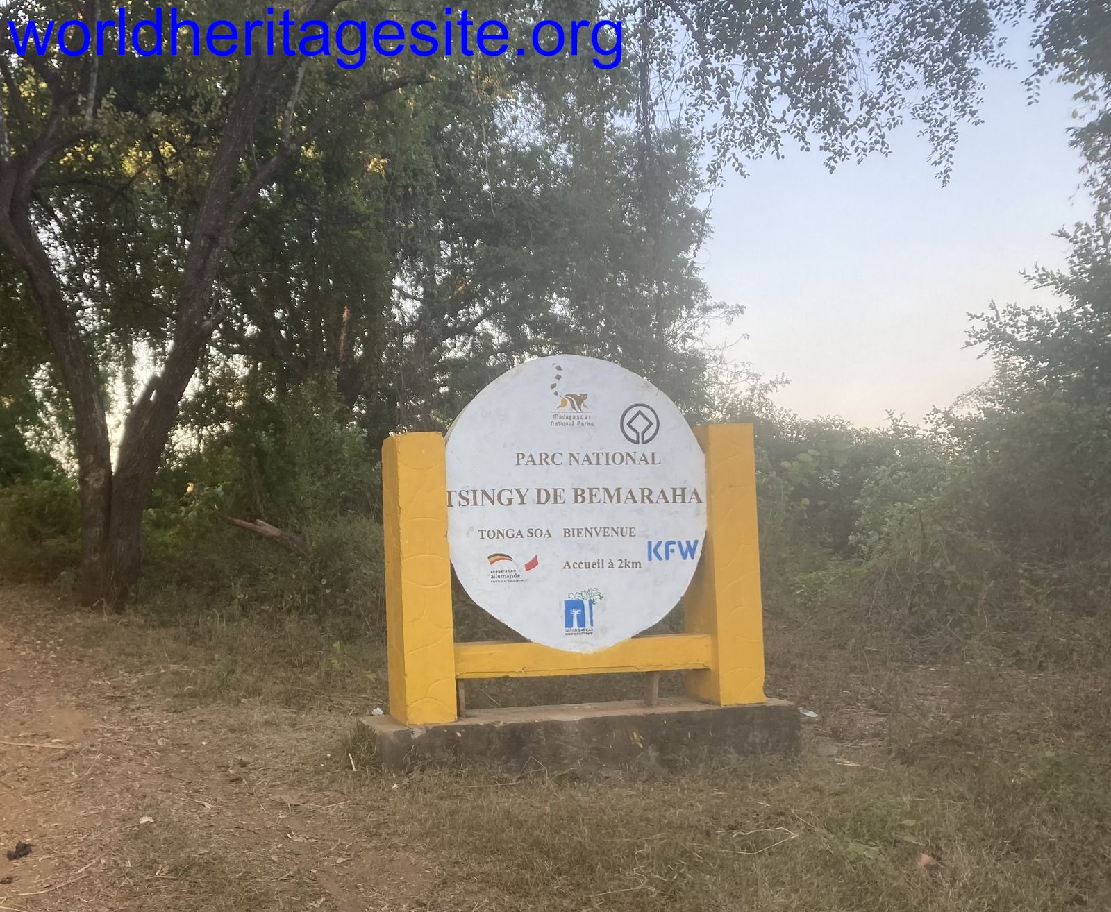
Community Perspective: this is a hard site to reach, "an “adventure,” and not for everybody". Practical details on how to get to Tsingy de Bemaraha for example can be found in the review by Els. Randi & Svein did the 6-7 hour long Grand Tour at Grand Tsingy and reported that in 2024 there is no armed escort necessary anymore to reach the site.


Map of Andrefana Dry Forests
Community Reviews
Dennis Nicklaus

I was really pleased to visit the Tsingy de Bemaraha, because an article years ago in National Geographic about them was what really got me interested in visiting Madagascar. Climbing on, and walking through the tsingy was really fun. You're really exploring an odd landscape.
Getting There
We visited in mid-May, near the beginning of the season there, as the roads aren't reliably dry enough to be open before May. Our trip was similar to what others have mentioned here; the trip getting to the tsingy is really a large part of the experience. We flew to Morondava, then briefly enjoyed the Avenue of the Baobabs en route to a one night stopover in the Kirindy Forest. Here we stayed in pretty rustic cabins (no hot water, limited hours electricity) at the Akiba Lodge, but loved the place -- the lemurs are just steps from your cabin. The next day, it's back in the car for the drive to Bekopaka, the village near the tsingy. About halfway there, we stopped for lunch at what we considered Madagascar's best restaurant, the Mad Zebu in Belo Tsiribihina.
After lunch, it's a long ferry crossing, then the drive gets interesting. As in, probably the worst road in the world that I have experienced. Deep ruts, deep mud, multiple stream crossings. At one point, a car a couple cars in front of us got deeply stuck in the mud. The road is narrow, so that if a car gets stuck, everybody behind must wait. It took two hours for the collected drivers and many locals to get them unstuck and build up the mudhole road with branches to make it passable (a later car also got stuck). A little after this, we took the short ferry across the Manambolo river and were soon at our lodge, the Soleil des Tsingy. The hotel is surprisingly luxurious, features nice standalone bungalows and gorgeous sunsets, and was not disappointing in any way.
The Grand Tsingy
The next morning, it's still 1.5 or 2 hours to get to the Grand Tsingy, across similarly bad, muddy, rutted roads (we only got stuck once, briefly, and slid in the mud into the embankment one other time, damaging a fender). Exploring the Grand Tsingy was fun. You are equipped with safety harnesses, which seemed superflous to me, given the risks you take driving there. It is nice that they are putting some attention to safety, but the climbing didn't really feel that dangerous to me. There were maybe around 25 visitors the day I went, including one group of 8-10 Europeans. Even with the moderate crowd, I did have to wait for a few minutes, especially at the initial ladders up. After most of our climbing and explorations, we stopped at a shady and scenic cave for lunch, a nice break from the hot sun on the tsingy-tops. I didn't find the hike strenuous at all, although it was pretty hot on top of the gray limestone. We saw a group of several lemurs on the walk back to the car, and saw a little nocturnal one in a tree and a chameleon on the hike to the tsingy.
Stay Three Nights
We stayed for three nights at the Soleil des Tsingy. It seemed like most of the other small groups only stayed two, which seemed rushed given the long drives. It is possible to visit the Grand and Small Tsingy in the same day. But I much preferred the way we did it. Our second full day, we took a pirogue (dug-out canoe) ride on the Manambolo River, seeing caves and the ancestral tombs. We really enjoyed this, more than we expected to. The bluffs along the river are beautiful. After the canoe ride, we walked through Bekopaka village to go through the Small Tsingy. The Small Tsingy are very similar to the Grand; they just aren't as extensive, or require as much climbing and ladders. They were also much less crowded.
Return To Morondava
After our third night, it's back in the car for the long drive back to Morondava, with another stop for lunch at Mad Zebu. On this return, we arrived at the famous Avenue of the Baobabs near sunset, when it is much busier. While the Avenue of Baobabs is one of the iconic images of Madagascar, I was really surprised to see that a few miles beyond the Avenue, the amazing landscape has hundreds of impressive baobabs scattered around. We had a very pleasant one night stay on the beach in Morondava. It would have been nice to relax there for longer as our hotel was very nice.
Alternatives to Bemaraha
Earlier in our trip, we had driven past the Ankarana Reserve of tsingy in northern Madagascar, another component of the extended WHS. I'm glad I went to Bemaraha, becuase I would have always wondered how different it is if we hadn't. But, if you're just looking to tick this WHS off your list, just hit Ankarana and save yourself the pain of the drive to Bemaraha. We also visited the Red Tsingy in the north, and while beautiful (and geologically much more transient), the Red is not nearly as spectacular as Bemaraha. There are more adventurous ways to get to Bemaraha like river rafting trips, but after doing it in the comfort of our lodges, those options are for people much more daring than me.
Summary
Horrible roads, so bad they made me question that Madagascar is even encouraging tourists to come to Bemaraha. But a very unique landscape in a very unique country make me glad to have visited. There is no longer any discussion of an armed convoy. There were probably about 15 4x4 cars going there the same day as us. We weren't necessarily a convoy, but we passed each other in the road, and if one gets stuck, others come along and help. So get an early start -- I wouldn't want to be the last car of the day.
Randi Thomsen

Els has covered this site pretty good, but we like to add a few comments.
First of all, what an adventure to get here! We really enjoyed the drive through wonderful lansdscape, small villages and the river crossings.
We stayed three nights, two days and did the Grand Tsingy first.
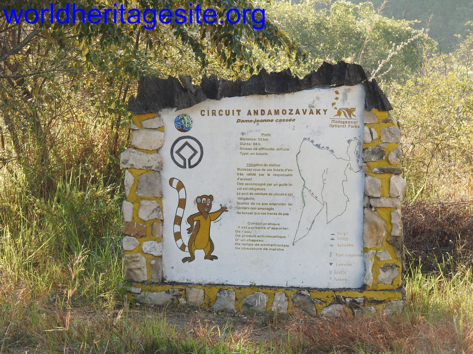
For the Grand Tsingy, our guide convinced us to do the Grand tour, combining circuit Ranotsara, Broadway and Andamozavaky. It will take about 6-7 hours and almost no one does it. And he was right, we didn’t meet any other people until at the end. The route adds one more viewpoint and a hanging bridge. And as Els explained, we used harness to clip on to safety ropes, up ladders and stepping stones, climbing our way to the top. I am impressed how they made this marvelous rocky terrain available to «common people». The view from the top is just fantastic.
Besides the climbing the track is winding through caves,(several places we have to squeeze ourselves through), boulders, rocky terrains and sometimes easy hiking in the forest. We encountered four kinds of lemurs: the Deackens Sifaka, several groups of Red faced Brown Lemurs, Bamboo Lemur and the Red-tailed Sportive Lemur (nocturnal, sleeping on a tree in the afternoon sun). We used in total 7 hours, with plenty of photo stops and a lunch break.
Day two we did the River Gorge and the Small Tsingy. It was well worth to stay an extra day
When you are there
We had an overnight at Kirindy and did a visit to Kirindy Forest, which turned out to be a nice surprise. We did both a night walk and a morning walk. We encountered all 5 possible lemurs at this time of year. At night, the Grey Mouse Lemur, the Red Tailed Sportive Lemur, Fork marked Lemur. Daytime: Brown Lemur, Verreaux’s Lemur and the Sportive Lemur sleeping on a branch. And as big surprise we also got a closer look at the Fossa. We stayed at Relais du Kirindy, nice place with a pool.
Practicality
- we stayed at L'Olympe du Bemaraha, dated, clean, nice pool, great sunset view. You can pay with credit card!
- Mad zebu restaurant in Belo, great place to stop for lunch. Gourmet food as good as you can get in Madagascar to a decent price
- Bring a bag of bon bons , all the kids are asking for it. It will make them 😊
- Bring your empty water bottles, they are happy for them too
- I also gave away small soaps to the women washing clothes
- There were no need for armed escort now
Els Slots

Although it has decent tourist facilities, the Tsingy de Bemaraha is only for the hardened traveller as realistically there is no easy way to reach this park on the west coast of Madagascar. The property is so poorly accessible from the nearest city or commercial airport that it almost fits into our ‘Takes more than 5 days’-connection: a return trip takes at least 5 days from Tana. To make matters worse, it nowadays should be visited as part of an armed convoy due to safety concerns as there have been robberies along the route. There is no public transport to the site, all has to be done by 4WD, although the very wealthy could charter a bush plane and land on an airstrip that lies some 8km from Grand Tsingy.
The road to Tsingy from the coastal city of Morondava (195km/8h) starts with a passage through the well-known Avenue of the Baobabs. From that point on, the sand road is all there is – Tsingy for that reason also is inaccessible during the rainy season. A bit further on lies the turn-off for Kirindy Forest, a park that has severely deteriorated since Covid: people abandoned the place, the dogs entered, and the resident fossa left after it found not enough food. The next bit of excitement comes after 4 hours at the crossing of the Tsribihina River near Belo: it takes about half an hour by a simple ferry that can take four 4WDs. Lunch is had in Belo, which has a couple of good restaurants. From Belo, the armed convoy is supposed to start, but somehow we missed it although we reported to the army post on the outskirts of the city. They just waved us on. We encountered enough gendarmerie along the road to let it feel safe enough. This is a less populated area, and the few villages look very poor. The condition of the track certainly did not improve the closer we got to our destination: in the final 20km, two nasty river crossings had to be done by 4WD.
The next morning we reported to the park office in Bekopaka. Since money got stolen from the office, the entrance fees nowadays have to be paid by mobile money transfer (my guide did that for me). However, the payment for the obligatory guided tours (which are much more expensive) can still be done in cash. I guess the entrance fees go to Parcs Madagascar and the tour money stays local. I had two days planned in the park, though most people do it in a day as most tours only take half a day. On the first day, I combined a boat ride and a visit to the Petit Tsingy.
Manombolo River Gorge
The park is bordered to the south by the Manambolo River; its Gorge “is a scenic attraction that adds to the intrinsic values of Bemaraha” according to the IUCN evaluation. We navigated it in two wooden canoes tied together, operated by a ‘poler’. The river, which cuts all the way through the limestone massif on a length of 370km to the sea, doesn’t run deep in the dry season. It has crocodiles, but the only wild animals we saw were birds. Mostly Diomorphic egrets, which nest here. We got out of the boat twice to look at caves, one where the guide enthusiastically pointed out dripstone (he obviously hadn’t been warned about my aversion against that natural feature), and the other where we saw a pretty nocturnal butterfly. Further up, high against the cliffs, the remains of Vazimba tombs can also be seen. The white skulls of the oldest Malagasy ancestors laying there even are visible to the naked eye.
Petit Tsingy
Back on land, we walked to the entrance of the Petit Tsingy which lies next to the village. It does have a creative entrance sign (made out of pieces of tsingy) including a UNESCO logo, so I think we can count that as the plaque. Hiking in the Tsingy is a skill that takes a while to get used to – the rock tops are quite sharp, but most of the time you can hold on to them sideways. They will not break easily. You have to squeeze through narrow passages, where I’d say a person 5kg heavier than me already would really have trouble. Climbing is done via well-positioned steps, using handrails and ropes for support, and ladders. All these man-made additions were in good condition and really added to my confidence in getting around safely. In the end, I must say that I found the experience more ‘interesting’ than truly spectacular – the Petit Tsingy is just a tiny plot of Stone Forest, taking 1.5 hours at most.
Grand Tsingy
The next day we departed at 6 a.m. for the Grand Tsingy. Its entrance lies 17km north of Bekopaka, so we started with another hour’s drive. This stretch of road is even worse than the others we’d been on so far, and we even got stuck on the way back (but my driver, my guide and the local park guide managed to dig us out). There’s a car park just outside the forest, from where the Grand Tsingy hikes start. We did the Andamozavaky Circuit.
The hike starts in the forest surrounding the Tsingy. It is home to lemurs, and we had good sightings of Decken's Sifaka (with a baby on the back) and Red-fronted Brown Lemur. After 1.5 km you reach the first ladder and that’s where the fun starts. I felt like a mountaineer, kitted up in a harness, clipping myself to the ropes that have been attached to the trickier parts, and climbing ladders to move from viewpoint to viewpoint. It is quite amazing how they have made these stony peaks accessible for viewing. After a couple of them though, you get the idea – it is what it is (googling 5 pictures of ‘Tsingy de Bemaraha’ will give you the best-known views) and comes without many surprises, although a blossoming flower at the bare rocks was a pretty sight.
I thoroughly enjoyed the whole expedition of getting there and being there, experiencing this part of Madagascar. It was one of the most adventurous WH visits I did so far. We managed to leave the area safely, this time with two armed soldiers in the back of ‘my’ 4WD as we led the convoy out.
Practicalities (June 2023):
- I reached the starting point of the expedition, the coastal city of Morondava, by a 1-hour domestic flight executed by Tsaradia from Tana (206 EUR). They only fly on Thursday and Sunday, and you have to book weeks ahead. Sometimes online booking via the official website may not work, then use Kiwi.com. I left again for Tana by Cotisse taxi-brousse, 12 EUR and 16+ hours.
- I had arranged the 4-day Tsingy transport (650 EUR) beforehand via R'jan Tsingy Expedition. Guesthouses and hotels in Morondava can link you with a local operator if you have not yet booked anything, the trip is regularly done in the dry season May-September.
- I booked the hotel in Bekopaka, the gateway town to Tsingy, myself: the Orchidee de Bemaraha, a dated but clean complex in a nice setting including a pool. They provide all meals as well, against a 50% higher cost than usual in Madagascar.
- The park entrance fee is 55,000 Ariary (12 EUR) per day. Plus the cost of a guided tour, depending on scope and group size about 165,000 Ariary (36 EUR). The boat guy and local guide expect a small tip as well. So bring lots of cash to the area (the hotel also only takes cash), I brought 2 million Ariary and used about 1.2 million!
Read more from Els Slots here.
Lane Nevares
Madagascar is not quite African and not quite Asian, but rather a land unto itself. As the world’s fourth largest island, the country is generally known for its delightful lemurs and bewildering Baobab trees. And while I wanted to meet those lemurs and walk under those Baobabs, Madagascar attracted me for another reason—the Tsingy de Bemaraha.
My traveling companion, Herr Kuls, and I landed in Morondava, on the western coast, on a bright May morning. Our guide Patrick met us off the plane, and introduced himself in excellent English. Morondava is a sandy, little place. The kind of beach town that tries to put on a happy face, but is poor and indicative of the difficulties Madagascar faces. We drove directly to our hotel, kicked off our sandals and settled in. Patrick advised us to rest up for the next day. Looking out towards the beckoning beach, we told him that wouldn’t be a problem.
The stars were still twinkling when a 4x4 truck picked us up before dawn. Our driver, Monsieur Jackie, was to drive us to Madagascar’s only UNESCO World Heritage Site, the Tsingy de Bemaraha, located approximately 145 miles (235 kilometers) away. En route, Patrick informed us, we would also see the famous “Avenue du Baobab.” Tsingy itself is a collection of improbable limestone karsts, pinnacled (“tsingy”) formations. These dangerously jagged, highly eroded pinnacles form an amazing forest, unlike anything, literally, on Earth. Our journey was to see, first-hand, these distinctive formations and walk inside the extraordinary forest.
My pre-dawn thoughts were focused on finding coffee, but an hour later, in the hushed calm before sunrise, we turned off the patchy asphalt road onto a dirt track. As the orangey-light grew brighter we witnessed a scene from Dr. Seuss’ imagination: Baobab trees. Magnificent, tall, and crowned with self-conscious branches, these implausible trees belonged to another planet. I forgot about the coffee.
Herr Kuls, the token German, and I laughed aloud at the grandeur of the trees. Like good tourists, we walked the avenue, touched the trees, snapped photos, and once satiated, hopped back in the truck. Fueled with excitement we couldn’t wait to reach the Tsingy de Bemaraha.
Although Patrick had specifically stated that traveling to Tsingy would be an “adventure,” and not for everybody, where I come from folks will travel 145 miles to buy a twelve-pack of beer. Herr Kuls and I weren’t dismayed; after all, it wasn’t really that far. Besides, we were in Madagascar, we’d just seen the miraculous “Avenue du Baobab,” and we were ready for anything.
Several hours later over difficult patchy roads, we reached an immense river, the Tsirbihina River. Monsieur Jackie and Patrick organized a ferry to take our truck across. We joined the locals aboard, smiled and said bonjour. We were in high spirits. Crossing a river as wide as the Mississippi brings out the Huck Finn in you. Safely across, we loaded ourselves back into the truck and hit the road.
Well, not exactly a road. The dirt road gradually dissolved into a grassy path. Monsieur Jackie informed us that the lack of a road indicated that vehicles were not yet traveling after the rainy season. He mentioned that each rainy season the roads fade away. Villages become isolated. Poor people go hungry. Zebu-pulled carts (bullock carts) and walking were the only means of transport.
I looked ahead at the expansive savannah and wondered how does Monsieur Jackie know which way to drive? There was no discernible anything, just tall grass as far as one could see. But we pushed on. We had to reach Tsingy before dark, or we’d be stranded.
Monsieur Jackie drove deliberately. One false move could cripple us. We were alone with little hope of finding assistance. We carried on. A couple of hours later, I noticed dense clouds of black smoke billowing on the horizon: Fire. “FIRE!” Herr Kuls shouted, echoing my thought. Monsieur Jackie told us to hang on. “Hang on?” I wondered. Our plucky driver grounded the truck into low gear and put the pedal to the metal. The engine heaved and we lunged forward into the raging fire.
As if charging into battle, we shouted in unison as we rushed through the wall of flames. Intense heat enveloped us and smoke confused our way. For minutes we drove blinded. Once through, Monsieur Jackie, with a sigh of relief, pulled the truck over. We jumped out and stared at the conflagration behind us. Adrenaline and disbelief surged through us.
Too many hours later, over punishing “roads,” and with sore bottoms, we finally arrived in Tsingy at dusk. Along the way we talked about the grassfire, and wondered if seeing Tsingy the next morning would be worth the price we’d just paid. I tried to forget that our diesel-powered truck could have easily caught fire.
The next morning we spent half a day exploring the Tsingy. Patrick translated the Park Ranger’s explanations. We asked questions. We snapped photos. We marveled. And then it was over. We returned to our bungalow for an afternoon of rest. Tomorrow we were driving back to Morondava. And all I could think about was 13 hours and 145 miles.
Site Info
- Full Name
- Andrefana Dry Forests
- Unesco ID
- 494
- Country
- Madagascar
- Inscribed
- 1990
- Type
- Natural
- Criteria
-
7 9 10
- Categories
- Natural landscape - Forest Natural landscape - Karst landscapes and caves
- Link
- By ID
Site History
2023 Extended
To add (to the original Tsingy de Bemaraha) five protected areas, including the National Parks of Ankarafantsika, Mikea and Tsimanampesotse, and the Special Reserves of Analamerana and Ankarana.
2023 Name change
From Tsingy de Bemaraha to "Andrefana Dry Forests" upon extension.
2023 Criteria
Criterion IX added upon extension
2008 Revision
Includes former TWHS Ankarafantsika (1985) and parts of the Sud Malagache (Tsimanmpesotse) former TWHS (1985)
1990 Revision
Includes former TWHS Gorges de Manabolo (1985)
1990 Inscribed
1988 Deferred
Nomination to be re-worked
Site Links
Connections
The site has 29 connections
Constructions
Damaged
Ecology
Geography
Human Activity
Timeline
Trivia
Visiting conditions
WHS on Other Lists
World Heritage Process
Visitors
43 Community Members have visited.