Rock Paintings of the Sierra de San Francisco
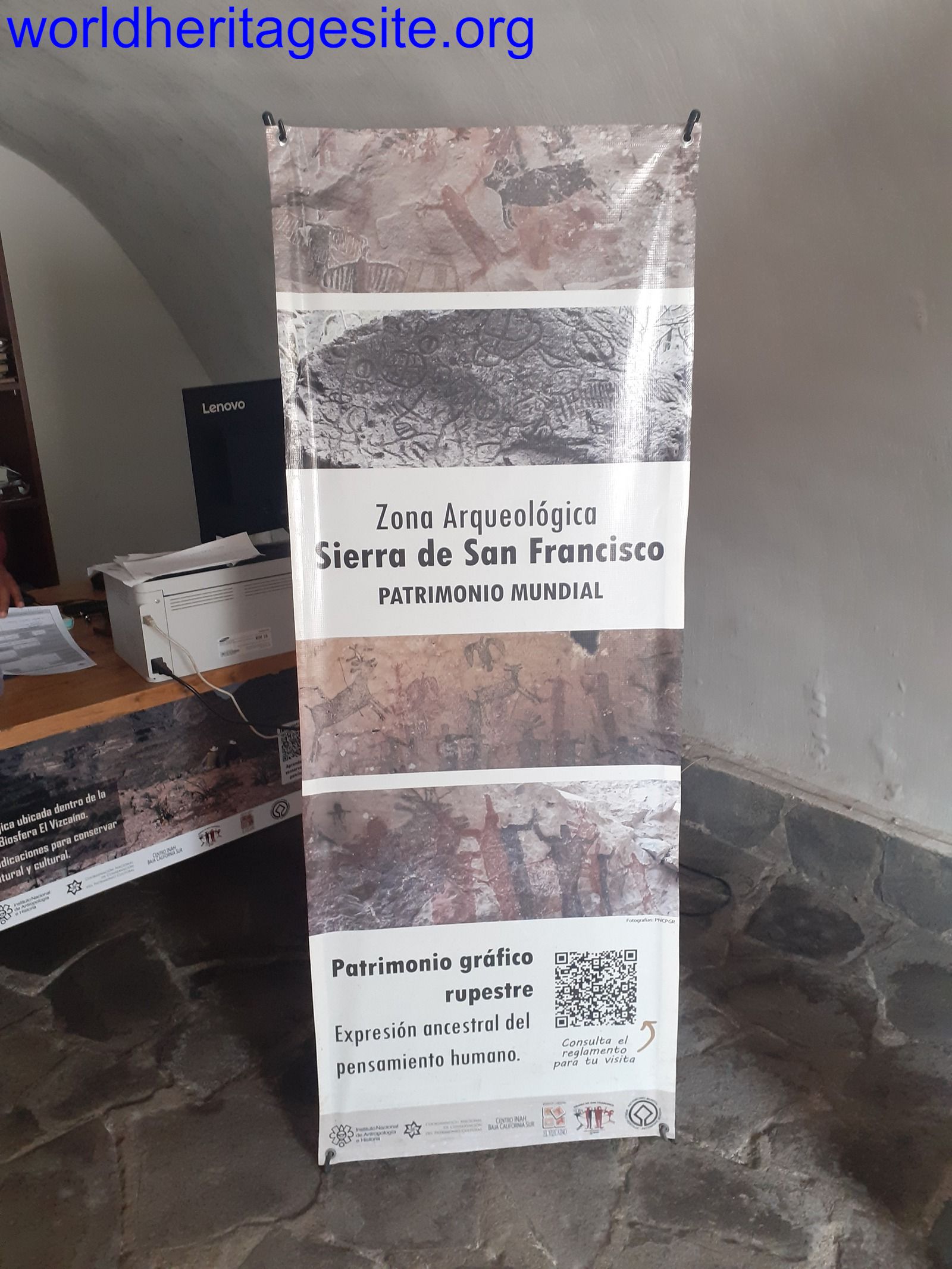
The Rock Paintings of Sierra de San Francisco comprises prehistoric rock art found in the harsh climate of Baja California, Mexico.
They are representations of what was once the life of the Cochimi or Guachimis, who lived relatively isolated and developed their own rock art tradition. The paintings were made on the roofs of rock shelters and on the walls of the Sierra de San Francisco mountain range. Around 250 rock art sites have been discovered, including huge panels, the so-called Great Murals.
Community Perspective: this large site is rarely visited. Els has described what a one-day-visit on a day tour involves and enjoyed the scenery the most, while Jarek visited 2 locations by rental car (getting his own permit).

Map of Rock Paintings of the Sierra de San Francisco
Community Reviews
Clyde

I visited the Rock Paintings of the Sierra de San Francisco within the El Vizcaino Biosphere Reserve in March 2024. Having already seen the El Raton replica paintings in the Anthropological Museum of Mexico City, and judging by their small size, limited quality and ease of accessibility, I opted to visit the El Palmarito Cave or Cueva Cuesta de Palmarito which involves arranging a trip with an experienced driver owning a suitable high clearance 4WD car (expect to pay 150-200 US dollars for the car and driver if you're alone), who in turn fixes a time with the site "ranger" to collect the entrance fee (around 500 pesos including entrance, camera fees and guide), who in turn sets up a local guide (one of the two available - a fit old former farmer who lives alone there or a younger ranchero proudly wearing his iconic hat) who accompanies you along the 1-1.5 hour trek (one way) and opens/locks the protective fence around the cave. Another advantage of organizing a trip with a driver is that he can take care of contacting the INAH office instead of you reporting at their office during their limited opening hours (frequently closed on weekends or during siesta times, so not very convenient if you're booked for a whale watching the day before!).
The Cuesta de Palmarito cave is located on one of the slopes that fall into the small valley of Santa Marta, where a very small "rancheria" community of herders/farmers is located. The red and black painted figures of the cave are mostly located at the top of the rock wall that shapes this cave, which is one of the highest in the area. The best preserved ones (also having bright yellow hues) are those on the cave ceiling as the ones further at the bottom are weathering very quickly. It is believed that the El Palmarito cave paintings are one of the first referenced by the missionaries, mainly by Jesuit Father José Mariano Rothea, who served as a missionary in San Ignacio, which was the closest religious establishment to the indigenous rancheria.
This site, like many others with cave paintings, has been related to the existence of several indigenous myths that account for the beginning of life and the creation of the first human beings in the ancient peninsular world. On the other hand, it has been considered that in general the cave paintings may also be related to the representation of the dead, the "possession of the spirit, the trance" and a "flight" that would be achieved by different means, but notably through the intake of native hallucinogenic plants that grow in the peninsular mountains. The El Palmarito cave has been dated to around 9,200 years ago, thanks to a female figure found there. This makes this place the oldest with cave paintings, even older than another dated figure of San Borjita, which was considered to be the oldest before, dating back to 7,500 years ago. Now there is a very small and limited information panel in Spanish near the wooden viewing platform but don't expect much.
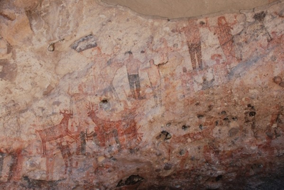
The paintings are believed to be to product of the Cochimi people of Baja California, culturally extinct around the 19th century. Radiocarbon dating of some of the cave paintings has suggested that some go back to as early as 5500 BC to as late as European contact in the 18th century, although in the AB evaluation, initially they were dated from 1100 BC to 1300 AD. Apart from the paintings of humans, the animal species depicted include deer, wild sheep, rabbit, puma, lynx, whale, turtle, fish and birds. One of the latter literally appeared to come to life when I visited, as I noticed a tiny colourful hummingbird that built its nest inside one of the many cracks within the original paintings of what seemed like a bird.
Apart from the El Raton replica paintings, in the Anthropological Museum of Mexico City I also noticed great replicas of what seem to perhaps be the best examples of rock paintings of the 250 locations with rock paintings. These are the replicas of the Cueva La Pintada or La Pintada Cave, which require a guided 3 day trip with mules to get to the original paintings in an area known as Santa Teresa or Salsipuedes. Depending on the level of fitness and the time taken to get there and back, it is possible to combine or extend such an in-depth visit with a visit to the caves of San Julio, La Soledad and Las Flechas too. There are only a couple of information boards with instructions on how to pay the visit the "mural sites" but no official UNESCO WHS plaque.
Jarek Pokrzywnicki

The Rock Paintings of Sierra de San Francisco – sites visited in February, 2024.
As Els already described carefully the basics I will focus on updates. Before any visit to the site – you have to obtain a permit (A4 paper with names on it, visiting hours and guide name), pay entrance fee (also a ticket for camera) and arrange an official guide. Local INAH office is located in the center of San Ignacio (near the church, Museo INAH San Ignacio, Valdivia Peña, google coordinates 27.283319417059342, -112.89868613892016). The office is open every day (except Sundays) from 11.00 until 18.00) so you can arrange a visit returning from Laguna San Ignacio – whale watching, El Vizcaino). Currently there is a perfect asphalted road to El Raton (the road is not shown on official UNESCO map as it is new) but for Santa Martha you need a car with high clearance or even 4WD.
El Raton (Cueva del Raton) – located 82 km from central San Ignacio, use national Highway 1, direction Guerrero Negro, after 45 km turn to the right (sign for San Fco Sierra). Within next 10 km you already pass through inscribed property entering a mountainous area (no sign but according to an official map you are there). Landscapes are amazing – wide valleys, steep slopes with lots of cactuses, rocks. The site is located on the right side (signpost, small parking space, google coordinates 27°35'29.5"N 113°01'26.5"W) but usually you have to drive further (around one kilometre) to Hostal Buenaventura (google coordinates 27°35'38.2"N 113°00'57.8"W) where guide would wait for you and you have to register the visit at the office (paper permit received earlier at San Ignacio). Than you return with a guide to Cueva del Raton (separate payment, in my case it was 200 Mex peso). The site is fenced (the guide has the key), path contains some 20 steps (not very steep). El Raton cave (or more precisely rock shelter) consists of several paintings presenting human and animal figures including famous black rat (el raton) which is probably a depiction of cougar.
Palmarito Cave (Cuesta Palmarito) – located some 7 km from San Francisco Sierra (straight line) but accessible only via Santa Lucia and rough road from there (totally it is around 60 km from San Ignacio). I have arranged that for the next day. You have to drive national Highway 1 to the east (direction Santa Rosalia), than after 20 km at Santa Lucia turn left (signpost Santa Martha 40 km), the more you drive the road deteriorate. Last 10-12 kilometres it is nightmare – you have to cross dried up rivers, full of stones and climb up steep river banks (I guess that this part of the road is inaccessible during rains or flood – hopefully rare in Baja California). At the INAH office in San Ignacio I have received exact location of Santa Martha (a map via Whatsapp) but it didn’t work since there were no connection. Santa Martha (google coordinates 27°32'35.3"N 112°57'52.5"W). Also my maps.me offline map did not cover these areas (last 10 km I used only topographic directions. Finally arrived (it took more than 2 hours from Santa Lucia) our guide was waiting for us in the centre of the village. Similarly to El Raton we have to go for registration and via equally bad road we moved for the entrance to the path for Palmarito (google coordinates 27°33'23.7"N 112°57'15.2"W). From this point there is approximately one hour trek to the paintings, the last part is quite steep. Paintings are similar to El Raton (hunting scenes, humans praying), there is also similar black imagination of rat (cougar) but they cover much bigger area. The guide is also paid separately (350 Mex peso).
Other places from Sierra San Francisco can be visited (with a guide and permit) during organised trips from San Francisco village (near El Raton) or from Santa Martha. Some of them are close to the villages (day trips) some require more preparation (multi-day expeditions with mules carrying equipment).
More about rock art in Sierra de San Francisco https://sandiegoarchaeology.org/Laylander/Baja/10ritter.pdf
Practicalities: For transportation I used a rented car with higher clearance (Chevrolet Tracker) – good choice but for Santa Martha a bit insufficient. Have in mind that there is only one petrol station in the area (in San Ignacio) so you have to plan accordingly. February is a peak season for whale watching so it is better to book ahead accommodation. In fact I tried to do so with no lack (only one expensive place was available during my dates) but somehow a day before I managed to reserve a place at Rancho Espinoza, Guamúchil (next village to San Ignacio), excellent place (60 USD for double without breakfast). San Ignacio is a natural center for visiting not only Sierra San Francisco but also El Vizcaino hence you need to have a place for longer stay. Food: there are restaurants in central San Ignacio (near the church) as well as some near petrol station (those are more basic) but there is nothing in Santa Martha (not even a single shop).
Places on the photo, bottom left, than clockwise: paintings at Palmarito, valley near El Raton, El Raton cave paintings, trek to Palmarito.
Els Slots

The Rock Paintings of the Sierra de San Francisco have hardly been reviewed on this website so far, so let’s start with the basics. The included area is large (it’s even in the Top 20 of largest cultural WHS) and stretches out north of Mexico’s Highway #1 in Baja California Sur between San Ignacio and El Porvenir. It holds several hundred small groups of rock paintings and rock carvings. The area is remote and difficult to access: for a day trip you have the choice between Ratón (via San Francisco de la Sierra: needs 4WD, an only short climb up a staircase, small group of paintings) and Palmarito (via Santa Martha: car with good clearance needed, requires a 1.5-hour hike, rock face with abundant paintings). If you go by yourself, you need to report to the INAH office in San Ignacio beforehand to pay the entrance fee and they will let the local caretaker know that you’re coming and he will lead you to the site of the rock art. Multi-day trips that are offered by specialized outfitters use mules to trek to the even more isolated cave paintings, which are also said to be the best.
I choose Palmarito as the location for my visit. As I had only a rental car with fairly low clearance, I played it safe by hiring a 4WD with guide/driver to take me out there. It was arranged by the place where I was staying (Ignacio Springs B&B in San Ignacio) and cost 1,500 pesos (67 EUR) per person. You could also ask at Rancho Grande restaurant, as they were the people who eventually drove me and two other guests of the B&B. I met them at the town of Bonfil by Highway #1, that’s where the unpaved track inland to Santa Martha starts. I hadn’t been able to find the mountain community of Santa Martha on any of the maps I had on my phone (Maps.me, Google Maps, Waze), the official map of the WHS and the one of the INAH website are the best ones of the area.
It's a 40km drive to Santa Martha. The road is mostly good, but there are some rough patches and crossings of river beds. It felt like driving in one of those classic Western movies, with a stagecoach raid about to happen at every corner. About 60 people live in Santa Martha, and they even have school. Most people seem to live off goat farming and we got to taste some of their delicious fresh cheese. There’s no cell phone reception here or along the road. Our local guide was already waiting by the roadside and we took him along to the starting point of the hike – the road for this final 5 km is in very bad condition and needs a 4WD.
The trail towards the rock shelter where the paintings are is fairly flat and easy for the first hour. You walk among a great variety of cactuses and medicinal plants, which contribute to the great scenery of the Sierra de San Francisco together with its many mountains. The rock and some of the paintings can already be seen from the trail: the larger paintings depict humans, it looks like they are waving to the people passing by. The final half-hour comprises the climb up to the rock shelter – the trail uses hairpin bends here to soften the steepness. It wasn’t too difficult going up, but going down is more tricky as there are a lot of loose stones. It’s best to wear proper hiking boots and/or use trekking poles.
The rock is protected by a fence, to which the local guide had the keys. You can then enter the wooden viewing platform that has been built directly underneath the paintings. The rock face is about 30m wide, and almost fully covered in paintings in red and black. Animals that are depicted include a tortoise, a puma, and deer. There isn’t any interpretation on-site (such as an information panel) and the guide also does not go much beyond pointing out the more remarkable paintings.
The paintings artistically aren’t that spectacular, nor are they very old. In the AB evaluation, they were dated from 1100 BC to AD 1300, while Wiki now states “A growing body of radiocarbon dates relating to the paintings has suggested ages from as early as 5500 BCE”. As said in the introduction, the more remote clusters that require multi-day trekking are said the be the finest. However, it is certainly worth visiting Palmarito as well for its great scenery that you will be able to enjoy along the road up there and during the hike.
Read more from Els Slots here.
sheilafromny@prodigy.net
We packed in for a camping trip with local guides, mules, and donkeys. The terrian is rugged and the views are out of this world. I managed to stay a day in a fresh water lagoon which I affectionitly call the viper pit. You do need a guide, and the hikes are always up, and the shade in the shelters are a great place to mediate and view the colorful panels. You could stay a week and still need more time. Try to visit when it is NOT summer.
Community Rating
Site Info
Site History
1993 Revision
Following the recommendation of the Bureau, the original nomination of the mixed site of El Vizcaino (including the Sierra de San Francisco) was resubmitted as separate cultural and natural nominations.
1993 Inscribed
Site Links
Unesco Website
Official Website
Related
Connections
The site has 10 connections
Geography
Human Activity
Timeline
Trivia
Visiting conditions
WHS on Other Lists
World Heritage Process
Visitors
26 Community Members have visited.