Palau
Imeong Conservation Area

Site Info
Official Information
- Full Name
- Imeong Conservation Area (ID: 1931)
- Country
- Palau
- Status
-
On tentative list 2004
Site history
History of Imeong Conservation Area
- 2004: Added to Tentative List
- Added to tentative list
- Type
- Mixed
- Criteria
Links
- UNESCO
- whc.unesco.org
All Links
UNESCO.org
- whc.unesco.org — whc.unesco.org
Community Information
- Community Category
- Natural landscape: Diverse ecosystems
- Archaeological site: Pacific
Travel Information
Recent Connections
News
No news.
Community Reviews
Show full reviews
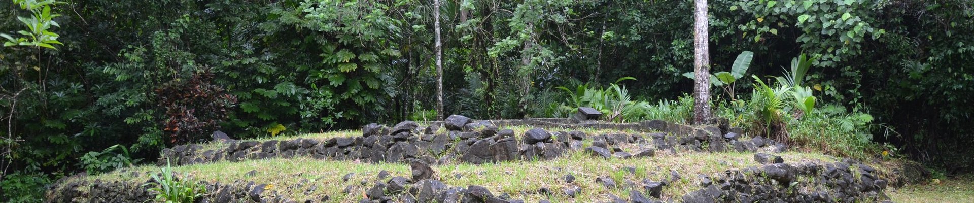
For one day of our Palau vacation, we decided to rent a car and have a self-made circle-island tour of Babeldaob, the largest island of Palau. Armed with our Cultural, Natural and Historical Sites of Palau pocket guide and map we set off. We noticed the Imeong Traditional Village on our map and thought it sounded interesting. We drove through where we thought it should be from the map, but didn't notice anything other than a very small modern settlement. Turning around and coming back, we finally noticed a wooden sign saying "Imeiuns Ancient Village" and "Emeraech (North Star) Stone Path." We walked up a gently sloping 4 meter wide stone path/staircase made of black basalt stones. At the top was a similar long basalt paved path, that just sort of dwindled out, leaving you to see the drying laundry of a couple local houses. Maybe some other stones. That's pretty much what we found. I don't think there was much else there, certainly no other signs or anything indicating what or where. But at least we found it (with a slightly variant spelling). Part of the description for this site includes the natural landscape of the area, and it is interesting to see the jungle-covered mountains. That area isn't really set up for casual hiking though.
The description mentions various Japanese WWII artifacts in the area. I'm not sure if it was included, but on the way to the Imeong Village, we also saw a sign pointing to …
Keep reading 0 comments