Blog WHS Visits
WHS #967: Khinalig
Khinalig isn’t visited much by our community – it is too remote to feature on a first itinerary of Azerbaijan. A direct drive from Baku takes 4 hours, so it should be in our Remote Cultural WHS connection. I got there via a day tour from Baku by the Azerbaijan Travel Company (booked via the cheaper GetYourGuide). They run daily group tours with an English-speaking guide, which are surprisingly popular. It included some other short stops as well (Candycane Mountain and the Red Village (the town of the Mountain Jews, where the synagogue now has been closed and is guarded by Azeri soldiers because of Gaza tensions)), but when you go on your own I’d recommend doing Khinalig only as it is by far the most interesting part.
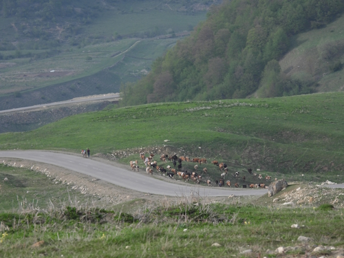
The name of the village and its people isn’t pronounced “Khee-nah-leek” as I had always thought, it is something like “Geh-nuh-leg” (the g as in the guttural Arabic/Dutch g). Despite the town of Khinalig being the obvious focus of the WHS, the core zone is much larger as it also includes both their winter and summer pastures, plus the narrow way between them which is over 200km! I tried to follow on the map whether the access road is part of that zone, but it isn’t: it meanders southeastward through an area with only minor roads. We still saw plenty of sheep and cows being moved around though.
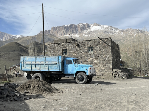
Although there is a paved road nowadays all the way to the village, parts had washed away recently so we still had to rely on 4x4’s getting there. Taxi drivers with 4x4 Lada’s have a good business going on in the city of Quba to provide them. The road seemed doable with any car with a strong engine (our minibus probably was too heavy), but it was quite fun actually to be driven around in an old Lada. It’s still a 50km drive from Quba to get to Khinalig. Most is steeply uphill and there was still plenty of snow in early May, sometimes also covering half of the road. It’s a pretty landscape dominated by U-shaped valleys and mountain meadows.
Khinalig village lies at the top of a hill. The road in the town itself is unpaved and very steep, so you might need to park at the foot of the hill and walk up. A few houses have opened up as guesthouses and a boy was following us around selling knitwear. We had lunch in one of the traditional houses where they had all kinds of local memorabilia hanging on the walls. They showed us a “meteorite”, a very heavy, rounded stone. According to our guide it had fallen from the sky in the 19th century and destroyed some houses, but I have found no evidence to corroborate that. These stones however do feature in the nomination file: they “are considered sacred (“coming directly from heaven”), and they are found in every mosque and shrine in Khinalig. The people pick up the rounded stones that they find in nature and bring them with themselves when they come to the shrines”.
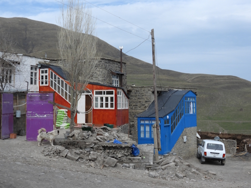
The buildings are mostly made out of local river stones, stacked together with some mud and straw. The roofs are all flat and are accessed via a ladder attached to the exterior – they serve as courtyards for the neighbouring houses. A typical house also has a “glassed gallery” – a wooden structure, now often brightly painted (photo 3), that has a covered staircase and serves as a kitchen and storage area. Cow manure is left to dry everywhere in town and is used for heating.
Before you go and visit, I can recommend reading the nomination file first, as it is very well done (if you ignore some funny misspellings). It explains the cultural landscape of Khinalig better than what you find with your own eyes or from a tour guide. To boost tourism a bit more, I think it would also be beneficial if hikes could be organized to visit some of the shrines, cemeteries, etc. along the migration route.
Els - 18 May 2025
Comments
Astraftis 19 May 2025
With regard to pronunciation, I do not know too much about Azeri, but I find interesting this name has a very Mongolic feel to it, so I wonder about its origin. In that case the initial kh is very similar to the Flemish g as in "zegt". Anyway, I just discovered that Khinalug language is a Northeast Caucasian one, and they call that place "catch"!
But yeah, Azeri has a posterior vowel harmony in that word and those i's are actually dotless ı, more similar to a schwa.
CugelVance 18 May 2025
A couple if years ago I visited Khinalig with a russia tour group as a day-trip from Baku.....the female tour guide was totally incompetent but she gave us plenty of time to discover Khinalig and we made quite a lot of stops around that mountain village.
Funnily, Khinalig didn't impress me much and not much is still there in my memory.However,the russian group was extremely nice and warm-hearted.All in all a wonderful day-trip despite the totally useless tour guide