Els Slots
WHS #798: Mistaken Point
Along with Red Bay in Labrador, Mistaken Point is the hardest-to-reach World Heritage Site of the 10 in Eastern Canada. Located in the far southeastern corner of the island of Newfoundland, it can only be visited with a prearranged tour. I reserved 4 weeks in advance by e-mail and was given a choice between two time slots on my preferred day. Fortunately, the tours rarely get cancelled ("about 5 times a year") as bad weather does not deter the Newfoundlanders, they are only called off when the waves are so high that they cover the fossils or it gets dangerous. The day before the visit, I drove from Deer Lake in the West to St. John's, the largest city in the East (which takes 6.5 hours). Then it's a further 2 hours to the South via the “Irish Loop”, a coastal road across the Avalon Peninsula past many villages of Irish origin.
12 people showed up for the 10.30 a.m. tour, all Canadians except me. We were then invited to follow our guides by car in convoy towards the starting point of the trail towards the fossils. Do they do it this way to discourage illegal entry? The entrance (just a rope across a path) and parking lot aren’t exactly hidden, but they don’t advertise it either. You could find the exact location on Google Maps of course but it is not signposted from the road. Also, when we parked our cars, we had to put a sign with the text “Tour” behind the windscreen: the police(?) apparently do check on illegal visitors.
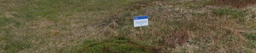
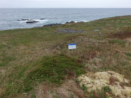
Above the cliffs, a narrow strip of peat has been designated as a buffer zone, with a sign referring to the Ecological Reserve every few hundred meters. Besides tourists who go on a tour like this (about 1000 per year), local people with a special permit are also allowed to enter the area. They may hunt and pick berries there; the bakeapple (cloudberry) is popular for making jam.
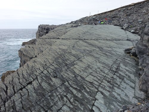
The 3km trail is easy, and a wooden bridge was even recently built to help you across a little stream. It rained heavily at the start of our visit, but fortunately, the sky cleared when we got to the fossils. These are best seen on two flat, horizontal coastal rocks. You are allowed to walk on the rocks, as long as you take off your shoes and leave behind other items such as a backpack or hiking poles. They don’t hand out slippers or free socks anymore – instead, the trip confirmation e-mail said: “bring a spare pair of socks”! In the end, I didn’t even need them, as the rocks had dried up enough to stay dry with some clever positioning of your feet.
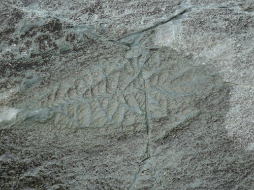
We were given laminated papers with examples of what the various fossils look like, and the guide pointed out the most important ones. Some look like leaves, or like the ferns you see in Joggins. However, they are all small organisms with no shells, bones, or other hard parts. Compared to Miguasha and Joggins, relatively few fossils have been removed here. This is probably because they were discovered so late (1967) – but still, until the 1980s the area was unprotected and 200-250 fossils have disappeared into museum collections. You can still see in a few places that a piece is missing. Sometimes also a boulder has fallen on top of them, you can see the damage. Erosion however is the main cause that more and more fossils are lost.
Visiting Mistaken Point will also introduce you to the charming Avalon Peninsula. It is recommended to drive the full Irish Loop (as mentioned above). There are gas stations along the way but hardly anywhere to buy food or drinks (so bring your own). There seem to be more amenities on the east side of the loop than on the western side. Not to be missed there as well is Witless Bay Ecological Reserve – home to hundreds of thousands of breeding seabirds at its islands. I joined a very satisfying 1.5-hour boat tour here and saw more common murres than I had ever seen together in my life, as well as loads of puffins and we had good views of both minke and humpback whales.
Comments
No comments yet.