Blog TWHS Visits
Archipelago of La Maddalena
The La Maddalena archipelago comprises the Italian part of the future Strait of Bonifacio transboundary nomination. After having visited the Corsican side earlier on this Mediterranean trip, I also checked out this Sardinian location. It has a very different feel about it, nothing like the steep cliffs at Bonifacio. However it must be said that I did not visit the Corsican Lavezzi Islands (“miniature paradise of sandy creeks and crystal-clear water”) which may be more similar to La Maddalena.
Between Palau (where I was staying overnight) and La Maddalena ferries sail back and forth in 20 minutes all day long. La Maddalena is the 'capital' of the La Maddalena Archipelago, a national park consisting of seven larger and many smaller islands. La Maddalena itself is a fairly large town, so for the real nature experience you have to go to one of the other islands. For example the neighboring island of Caprera, which is connected to La Maddalena by a dam. The island measures only 15 square kilometers, so I was going to explore it on foot.
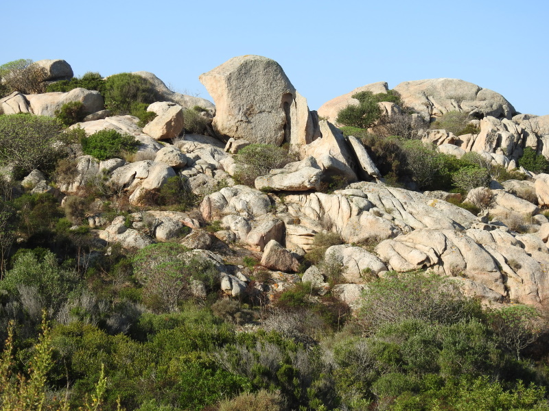
The bus dropped me – the only passenger - at the Garibaldi museum. I had planned to do a hiking trail along the north coast from here, but I couldn't find the starting point! So I first walked to the other side of the island via the main road. The scenery here on Caprera is captivating: large boulders that seem to have fallen from the sky, surrounded by typical Mediterranean low plants and shrubs. The road goes through a lovely pine forest: the trees are all bend to the same side, crooked by the wind.
On the south side of the island I followed hiking trail #1, a narrow path through the bushes and along the coast. It ended after about 20 minutes in the village of Stagnali. I had read beforehand that they want to develop tourism here. There is a geological museum, but I found it closed. The rest of the village also seemed completely deserted and there are many dilapidated buildings. A dog angrily barked at me from afar. I left quickly.
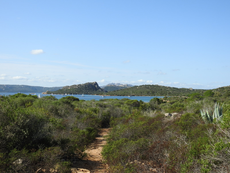
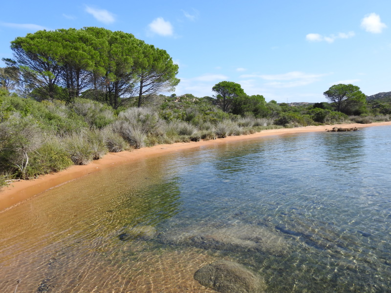
I walked a little further southwards and then arrived at a large parking lot where I continued on trail #4, to Cala Portese. This one was also poorly indicated, but using maps.me on my phone and some sense of direction I manage to reach the end point. Cala Portese is a textbook example of what Caprera and the La Maddalena archipelago are known for: an idyllic beach. Due to the shallow sea, the sea water is very clear. I sat here on a rock for a while, enjoying the view. Later a guy arrived for a swim; in the distance an old man was fishing. We were the only 3 humans around.
Some practical notes on visiting Caprera to conclude. You can get there on the local Turmo Travel bus #1 (schedule), it departs from the Garibaldi column near the port in La Maddalena. Tickets have to be bought at the tobacco shop some 200m down the Via Oberdan. At Caprera, the bus does not go to the eastern side of the island (it does stop at the crossing towards it though). So if you want to explore that side, you’d have to walk over there right away or rent a bike / scooter in La Maddalena town. The connecting dam is walkable too, so as a last resort you always could walk to Caprera but it will add another 5km each way to your hike. There are a few small road side eateries on Caprera where they sell drinks and snacks.
Els - 25 October 2020