Blog TWHS Visits
New Dutch Waterline
The “Nieuwe Hollandse Waterlinie” (New Dutch Waterline) is a proposed extension to the Defence Line of Amsterdam, which will be discussed at the 2020 WHC. It comprises another series of defense works, stretching out a further 85km from the southeast of the Defence Line of Amsterdam across the province of Utrecht into Gelderland and Noord-Brabant. Both used water – a 50cm layer of it, “too shallow for ships and too deep for men on horses” - to keep invaders out. The new name of the combined WHS shall become: “Dutch Water Defence Lines”.
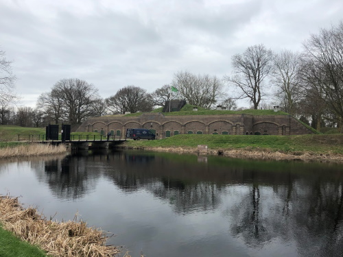
The New Dutch Waterline actually is the better known part of the two among the general public. I had visited one of its components before – Loevestein Castle, one of the most interesting castles in Holland – but last week I headed out for a hike in the area of Fort Ruigenhoek. Ruigenhoek and 3 other forts in the vicinity were especially built to protect the city of Utrecht, which established itself more and more as a railway infrastructure hub in the 19th century. These forts replaced an earlier defence line which had become too close to the city due to its expansion in the 1860’s; hence the “New” in New Dutch Waterline.
Ruigenhoek lies so close to the city of Utrecht that it attracts lots of visitors at any moment. With all schools closed and so many people working from home due to the COVID-19 crisis, even during the weekday afternoon that I visited there were dozens around. The area has been turned into a “recreational space”, with bike paths, hiking trails and a large playground for kids. I must say that this purpose is much more prominent than the monumental heritage, for which it would become part of a WHS.
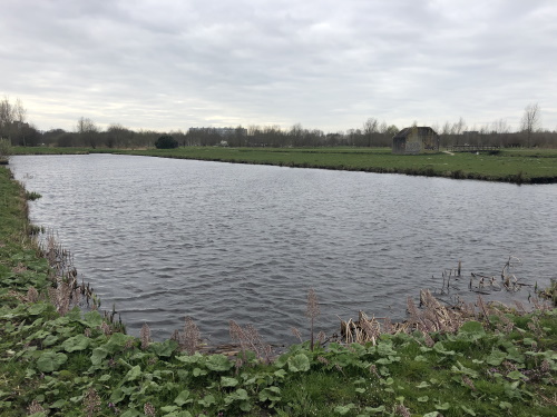
I do quite a lot of short to medium length hikes in the Netherlands and there are a few things that I then hate to encounter – cyclists and hikers sharing the same (paved) path and inadequate signage are among the worst. Both occur here, so it was not a particularly pleasant hike. Also, the typical polderlandscape (you’ll remember it from Beemsterpolder) creates boringly long and straight stretches of road with no protection from wind and weather.
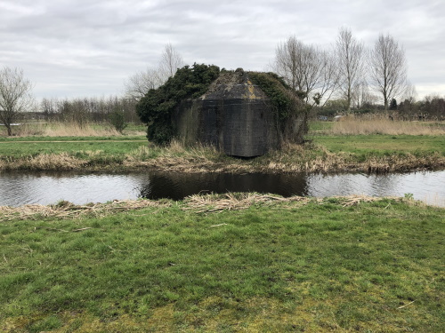
The interesting thing about these Water Defence Lines I find is that they had and still have a lot of impact on the visual landscape of the Randstad, but that they were rarely used. Here at Ruigenhoek especially the numerous ‘bunkers’ stand out. These are concrete shelters built for small groups of soldiers, where they could hide when the going got tough outside in the fields. They were constructed just before WWII, but never used. The deliberate flooding of the polders in the New Dutch Waterline also was only used 3 times in history.

This extension will be proposed as a ‘significant boundary modification’ to the existing Defence Line WHS. The list of included locations will also be updated. A few of the locations of the current WHS will be dropped, leaving 1 huge continuous core location plus 8 separate satellite locations. The nomination dossier and its appendixes are available online and I found them quite an interesting read.
Els - 22 March 2020