Blog WHS Visits
WHS #673: Geirangerfjord
Geirangerfjord is one of the two West Norwegian Fjords that have been inscribed on the World Heritage List because they are among the longest and deepest fjords in the world. They are also known for their beautiful and dramatic landscape with many glaciers, waterfalls and lakes. During my visit I based myself for two nights in the town of Geiranger. The town has a remote location: I spent over 2 hours driving from the nearest airport in Alesund, hitting less than 50km on average because of the many hairpin bends, the long and deep tunnels and an unavoidable ferry crossing. The approach to Geiranger via the Eagle road is epic though: you feel so tiny in your car amidst these surroundings. The term ‘dramatic landscape’ is overused in general, but fully fits this area which already is in the rather large core zone around the fjord itself.
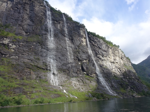
On my first morning in Geiranger I joined a 90 minute-boat tour. This is a very touristy affair and the trip only involves navigating Geirangerfjord until it meets the Sunnylvsfjord, and then it returns the same way. From the water level though the many waterfalls in this area can be seen well. The running commentary on the audio guide also directs one’s attention to the historic farms. These are somehow plastered to the very steep cliffs.
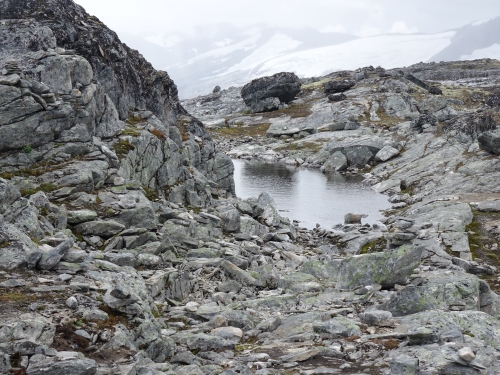
A totally different experience than the sedate fjord cruise is the road trip up to Dalsnibba. More hairpin bends and narrow roads through a barren glacial landscape lead up to this viewpoint at 1,500m altitude. The Geirangerfjord lies 17km away but can still be seen – however the view during my visit wasn’t great because of the weather circumstances: it was so cold that I wished that I had brought gloves and a mix of rain and snow fell down from the sky. Most tour buses stop at a view point called Flysdalsjuvet, just above Geiranger, to let its passengers take panorama photos of the fjord. For me it proved to be the best spot as well.
The next day I visited the Norsk Fjordsenter, which is the world heritage information center. It does warrant half an hour of your time as it explains the process of how the fjords came about very well (they were carved by glaciation during the Ice Ages and filled with sea water after the ice melted when the bottom reached below sea level ). It also exhibits life in the area in the late 19th and early 20th centuries. Most of the hiking trails in the area are very steep and eventually end up at a waterfall.
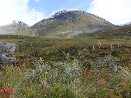
I opted for different scenery: at the top of the hairpins via Eagle road there’s a parking lot called Korsmyra. You can do a couple of hikes from there that involve less climbing, as you are already at considerable altitude. I choose the medium level but short ‘S’-trail to Hesjedalshaugen. This proved to be well worth it: it’s a quiet trail that leads through the grounds of a sheep farm. They keep black sheep there – at first when I saw them from a distance I thought they were wild reindeer! The views are good here as well and I enjoyed the various plants in the swampy grounds.
These fjords are by far Norway’s best and most quintessential WHS. Tourism has a long history here: already in 1858 a weekly steamship brought passengers to Geiranger. Last year they had 182 cruise arrivals. The town has only 246 permanent inhabitants – and sees a whopping 700,000 visitors a year. It’s not over-commercialized though: no bungee jumping and I read somewhere that it still has only 4 hotels. Its attractions are on the pricey side (12,5 EUR for the visitor center, 14 EUR for the toll road to Dalsnibba and 35 EUR for the fjord cruise) – but hey, this is Norway. Geirangerfjord is a classic destination and a bit old-fashioned as well; it reminded me of Halstatt and towns in the Swiss Alps.
Els - 26 August 2018