Costa Rica, Panama
Talamanca Range-La Amistad Reserves


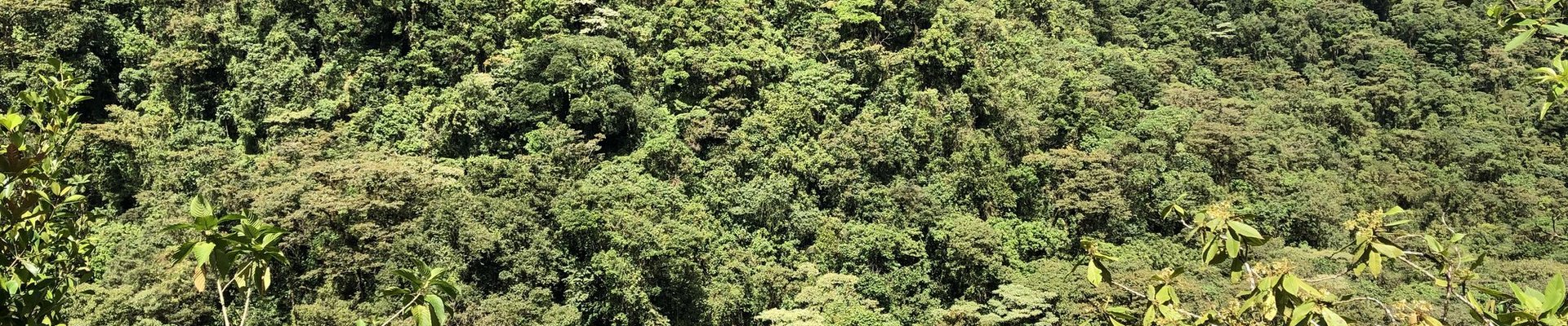
Talamanca Range-La Amistad Reserves/La Amistad National Park comprises a large mountain range covered with dense forests and marks of glacial activity.
Both the high mountains, the glacial features such as cirques and lakes and the natural forests are unique to Central America. It is also a land bridge connecting animal and plant species from North and South America. This is a vast contiguous and transboundary site comprising 8 parks: Barbilla, Chirripó, Hitoy Cerere, La Amistad (Costa Rica), La Amistad (Panama), Las Tablas, Rio Macho and Tapantí-Macizo de la Muerte.
Community Perspective: It is quite hard to gain deep access to any of these parks; they are best for hiking and birding. In Costa Rica, Anthony visited La Amistad, Esteban and Patrik Chirripo National Park, and Els Tapantí-Macizo de la Muerte. Jarek covered the Las Nubes section of La Amistad on the Panama side.
Site Info
Official Information
- Full Name
- Talamanca Range-La Amistad Reserves/ La Amistad National Park (ID: 205)
- Countries
- Costa Rica Panama
- Status
-
Inscribed 1983
Site history
History of Talamanca Range-La Amistad Reserves
- 1991: Extended
- To include the protected areas in Panama.
- 1983: Inscribed
- Inscribed
- Type
- Natural
- Criteria
- vii
- viii
- ix
- x
Links
- UNESCO
- whc.unesco.org
- Official
-
- sinia.gob.pa — Parque Internacional La Amistad (Panama)
- sinac.go.cr — Parque Internacional La Amistad (Costa Rica)
All Links
UNESCO.org
- whc.unesco.org — whc.unesco.org/
Official Website
- sinia.gob.pa — Parque Internacional La Amistad (Panama)
- sinac.go.cr — Parque Internacional La Amistad (Costa Rica)
News Article
- Nov. 24, 2017 ameliarueda.com — New dog species discovered in Costa Rica
- Feb. 26, 2008 commondreams.org — UN delegation visited La Amistad after receiving a petition by conservation and indigenous organizations to declare La Amistad as a World Heritage site "in danger"
- April 24, 2007 biologicaldiversity.org — Today the Center for Biological Diversity and more than 30 other organizations from the United States and Panama petitioned the World Heritage Committee to list La Amistad International Park as a World Heritage site 'In Danger' due to the planned construction of four controversial hydroelectric dams. The United States-based AES Corporation is pushing forward with plans to construct a series of hydroelectric dams in the Changuinola River basin of Panama, putting the exceptional natural values of La Amistad at great risk. The Changuinola River flows from the heart of La Amistad and is one of the only free-flowing rivers remaining in Central America. The four dams would permanently alter more than 600 miles of stream and flood significant areas of tribal land.
Community Information
- Community Category
- Natural landscape: Forest
Travel Information
Recent Connections
-
Perfect Inscriptions
1983 -
Over 100 mammal species
215 species of mammals have been record… -
Extended
1991: to include the protected parts in…
Connections of Talamanca Range-La Amistad Reserves
- Geography
-
-
Pan-American Highway
Tapantí-Macizo de la Muerte National Park - The border of this national park more or less follows the outline of the highway for some 20-30 km, between the towns of Trinidad and Villa Mills -
Territorial Highest points
The Costa Rican sector includes Cerro Chirripo "The highest point in Southern Central America" (AB evaluation) at 3820 metres and thus also the highest point in Costa Rica. The original nomination also included the highest point in Panama :- Volcan Baru at 3470M metres (from which it is possible to view both Pacific and Caribbean) but IUCN/WHC required Panama to exclude it for "lack of integrity" -
Cirques
"impressive marks of Quaternary glacial activity, which has shaped glacial cirques" (OUV) -
Situated on a Continental Divide
The International Park is situated generally across the cordillera which constitutes the Continental Divide and, e.g the Costa Rican portion includes the "Caribbean La Amistad and Pacific La Amistad Conservation Areas". -
World's most prominent mountains
Cerro Chirripo 37th most prominent (3727 m)
-
- Trivia
-
-
Total Solar Eclipse since Inscription
July 11th, 1991 -
Covers more than 5 percent of country
Covers 7,27% of Costa Rica
-
- Ecology
-
-
Anteaters
silky anteater, northern tamandua -
Biological Corridor
Mesoamerican Biological Corridor -
Orchids
Only in the La Amistad National Park this source indicates more than 500 identified species (see Link). -
Over 300 bird species
"Around 600 species of birds have been documented" (OUV statement) -
Jaguar habitat
-
Rainforests
-
Over 100 mammal species
215 species of mammals have been recorded (OUV synthesis) -
Tapirs
Baird's tapir -
Sloths
brown-throated sloth, two-toed sloth -
Peat
"Other particularities of major conservation value include high altitude bogs" (OUV), "Peat deposits are found extensively throughout Central America and the Caribbean region, ... Some examples of these types are .. the Talamanca Mountain blanket deposits of Costa Rica (mountain-top)."(see link)
-
- Damaged
-
-
Poaching
Civil society organizations have warned about increased pressures from ... increased poaching. Although these claims could not be validated, the proximity of these activities to the property does represent an imminent threat (Panama) -
'Threatened' by Dams
See whc.unesco.org
-
- World Heritage Process
-
-
Perfect Inscriptions
1983 -
First inscriptions
Costa Rica 1983 -
Transboundary sites
-
Country gained extra WHS by an extension
Panama (1991) -
Extended
1991: to include the protected parts in Panama -
Inscribed on all 4 Natural criteria
-
- Human Activity
-
-
Natural sites with indigenous human population
Approximately 10000 Bribri, Cabecar, Brunca and Guaymi live within the park (AB Ev).
-
- WHS on Other Lists
-
-
Biodiversity hotspot
Mesoamerica -
WWF Global 200
Terrestrial, Tropical and Subtropical Moist Broadleaf Forests: (38) Talamancan and Isthmian Pacific ForestsSee web.archive.org
-
World Biosphere Reserves
Separate Biosphere Reserves in Panama (La Amistad (2000))and Costa Rica (La Amistad (1982)) -
Ramsar Wetlands
Turberas de Talamanca, San San - Pond Sak -
Alliance for Zero Extinction
La Amistad and Surrounding Areas: Oedipina grandis; Cordillera de Talamanca Norte: Oedipina altura AND Oedipina paucidentata -
World Heritage Forest Programme
-
Centres of Plant Diversity
MA17 La Amistad Biosphere Reserve - "The property boasts an exuberant biological diversity of both flora and fauna with an elevated degree of endemism across numerous taxonomic groups, often exceeding one third of the species within a taxonomic group. The Talamanca Mountains host some 10,000 flowering plants and over 4,000 non-vascular plants. There are approximately 1,000 fern species and about 900 species of lichen"
-
- Timeline
-
-
Late Pleistocene
At least since the last glaciation about 25,000 years ago, tropical rain forests have covered most of the area... (AB ev)
-
- Visiting conditions
-
-
Foreigner prices
• La Amistad National Park: Residents: ₡800; Non-residents: $10 (₡5.638 at today's exchange rate). • Chirripó National Park: Residents: ₡4.000 (not including transportation San Gerardo-Crestones base), Non-residents: $18 (₡10.148 at today's exchange rate, not including transportation San Gerardo-Crestones base). • Tapantí-Macizo de la Muerte National Park: Residents: ₡800; Non-residents: $10 (₡5.630 at today's exchange rate). • Barbilla National Park: Residents: ₡1.000; Non-residents: $5 (₡2.819 at today's exchange rate). • Hitoy Cerere Biological Reserve: Residents: ₡1.000; Non-residents: $10 (₡5.630 at today's exchange rate).
-
- WHS Names
-
-
Named after a Mountain
"The Talamancas are a spectacular mountain range rising from sea level on the Caribbean to over 12,000 feet then dropping back down to the Valle General on the Pacific side"See en.wikipedia.org
-
News
- ameliarueda.com 11/24/2017
- New dog species discovered in Cost…
- commondreams.org 02/26/2008
- UN delegation visited La Amistad a…
- biologicaldiversity.org 04/24/2007
- Today the Center for Biological Di…
Recent Visitors
Visitors of Talamanca Range-La Amistad Reserves
- Atila Ege
- Bram de Bruin
- Carlos Sotelo
- Chinmaya
- Christoph
- dave wood
- DouglasR
- Dwight Zehuan Xiao
- Els Slots
- Erik Jelinek
- Eva Kisgyorgy
- Frederik Dawson
- Gary Arndt
- Grzegorz Andruszkiewicz
- Hammeel
- HaraldOest
- H Beswick
- Iain Jackson
- Jarek Pokrzywnicki
- Jean Lecaillon
- João Aender
- Jon Opol
- KarenBMoore
- Kasper
- Kevin McFarland
- Kurt Lauer
- leroykstlj
- Loic Pedras
- Ludvan
- Luis Filipe Gaspar
- Mahuhe
- Martin
- Mikko
- MoPython
- Mtlmr
- Nihal Ege
- Patrik
- Piotr Wasil
- rivr
- Roel Sterken
- Roger Ourset
- Roman Bruehwiler
- Rosemary
- Sandra!
- Sergio Arjona
- Thomas Buechler
- tony0001
- Truls Brekke
- voyager
- Walter
- Westwards
- Zoë Sheng
Community Reviews
Show full reviews
When I started to look into the possibilities to visit one of the national parks, the climb up to Chirripo came out as the most attractive option. To properly enjoy the guarrapo, a principal characteristic of the world heritage site, one needs an overnight at the mountain guesthouse. When I checked the site around New Year, there was just one night available in March. I booked this quickly and then planned the rest of my trip around it.
One first books and pays the park entrance at the SINAC website, then one sends a whatsapp message to the mountain hut organisation with the SINAC reservation number. They will send a payment link for the accommodation The day before the climb one has to register at the SINAC office in San Gerardo de Rivas before 16.00h and book the meals at the mountain lodge office opposite. There are just few buses daily from San Isidro del General and I was in for a 2,5 hour wait there, luckily the square is quite lively and there are places for lunch.
When I arrived at the village, there was a heavy rain shower and I asked at the park office if I should be prepared for more rain, but the ranger said it was only the second shower this year, and it is very dry up in the mountains.
It is a climb of 2000 meters and 14 kilometers to the lodge which is at 3300 meters. I stayed at …
Keep reading 0 commentsJarek Pokrzywnicki
Talamanca Range-La Amistad Reserves
Talamanca Range-La Amistad Reserves (Inscribed)

Site visited during Panama – Costa Rica trip (November, 2017) – since Els carefully described Costa Rican part of this serial heritage I will focus on Panamanian side. Technically, this National Park in Panama is divided in two sections: Las Nubes (in the south of Talamanca Range, Chiriquí Province) and Wekso (northern part, Bocas del Toro Province, more interesting, but far more difficult to get).
As I was travelling from Coiba National Park by public transport I went only to Las Nubes. It is possible to get from Santa Catalina (main access village for Coiba snorkeling activities) to Cerro Punta (central village around Talamanca Range) within one day. The journey requires 3 different buses and some luck. From Santa Catalina you should take first bus to Santiago de Varaguas, than change to the one for David, and change again there for the final trip to Cerro Punta (via Volcan). With a bit of luck you should arrive late in the afternoon to Cerro Punta. As hotels at central Cerro Punta were closed that time for unknown reason I moved closer (to Talamanca) to the village called Guadalupe, some 3-4 km from the center of Cerro Punta; place with its own shop (supermercado), restaurant and hotels (hostels), everything within walking distance.
Next day, with the help of organized local taxi lift I went to the Las Nubes section (the entrance is around 7 km from the village, google coordinates: 8°53'26.6"N 82°36'39.6"W). As in other National Parks in Panama you …
Keep reading 0 comments
“The rugged terrain, difficult access and the formal protection status have kept human impacts at bay”, the OUV statement for the Talamanca Range states proudly. That means that a proper visit to this WHS. However, it covers over 7% of Costa Rica, and it is not so easy (for a glimpse of it you can drive Route 2, Carretera Interamericana Sur, from San José to San Isidro General and look to the left). It encompasses eight contiguous protected areas, including one in Panama. I first targeted Chirripó NP; however, it turned out that access is almost exclusively geared to trekkers trying to reach the peak of Chirripó mountain. Esteban found me one alternative, with a local rural tourism association in San Jeronimo, which may be worth looking into for a future WH traveller.
Eventually, I settled for the safe bet of Tapantí-Macizo de la Muerte National Park. This lies near the pleasant town of Orosi, 2 hours south of San José. COVID limitations on the number of daily visitors required me to reserve a spot beforehand for a specific day to visit, but otherwise, the park is easily accessible. It lies at the northern edge of the Talamanca range and is mostly known for its rainforest habitat. Consequentially it is also one of the rainiest parts of Costa Rica.
I arrived there at the opening hour of 8 am. On the advice of the Swiss owners of my guest house, I left the car at the park reception and …
Keep reading 2 commentsEsteban Cervantes Jiménez
Talamanca Range-La Amistad Reserves
Talamanca Range-La Amistad Reserves (Inscribed)

This conservation area doesn´t only include La Amistad International Peace Park, but also a myriad of other protected zones, such as Tapantí-Macizo de la Muerte National Park, Chirripó National Park, Barbilla National Park,Hitoy-Cerere Wildlife Refuge, Las Tablas Conservation Area, Río Macho forest area and several indigenous reserves, on both the caribbean and the pacific sides of the Talamanca mountain range in Costa Rica.
As it becomes apparent this areas are spread all over that mountain range in the costarican side of the border and are a great percentage of our territory. They range over a diference of 3.000 meters from the rainforest and marshy lowlands on the caribbean to the high peaks in the range, that include most of Costa Rica´s highest peaks, including the Chirripó (over 3.800 meters o.s.l), Kamuk and Cerro de la Muerte, all them which in the ice ages were covered with glaciars and today still show the action of the icefields.
I personally recommend as a costarrican the Chirripo National Park, since I visited it some years ago. It is so different to what tourists are accostummed to visit in Costa Rica (beaches and rainforest) that it drives completely another kind of adventure and spirit to it. It´s a really spiritual place, the low temperatures, the difficult trails, the rocky landscapes and extremely pristine lakes and rivers, the ghostly forests, the winds, the fog, the view atop of Chirripo mount of both seas, and a great part of the country, the impressive sunshines and sunsets, …
Keep reading 0 comments
In February, I was in Panama City for a meeting and decided to make it to Amistad. First there is a 6.30am flight from Panama City to David in Chiriqui province. I was picked up by a guide at 7.30am in David and travelled another hour passed Cerro Punta to get to the park entrance. The scenery along the way were all cattle farms and agriculture. Very lush as we are now up to 6000 feet.
In the park there was a small park HQ where you registered and paid a small fee. Then there were several trails to take in the forest. I took the El Retorno trail hoping to see the Quetzal bird. No luck on the bird and after a couple of hours we were done. I was planning on staying the night in David but decided that there was nothing to do there and forfeited my room to fly back to Panama City on the 5pm flight.
If you have seen tropical forest before, you can definitely skip this one.
Keep reading 0 comments