CugelVance
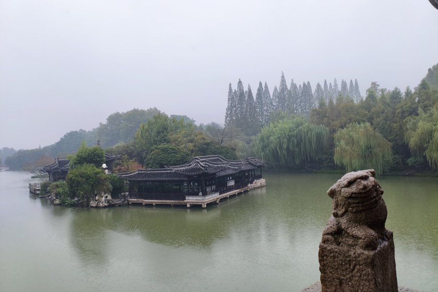
Slender West Lake Area, China
Slender West Lake and Historic Urban Area in Yangz (On tentative list)
Time of the visit: the 7th of nov.,2025
Slender West Lake, YangzhouWhy the name? Slender West Lake?The lake is long and thin, like a pretty, winding river. People called it "Slender West Lake" because it looks like a smaller, more graceful version of the famous West Lake in Hangzhou.It's a beautiful park and lake in the middle of the old city of Yangzhou. No wild nature—it was carefully designed by gardeners hundreds of years ago to look perfectly pretty.It is more a giant, natural painting you can walk through, with bridges, islands, willow trees, and old pavilions. Some highlights are the Xichun Tai (Dawn on the Spring Terrace): The iconic pavilion at the lake's heart, offering the best panoramic view. It's where Emperor Qianlong famously fished.The Wuting Qiao (Five-Pavilion Bridge): A stunning stone bridge with five pavilions, resembling a belt of flowers on the water. It is the symbol of Yangzhou.The White Dagoba: a replica of Beijing's Beihai Park dagoba, commissioned to please Emperor Qianlong. It creates a striking focal point and symbolizes Yangzhou's connection to imperial power.The Twenty-Four Bridge Scenic Area,this area features a 24-meter-long bridge with 24 balustrades and 24 steps, evoking poetic nostalgia.The Xu Garden & Small Golden Hill,:exquisite smaller gardens within the park that demonstrate classical Chinese gardening techniques of enclosure and illusion.Yangzhou was once a very rich city because of the Grand Canal, the ancient man-made river that brought money and emperors right to the city. Slender West Lake was like the city's gorgeous …
Keep reading 0 comments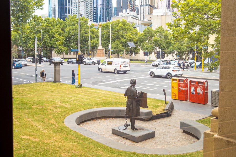
I was particularly keen to write a review of the Victorian Trades Hall as previous reviews have not covered this property in detail. I also think that this serial nomination has a strong chance of becoming a UNESCO World Heritage site. I visited Victorian Trades Hall in Dec 2025, and here is how it went.
When asking paid off
Victorian Trades Hall Council offers only a few tours a year and are perhaps the only way to explore the building in detail. As I was visiting over Christmas, it wasn’t surprising that none were scheduled. I reached out to their office to ask (with a bit of enthusiasm) whether any tours might be planned and mentioned that I’d really appreciate the chance to join one. A couple of weeks before my trip, they sent me a message confirming they were going to run a tour, though on my last day in Melbourne. On the day of our tour, our guide mentioned that my request had helped make it happen—a nice (and quite flattering) bonus.
The tour
Our tour began in a meeting room. There were only four other guests who all seemed to be affiliated with unions or labour groups. With such a small group all huddled in a room, and the Trades Hall staff seemingly already on break, the tour felt personal and relaxed.
Our guide started off by giving us a bit of history of the labour movement in Australia, including the events that were associated with Victorian …
Keep reading 0 comments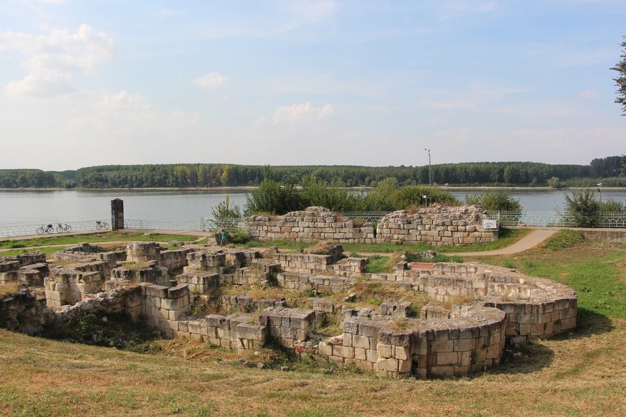
During the community meetup 2018 in Bulgaria I managed to visit two locations of the Bulgarian Limes.
Sextaginta fortress
The first location was the Sexaginta fortress in Ruse, where we spent the night. The fortress was turned into a museum, providing information boards and boardwalks for easier access. Only a few foundations are left of the fortress, but still enough to make this a worthwhile visit.
Ancient settlement of Durostorum
The second location was Durostorum, an ancient settlement in Silitra. The town is also home to a second Roman TWHS, the beautifully painted tomb and a good crossing point into Romania. Beeing at the same time a public park, the settlement is freely accessible. The ground structure of several buildings and even parts of the town wall are visible.
These two locations alone have more visible remains than everything I saw in Germany and Austria, so extending the current WHS with the Bulgarian part would for sure be an upgrade.
Keep reading 0 comments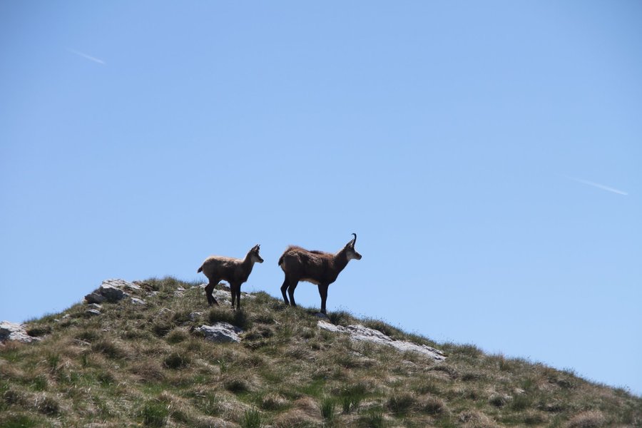
Visited May 2025. I started my visit to Durmitor NP, like most other visitors, from the ski resort town Zabljak. The Black Lake is only a few minutes drive and I arrived so early in the morning, that nobody charged me for the parking lot.
The full loop around the lake is pretty easy. You mostly walk in the forest with only a bit of climbing around the back part of the lake.
After the lake visit I took the road to Bosnia, that crosses right through the core zone and offers stunning views of the mountains. The road conditions were good in May, but the road is winding and very narrow. Counter traffic, caravans, trucks and cow herds made this a rather painful drive.
I stopped at Valovito lake and then at the trail head to Bobotov Kuk. This is a famous hike in Durmitor NP and the trail head even has a “parking lot” that is basically some space along the road where your car is not immediately plunging into the Abyss.
The hike is amazing, but not for beginners. I did not make it all the way to Bobotov Kuk, as there was still too much snow to comfortably hike there, but I hiked around 2 hours into the area (and 1.5 hours back). My highlight was spotting a Balkan Chamois with her kid. This is an essential part of the park, so I recommend everybody not to stick to lakes or canyon only.
Stecci nearby
All …
Keep reading 0 commentsPhilipp Peterer
Just another train line
Sistema Ferrocarril Pte. Carlos Antonio Lopez (On tentative list)
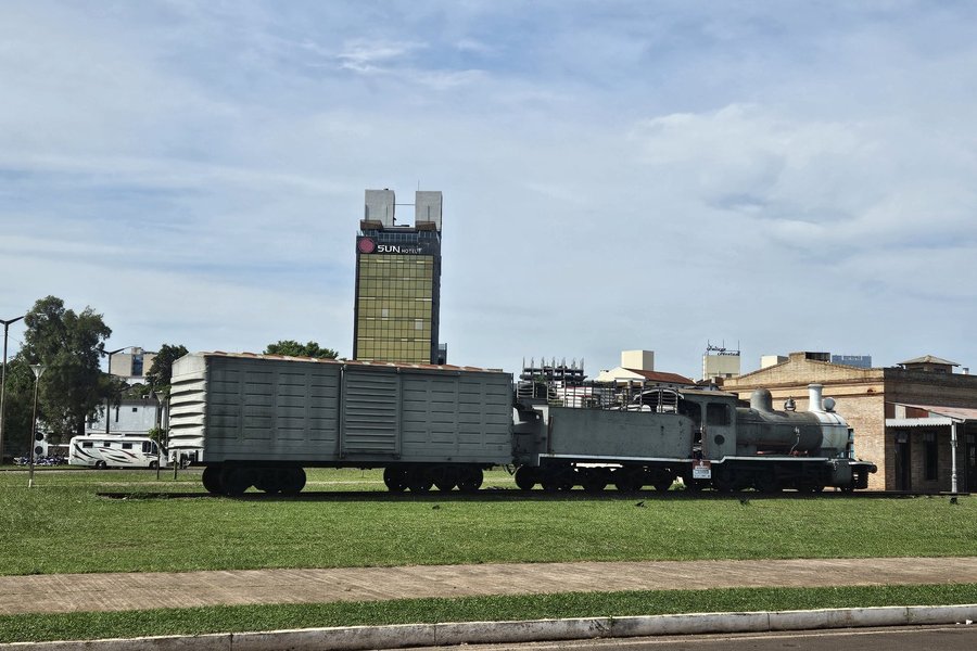
The proposed components in Encarnacion are rather easy to pick up, if you visit Paraguay the lazy way (day trip from Posadas to visit the one WHS and done). The rail bridge is connected to the road bridge and the only way between Posadas and Encarnacion, so it´s impossible to miss. Saying it is not spectacular at all would still be an understatement.
The second component is the old train station of Encarnacion. I honestly only saw it by chance. Our driver wanted to show us (for a few extra bucks of course) the beach, on our way back from visiting the WHS. He stopped right in front of the station. The station, again, is nothing special. But at least, there is an old train parked in front of it.
I don´t understand why a train line Built by British engineers in the new world should be a WHS and I could not see any OUV, at least not in Encarnacion. There are already a few train lines on the list and I feel any new addition to this segment would need to be really outstanding to be justified.
Keep reading 0 comments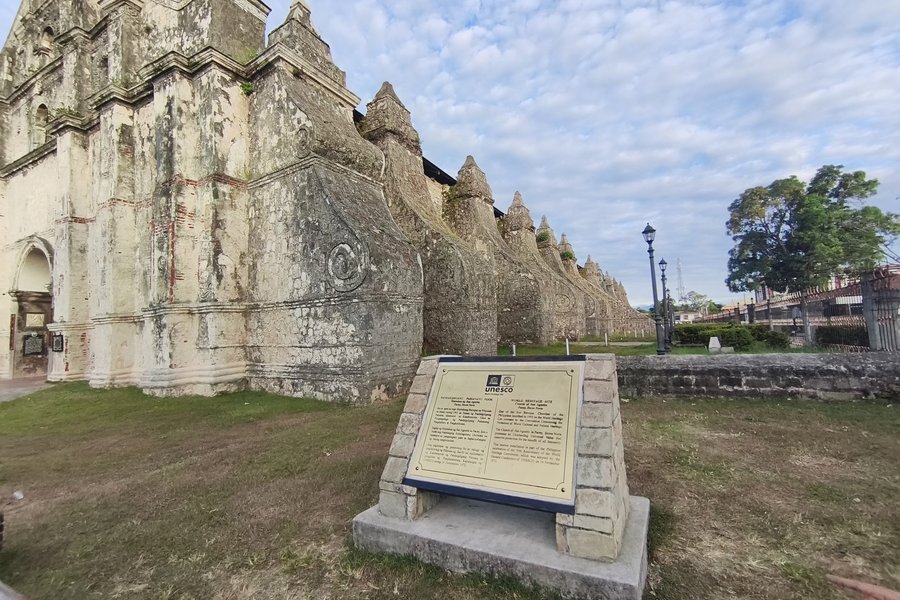
Time of the visit: the 8th of Dec.,2025 as well as the 11th of Dec.,2025
The "Baroque Churches of the Philippines"are :
1)San Agustín Church, Manila (Intramuros)
- Oldest stone church in the Philippines (completed 1607). Survived wars; features ornate interior,flamboyant ceiling, and a serene cloister. Represents the transplant of Spanish/Mexican Baroque.
2)Paoay Church, Ilocos Norte
- The ultimate "Earthquake Baroque" icon. Known for its massive, curving buttresses and detached bell tower. A fortress-like church built from coral and brick.Massive, colossal
3)Santa María Church, Ilocos Sur
- A fortress church on a hill. Uniquely accessed by a long, steep stone stairway rising from the town. Built like a citadel with thick defensive walls.
4)Miagao Church, Iloilo
- Known as a "fortress-church" against pirate raids.
I only visited the Intramuros church as well as the Paoay church more profoundly.I only very briefly had a look at the Santa Maria church from the outside.I didn't visit the Miagao church.
This is one of those UNESCO World Heritage Sites that surprises and captivates you. To put it mildly, my expectations had been very low.
I stayed for several days in the unesco city of Vigan not far away from Paoay.Vigan was a great city to experience the crazy Christmas season in the Phillipines.Unforgettable.Incredibly hospitable people in the Northern part of the Phillipines.
On the 8th of Dec.,2025,I took a bus from the Partas bus station to Batac intersection( all buses to the North pass through that intersection,just a stone' throw from there to Paoay). Usually there …
Keep reading 0 comments
Site visited in December 2025. Although Shark Bay is (rightly) associated with marine life, it also has a surprising amount of things to offer on land.
I began my tour at the stromatolite colony in Hamelin Pool, which is closest to the entrance to Shark Bay core zone from the North-West Coastal Highway. Stromatolites are among the oldest, if not the oldest, organisms on Earth – the oldest colonies are 3.7 billion years old, while the Australian ones are several hundred million years younger. They look inconspicuous, essentially like rocks, although the hardened ones are no longer active. The active ones are simply colonies of cyanobacteria, which produce oxygen from other gases, primarily nitrogen, through photosynthesis. It is estimated that the Earth's atmosphere in its present form, i.e., with a high oxygen content, was created thanks to the activity of cyanobacteria. The hiking trail in Hamelin Pool is closed after the cyclone, but I climbed over a low fence and got closer – everything for better photos.
Driving around the Peron Peninsula, I saw emus up close for the first time. They weren't afraid of anyone, unlike the ones around Willandra, which wouldn't let anyone get closer than 100 meters.
My next stop was Monkey Mia, a place known primarily for dolphin feeding. I'm not particularly fond of this type of activity, but since I'd never seen dolphins up close, I decided to give it a try. There was an hour left until the next feeding time, so …
Keep reading 0 comments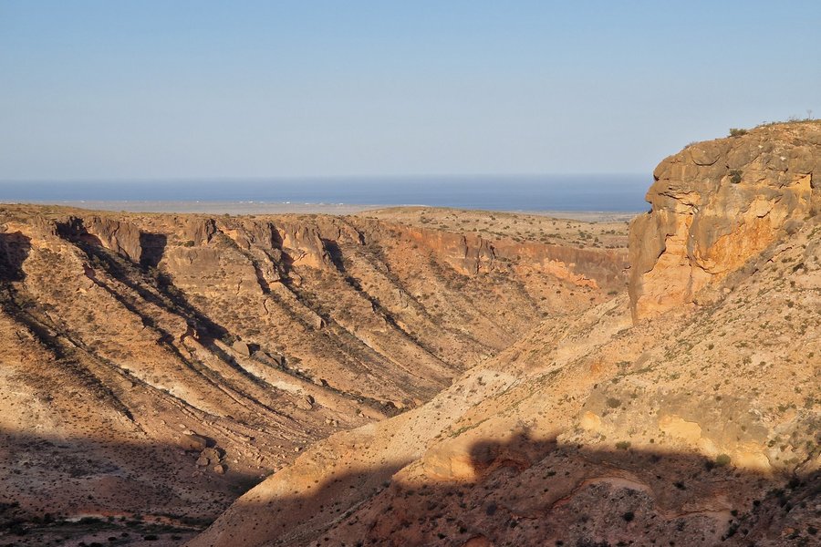
I didn't have high expectations for the Ningaloo Coast. The descriptions and reviews suggested it was primarily for divers. And indeed, upon arriving at Coral Bay, the infrastructure is focused primarily on diving and sunbathing. The beaches in Coral Bay are very nice, and the water is shallow (when you enter the water, you cross the core zone boundary), but they don't stand out in any way.
So I continued towards Exmouth, passing countless termite mounds along the way.
Near Exmouth, there's a turnoff towards Cape Range National Park. Despite my exhaustion (I'd already covered over 1,000 km that day), I decided to turn off and see what this place had to offer. The drive isn't long, maybe a few kilometers, during which we cross the border of Cape Range Conservation Park. Be warned, the Conservation Park is outside the core zone; you have to keep going. A moment later, we cross the border of the national park proper and the core zone. The landscapes here are completely different – karst canyons of streams flowing into the ocean, dotted with numerous caves. The setting sun made it all look truly spectacular.
There are trekking routes in Cape Range NP, but due to the temperatures, it's best to start very early in the morning or late in the afternoon. During the day, the heat is unbearable.
Keep reading 0 comments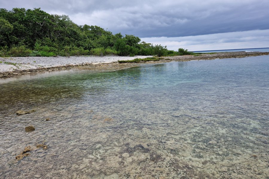
The place isn't very easy to see. Of all the proposed locations, only two are on land – one is the Punta Frances and Punta del Este National Parks on Isla de la Juventud (accessible by ferry from Surgidero de Batabano or by plane from Havana), the other is Guanahacabibes National Park on the southwestern tip of the main island. After visiting Viñales, I decided to see what this place had to offer.
The road from Viñales is terrible – no wonder Google Maps shows 3 hours for only 137 kilometers (from Havana, it's almost 5 hours). Along the way, we pass the Sacred Heart of Jesus Church in Sandino, built in 2018 – the first church built in Cuba after the Cuban Revolution in 1959!
The closer to Guanahacabibes, the worse the road, but it's accessible by regular car. The last major town is Manuel Lazo; the park boundary is about 20 km further, and after a few minutes of driving, you can reach a small Visitor Center.
Unfortunately, everything was closed during our visit; I just looked through the windows and continued on. Unfortunately, after another few minutes, I reached a barrier. Access was only permitted with a guide. Fortunately, the ranger's hut was right by the sea, and there was a coral reef on the shore. So, at least I had a glimpse of the core zone of this entry. Unfortunately, the reef was largely extinct and fossilized, although some living organisms could be observed.
After my …
Keep reading 0 comments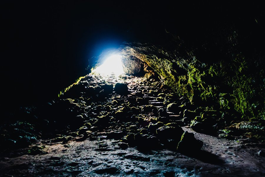
Budj Bim Cultural Landscape was the final UNESCO World Heritage site I visited in 2025 (visited Dec 2025). We based ourselves in Mount Gambier, about a 1.5-hour drive away from the site. The property comprises three components: Budj Bim (northern), Kurtonitj (central), and Tyrendarra (southern). While it is technically possible to visit certain publicly accessible areas in each component in a single day, I chose to slow things down and focus on one area instead—Lake Surprise within the Budj Bim component.
Budj Bim and visitor access
Budj Bim is the largest component, accounting for around 90% of the total area, and is arguably where most visitors go. Meaning “high head” in the Gunditjmara language, Budj Bim refers to the volcanic complex (Mount Eccles was its colonial name), with Lake Surprise forming its crater lake. Tae Rak (Lake Condah) and Lake Surprise are the main visitor-accessible areas within Budj Bim. The Tae Rak Aquaculture Centre in Tae Rak offers cultural tours to Budj Bim and Kurtonitj but is closed on Mondays and Tuesdays—the very days we were staying in Mount Gambier. Winda-Mara Aboriginal Corporation also offers tours to Tyrendarra, but after contacting their office they confirmed that they were understandably on a holiday break from 22 Dec until 5 Jan.
Activities around Lake Surprise
Walking, picnicking, camping, and cycling are essentially the main activities available to visitors in the area. We arrived at the campground shortly after lunch and set up for a picnic. After finishing our snacks and a bottle …
Keep reading 0 comments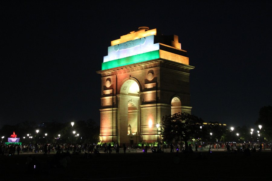
I'll concede one point. Delhi has a complicated history, one that's really hard to showcase through the list (mostly because it doesnt have a cohesive old town, but a score of "centres" from its many foundations)
Delhi has been the epicenter of Islamic India ever since the Delhi sultanate. Any good guide on indoislamic architecture is bound to go mention Delhi the most out of any city in the subcontinent.
Now onto the harsh part. India might be the world champion at whs duplication. What they don't have in numbers, they make up on sheer bashfullnes. Jaipur alone is on the list thrice. The sundarbans are among the most nonsensical separations in the list. Mumbai basically got the same site on the list twice. And of course here they're trying to follow the recipe.
As already pointed out by els, the site subsumes three already inscribed sites as the highlights of their areas. So the proposal ends up being a reshuffling of sites with a few toppings, notably the jama masjid, the purana qila complex and a score of mausoleums. What's interesting is that, for reasons I don't fully understand, the dossier leaves out many important sites in Delhi like the tuglabaq fort and the lodhi tombs.
Of course the exception to this lack of originality is New Delhi, which is a truly original addition to the list. My take, is that India thought the proposal was too weak and thus made this abomination a la Frankenstein.
Els has commented …
Keep reading 0 comments
Time of the visit: the 22nd of Dec.,2025
The question which first comes to your mind is: why on earth is the SBG a UNESCO whs????
Because of its ( according to official sources)1. Historical Role in Global Plant Economy: In the late 19th and early 20th centuries, it was a key hub for the introduction, cultivation, and distribution of the Para Rubber tree (Hevea brasiliensis). The successful development of rubber tapping techniques here revolutionized the Southeast Asian economy and the global rubber industry.2. Pioneering Tropical Botanical Science: It is one of the oldest tropical botanic gardens (founded in 1859) and has been a leading centre for plant research, particularly in orchid breeding. Its orchid hybridization programme is world-famous.3. Unique "Garden City" Model: The Gardens' landscape design and its seamless integration into the urban fabric of Singapore directly inspired and guided the nation's transformation into a globally admired "City in a Garden."4. Living Heritage Site: Unlike many historic gardens, it has continuously evolved, remaining a free public space for recreation, education, and cultural activities, deeply cherished by Singaporeans.
The official ICOMOS (International Council on Monuments and Sites) evaluation report prior to inscription actually recommended deferral. Their concerns were later overruled by the World Heritage Committee.
ICOMOS sought a clearer, more demonstrable link between the garden's design and the actual city planning of Singapore beyond a general "inspiration."They questioned if the SBG was truly exceptional compared to other historic botanical gardens like Kew (UK) or Padua (Italy).
Good points IMO.
…
Keep reading 0 comments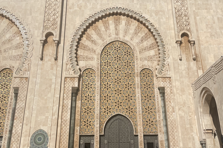
If you are traveling to Morocco, chances are you will visit Casablanca during your stay. As Morocco's largest city, Casablanca has plenty of connections for transportation, places to see, places to eat, and places to stay. I enjoyed Casablanca, but I don't know if I would say it needs to be a WHS. The city, which boomed into 4 million inhabitants largely within the last century, ended up being one a city I came back to largely for logistical reasons, rather than tourism. I did really enjoy the Hasan II Mosque -- it is gigantic, with the 2nd tallest minaret in the world, and was the tallest at the time of its construction in the 1980s. I also had some great Moroccan food, found souvenirs, and there was plenty of public transportation to get around. Would I say Casablanca should be a WHS? No. Would I say you should visit it? Yes!
Keep reading 0 comments
Meknes was my least favorite WHS in Morocco. After seeing the medinas of Marrakech and Fes, Meknes (perhaps unfairly) feels underwhelming. The must-see site of Meknes is the magnificent mosaic gate, Bab El Mansour Laalej, which is one of the first images that pops up when you google the city. Although it was stunning, it did not feel any different from the number of mosaic gates and walls I saw throughout Morocco. The city was pretty empty as well, perhaps a pro for those who prefer a more hole-in-the-wall feeling to their travel plans. I enjoyed Meknes, but I wouldn't recommend anyone go out of the way to see it.
Keep reading 0 comments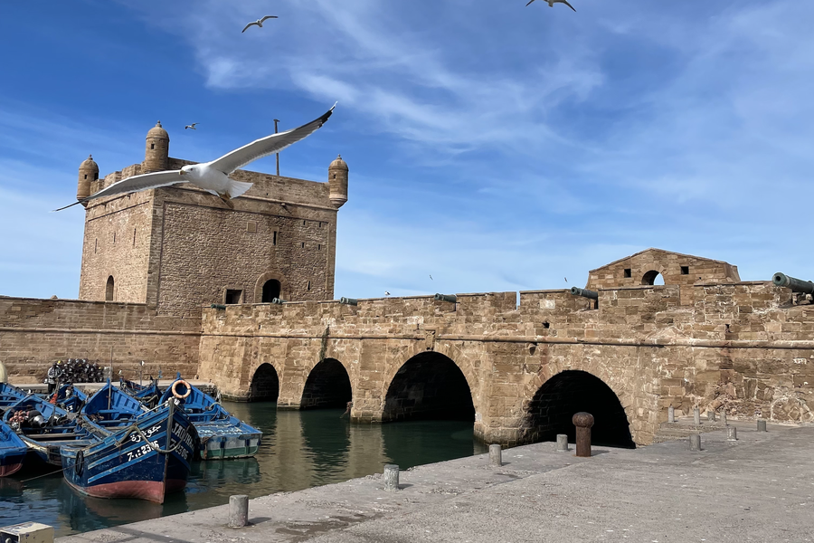
I visited the city of Essaouira (aka Mogador) in early 2026. The weather wasn't particularly cold, but it was incredibly windy. There's lots of seafood, as expected, and seagulls flying around waiting to photobomb any pictures you may take. I was only able to spend a half-day in Essaouira, doing a guided tour of the medina and lunch on the seaside. However, the city was beautiful, and felt strikingly different than the other Moroccan WHS I have been to. This is perhaps influenced from its Portuguese history. I found the medina easy to navigate, and the crowds were much less overwhelming than anywhere in Fez/Marrakech/Casablanca. Overall, Essaouira is a city I would recommend to any tourist -- it has something for everyone, from Game of Thrones filming locations, a WHS, fresh seafood tajines, beach resorts, calm atmosphere.
Keep reading 0 comments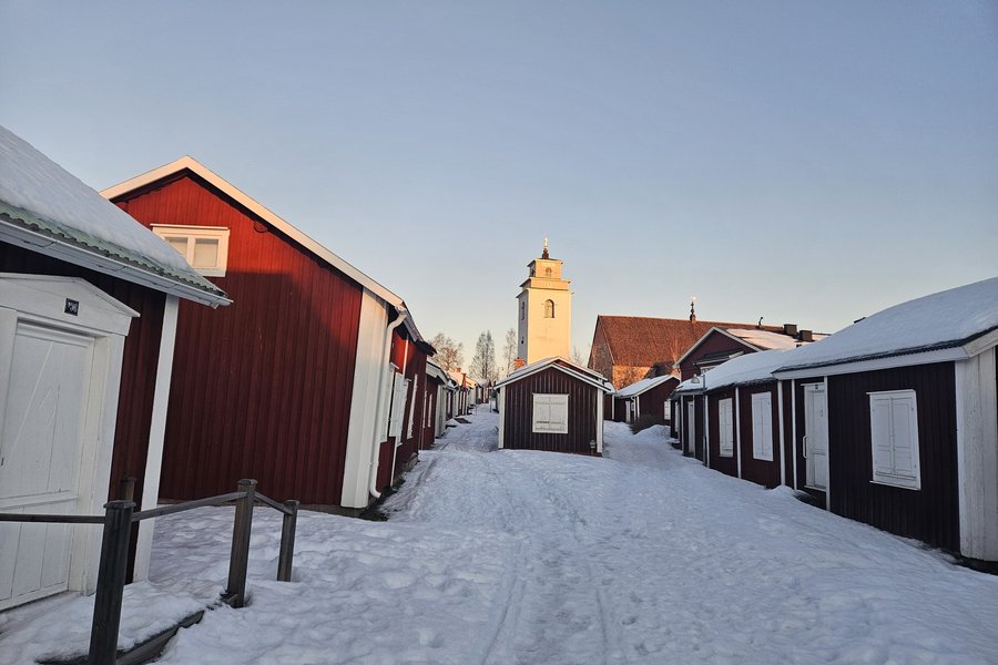
All previous reviewers have visited Gammelstad in summer, so I will add my experience of visiting the site in winter.
We profited from a rare seasonal direct flight to Lulea from Zurich in December 2025, targeted at winter tourists. Having our hotel in Pitea, I rented a car. From Lulea, there would also be regular, buses even in winter.
Days are very short, but there is no eternal darkness. Around 10am there is some light and between 11am and 1pm the sun is partially and for a few minutes even fully visible. The temperature was actually not too bad, always at or just above 0 degrees Celsius. The whole region is covered in snow, that is mostly rather ice.
We visited on a Saturday, and the town was surprisingly lively. The houses are private property, but the rule was kept, that they can only be inhabited during the weekend. Many seemed to have used the opportunity to spend Christmas in their holiday house, assuming by the number of cars in front of the houses. There was also a fair amount of visitors roaming the streets.
The church, a small shop and a restaurant (rather Kebab place) were open. The visitor centre should have been open but was closed. Same goes for the other 2 Cafes I found.
Apart from the very short hours with daylight, there are no drawbacks in visiting Gammelstad in winter. There are even some advantages. If you are lucky, you combine your visit spotting northern lights, …
Keep reading 0 comments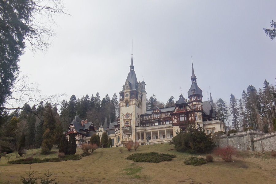
I visited Peleș Castle way before joining the site thus it wasn't even on my "must visit" list. It only became part of the tentative list in 2024 as well and I wouldn't have noticed it if not for another review. I was also my first trip to Europe, not counting the UK (they often don't consider it as part of Europe but oook let's leave that discussion for another day).
It's also unfortunate that I only visited one of these. There are actually 3 properties but I believe that Peleș castle is surely the best. It was featured in "Brothers Bloom" briefly; however, only the exterior and one wouldn't think that Rachel Weisz really lives there from her playing an instrument outside for a few seconds. Anyhow, it was "famous" and I had it on my todo list when visiting Transylvania (which exists, not a vampire thing, although there is a Bran Castle which is a reference to "Dracula's Castle" due to the torture dungeons, I think it should be on your list as you are in the area already).
You can park just at the hillside of the castle and walk up, although things might have changed. It's been 10 years since my visit and it was in March thus it was quite empty. On the pictures it seems busy and I figure in summer the whole area is full of tourists. My group was 4 people even though one came late so it was veeeery relaxing.
First …
Keep reading 0 comments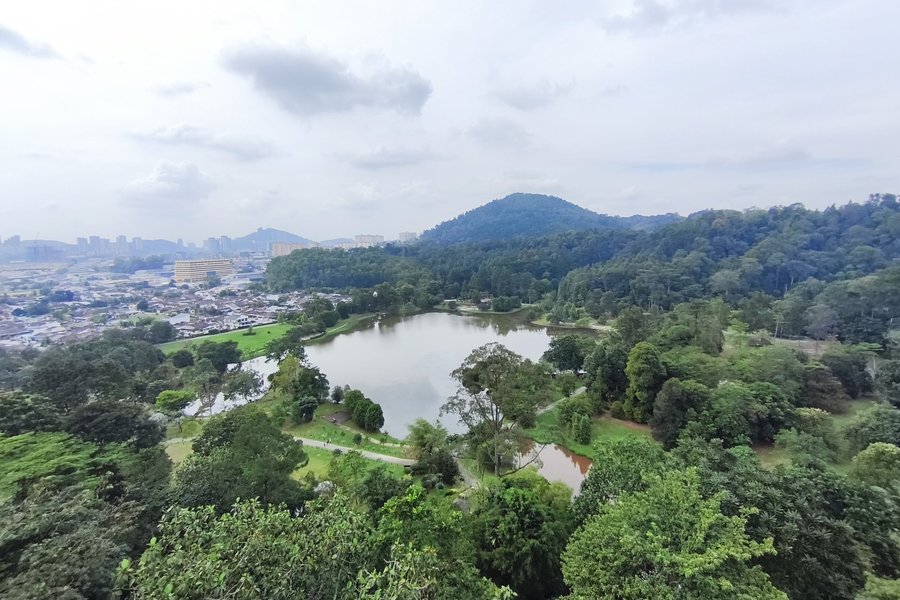
Time of the visit: the 25th of dec.,2025
FRIM (Forest Research Institute of Malaysia)It started in 1929 as an old, tired and ecologically dead mining land. Scientists planted trees to turn it back into a beautiful, healthy forest. They wanted to study how to grow and protect forests.UNESCO chose it because it's a perfect example of a man-made forest that became a real, natural forest again. It shows the world how we can heal damaged land. It's also a very important place for science and protecting plants and animals.A visitor can see quite a few endangered tree types.FRIM's highlight is certainly it's skywalk.The skywalk is a long, sturdy bridge built high up in the tree branches. You walk 30 meters above the ground (as high as a 10-story building!). From there, you can see over the top of the whole forest and even get a view of Kuala Lumpur in the distance. It feels like you're walking through the canopy with the birds.For an extra 10 Ringgit you can climb up the so-called tower....the highest point of the skywalk.A guard checks your extra ticket.
The skywalk itself is quite amazing and also a bit scary at times .
Tickets should be bought a few days in advance .A single one costs 40RM+10RM for the tower+10RM for the FRIM area.
The FRIM is easily reachable by public transport.I just took one of the frequent commuter trains from Kuala Lumpur 's city centre and got off at the station "Kepong Sental'.From …
Keep reading 0 comments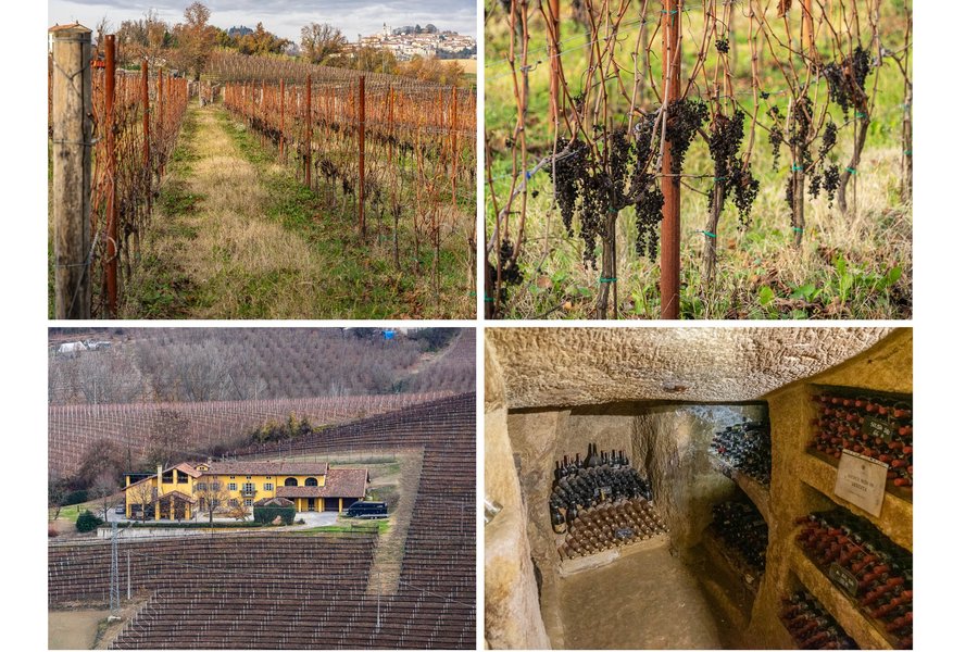
It probably goes without saying that in the warmer months, with extended daylight, I would likely get more out of touring wine-growing areas than I could in November. In any instance, driving around vineyards and pretty villages and stopping by for tastings and tours should span more than one day in order to attain the full appreciation of this beautiful region. I could only devote one day to Piedmont Vineyard areas in late fall of 2025 on a wide-ranging Northern Italy trip with the base in Milan. I'm happy that I made the effort.
I first thought of starting in Barolo and making my way towards Milan through Barbaresco and Monferrato, but that was certainly too ambitious for a single day. I always in the past preferred the “queen wine” of Barbaresco Nebbiolo to its more exalted Barolo cousin, so in the end I limited myself to only Barbaresco and Monferrato, with only three major stops = and many minor ones at different picturesque spots as I drove through the hills. Of course, as I was driving, I had to carefully spit the wine during tastings instead of swallowing. I positively hate having to spit a good product, so just to be on the safe side, I only planned two tastings for the entire day.
The first was in Enoteca Regionale del Barbaresco, where for €15 I got to taste 6 different wines from two local producers. You cannot hurry that process if you want proper enjoyment. That contributed to …
Keep reading 0 comments
Foreign visitors to Laos are very likely to arrive or depart by plane from Vientiane Airport, the capital.
It would be a shame not to spend some time in the city to soak up the atmosphere and visit, among other things, Wat That Luang, which the Laotian nation hopes to have inscribed on the World Heritage List. Day and night, the general atmosphere in Vientiane is relaxed, much like in Luang Prabang, though a little less secluded.
My friends, my wife and I had landed in Luang Prabang Luang Prabang in winter 2025 where we rented a car to visit the north of the country, including the Plain of Jars.Plain of jars in winter 2025, and end in the capital where we caught our flights back to our respective homes. I think it's better to do the loop in this direction rather than the other way around, otherwise you risk being disappointed by the capital.
As we were staying in the presidential district along the Mekong, we had to take a tuk-tuk to visit Wat That Luang, which was 4 km away. As I already wrote in the column about Luang Prabang, I am quite easily impressed and it was my first time in Southeast Asia, so it was difficult for me to compare the Wat That Luang site with other Buddhist sites, but the building seemed impressive enough on the one hand, and unique in its form which has no equivalent in Europe on the other, that …
Keep reading 0 comments