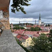
Connected Sites
-
2007 - buffer zone, 2018
-
2011: to include the Koongarra Project Area. Known uranium deposits had led to its exclusion from the National Park and World Heritage site in 1981 with the Koongarra Project Area Act.
-
2011: a 20% increase in area, the modification consists of two groupings, either of elements which were previously separate, or of new elements which were not included in the original boundaries of the property.
-
2008: To include the central part between the 2 monuments to express the continuity of the territory - so it became continuous.
-
2012: To add recent excavations of a wall to the north
-
2017: reduction of the boundaries, linked to the Beak Point area, which is wrongly part of the World Heritage property
-
2023: add three aquatic parts that were in the buffer zone, including submerged remnants of a linear stone structure, walls of a Byzantine fortress and other archaeological remains of different structures
-
2023: increase of 53%, Firstly, add the managed Fauna Reserve and more than two thirds of the “N’Zo Fauna Reserve”. The new boundaries add a part of the Haut Dodo classified forest in the south-west and a part of the Rapides Grah classified forest in the south-eastern and eastern part of the national park.
-
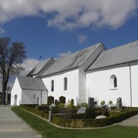
2005: boundary change to be in line with the boundaries of the National Park approved by the State Party in 1997, thus excluding the town of Zabljak from the property
-
2019: adding the Machado de Castro National Museum
-
2016, to include: "Dinh mountain, a mountainous area to the south of the property, an area with isolated karst towers emerging from the corrosion plain to the north east of the property, and a slight reduction of the property in the north, to exclude a quarrying area, around Tam Coc wharf, to exclude urban development, and at Bich – Dong, to exclude an hotel. "
-
2018: new components being added to the property: Upper Geomunoreum Lava Tube System (two components with a total of 46.6 ha)
-
2008: encompass the total area of historic fortifications which form a green area around the medieval city, and some key 19th century buildings such as a church and two theatres. Its boundaries would coincide with those of the Old City Conservation Area
-
Primeval Beech Forests
Albania, Austria, Belgium, Bosnia Herzegovina, Bulgaria, Croatia, Czechia, France, Germany, Italy, North Macedonia, Poland, Romania, Slovakia, Slovenia, Spain, Switzerland, UkraineInscribed: 2007326382023: enlarging the Dürrenstein component part (Austria) to become Dürrenstein Lassingtal, and by merging the component parts Paklenica National Park – Suva draga Klimenta and Paklenica National Park – Oglavinovac-Javornik (Croatia) to become Paklenica National Park component part. -
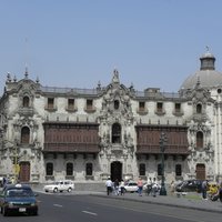
2023: To incorporate six monuments located within the buffer zone. From these, four are adjacent to the property’s boundaries: Prado or “del Corcovado” House, San Bartolomé Hospital, Nuestra Señora del Prado Church and Monastery, Santa Rosa de Santa Maria Church and Monastery; and two are separate areas: Ancient Indigenous Reduction of Santiago Apostle of Cercado and Quinta and Molino de Presa. It now becomes a serial property composed of three serial component parts: Historic Centre of Lima, Ancient Reduction of Santiago Apostle of Cercado and Quinta and Molino de Presa.
-
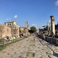
2015: "extends the property boundary to the walls of Urban VIII in order to include the Gianicolo quarter, the Palazzo di Giustizia, the Bridges Margherita, Cavour and Umberto, essential achievements of the 19th century urbanism, as well as the bridge and the Castel Sant’Angelo."
-
2010 - a number of small changes, including the addition of "the small promontory, beach and inner harbour as the original mooring and landing place at Yunotsu for the Iwami Ginzan mine"
-
2011 boundary change to include the Hamburg Wadden Sea National Park
-
2008: "including the whole of the Fyfield Down site. Scientific work (2000) has led to the conclusion that the importance of Fyfield Down is far greater than initially thought, particularly its remains of earth construction, associated with the late prehistoric period, linked with the Avebury mound. ... also a series of minor rectifications, such as the whole of the West Kennet Palisaded Enclosure complex and the East Kennet Long Barrow and the whole of the Fox Covert tumulus "
-
2008: "combine the two existing parts of the property into a single ensemble, by including the portion of the avenue which separates them, that is part of St. Margaret's Street to the north and the start of Abingdon Street to the south."
-
2021: to exclude the site of the recent housing project facing the ‘Red Brick building’ (Fabbrica di Mattoni Rossi)
-
2007 (Islas Marietas National Park and the Archipelago de San Lorenzo National Park), 2011 (Balandra Zone)
-
2023: enlargement of all three component parts, intended to align the boundaries of the property with the new, extended boundaries of the Nature Reserve. The areas consist solely of marine areas. The extension adds 98,970,200 ha to the property resulting in a total area of 166,267,100 ha.
-
2017: Include Audion area, Martyrs graveyard area, Natural spring water area (addition of 14% to core zone)
-
1995 (not labelled as Minor Boundary Modification as probably too early for that): "the new boundary will reduce the total area by about thirty percent, adopted the revised boundaries, as they better define the area containing the World Heritage values and will considerably facilitate the management of the property."
-
2010: numerous small changes, including those to allow for more precision in the habitat of the Yunnan Snubnosed monkey and to correspond with the refined boundaries of areas that after inscription have become a full Nature Reserve.
-
2010, 2012, 2013 (to include 21 named adjoining areas that were already under the same management)
-
-
2008: "the two sites be made into one, and that precise boundaries be defined which are adapted to the cadastral land division. The part added to the property corresponds to a portion of Road 241, between the mountain and the town, and a residential district."
-
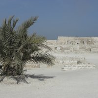
2008: to include in the core zone a sea channel, partly natural and partly man-made, which was cut through the fossilized coral reef to allow ships to access the port, and a tower structure built on the western edge; 2014: palm groves and agricultural gardens, located west, south and east of the Qal’at al-Bahrain property
-
To increase the surface of the property from 365 ha to 531 ha, including Austerlitz station and other sites of interest.
-
2017: to add "a section of Mount Wuyi lying in Jiangxi Province to the large component part of the property", and reconfigure the buffer zone
-
2019: several waters deleted: four small ponds southwestward of the small town Zaisersweiher and the lake “Eckhausee” in the open field Eckhau. The former lake Billensbacher See is added.
-
2009: "rationalize the boundaries of the World Heritage property so that they would coincide with the boundaries of Manu National Park, and not just a portion of it. The area is near the village of Boca Manú and the communities and settlements in the Upper Madre de Dios.""
-
2013: inclusion of some important wetlands and landscape features across the Mekong River within the property.
-
2017 - inclusion of the Estate of Chenonceau (was an inconsistency between text and map)
-
2015: including the Sinyaya component, to be added as the Sinsky Plot (becomes a serial site)
-
2016: 13% increase in the length of the routes but only 2% of the area: redrawing of routes 2 and 3
-
2018: to cover the areas of recent archaeological discoveries, including the wooden palisade and its adjacent wooden buildings.
-
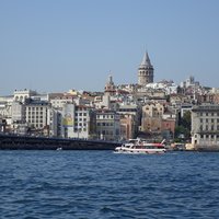
2017: The boundaries have been slightly extended to include (among others) the Marmara Sea Walls; Historic grounds of the Topkapi Palace; Remains of the Boukoleon Palace, The Süleymaniye Hamam which is an integral part of the Süleymaniye social complex, The Marble Tower, Fragmentary surviving sea walls extending northeastwards from the Marble Tower.
-
2016: to include Mirza Muzaffar Hussain’s Garden Tomb (3.34 ha); an unknown Mughal garden tomb (0.82 ha); Sundarwala Mahal Garden Tomb (0.37 ha); Sundar Burj Garden Tomb (0.23 ha); Nila Gumbad’s Garden Setting (0.37 ha); and Lakkarwala Burj Garden Tomb (0.31 ha).
-
2021: Plus 8%, adding Wulipo National Nature Reserve
-
"2016: "extends the boundary of this coastal site by a small distance (5m) inland to account for the possibility of coastal erosion; to address concerns that, should there be significant erosion, the cliff faces, which are key attributes of Outstanding Universal Value (OUV), would no longer lie within the inscribed boundary of the World Heritage property"
-
2023: to include the oasis
-
2021: incorporate San Miniato al Monte complex (the Abbey and the area embedded within the walls of the homonymous Fort) and its surrounding environment (cemetery, San Salvatore al Monte Church, Veterans Memorial Park and Ramp) (a 5,3% increase)
-
2005: Brought in line with the extended National Park. Including West Triangle, Flood plain of the Partido stream and Los Caracoles.
-
2023: more precise borders and alignment with the national park; this means adding parts of Mount Gorowi
-
2017: plus 3%, adding Chapada de Nova Roma Ecological Station in 2017 and the Natural Heritage Private Reserves (RPPNs) Catingueiro, Ponte da Pedra, Maria Batista, São Bartolomeu, Integra o Park, Komodo and Diamante
-
2016: to include Samanids and Chasmai Ayub mausoleums (in Bukhara city) and remains of the ancient walls and town gate (Talipoch gate)
-
2017: the inclusion of the Sepolcreto archaeological area
-
2011: minor changes: in five cases, they correspond to an extension of the property, and in one case a reduction. Including the whole quarter of Kampung Ketek.
-
2011: to allow the re-routed A-16 Road to be excluded from the boundary. Since Route A-16 will now run down and parallel to the south boundary, it is logical to move this boundary slightly upwards, so as to leave Route A-16 outside the property, thus forming a single compact polygon.
-
2017: removing the modern farm in Moen, which was included by mistake.
-
2009 - Boundary