The Manglares Route of Pacific Coast of Guatemala
The Manglares Route of Pacific Coast of Guatemala is part of the Tentative list of Guatemala in order to qualify for inclusion in the World Heritage List.
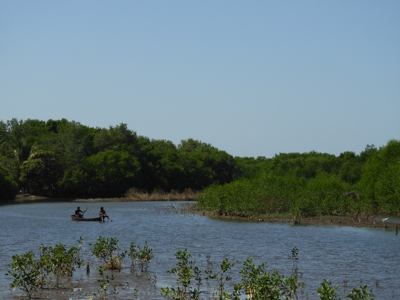
The Manglares Route of Pacific Coast of Guatemala comprises Manchón Guamuchal reserve and Monterrico. Monterrico is known for its volcanic black sand beaches and annual influx of sea turtles. Manchón Guamuchal is a litoral wetland zone with one of the last remaining mangrove forest areas on the pacific coast of Guatemala and an important stop for migratory birds.
Map of The Manglares Route of Pacific Coast of Guatemala
Load mapThe coordinates shown for all tentative sites were produced as a community effort. They are not official and may change on inscription.
Community Reviews
No reviews yet. Be the first!
Site Info
- Full Name
- The Manglares Route of Pacific Coast of Guatemala
- Country
- Guatemala
- Added
- 2002
- Type
- Natural
- Categories
- Natural landscape - Marine and Coastal
- Link
- By ID
Site History
2002 Added to Tentative List
Site Links
Locations
The site has 2 locations